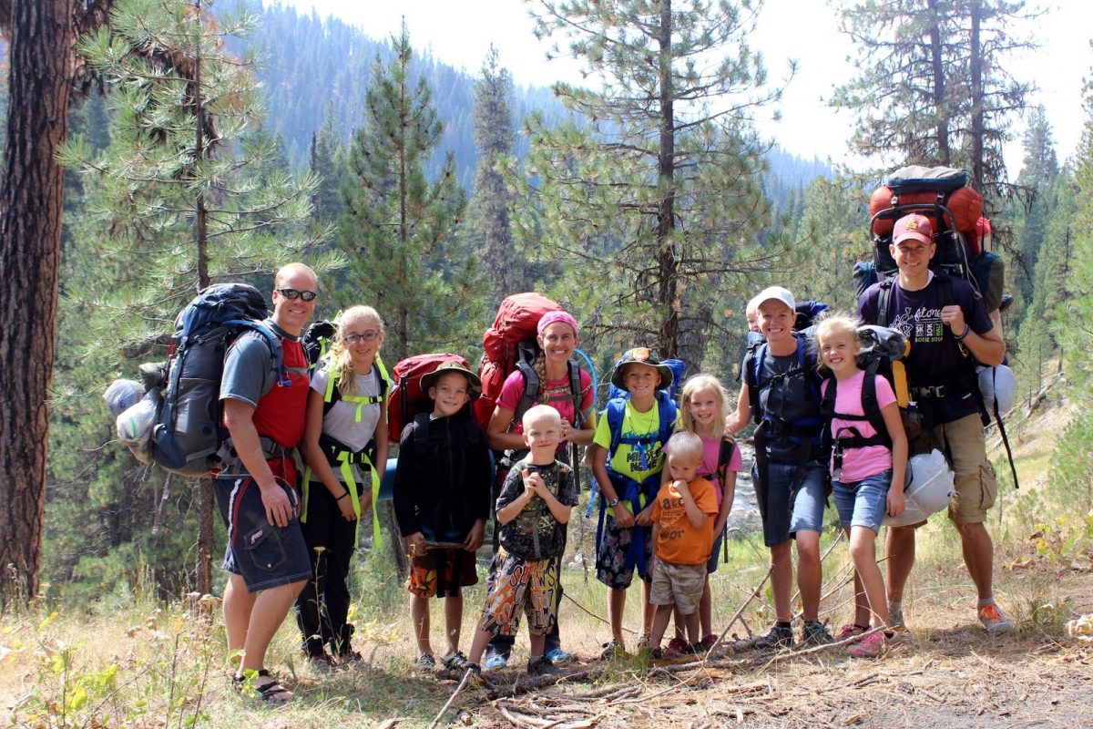
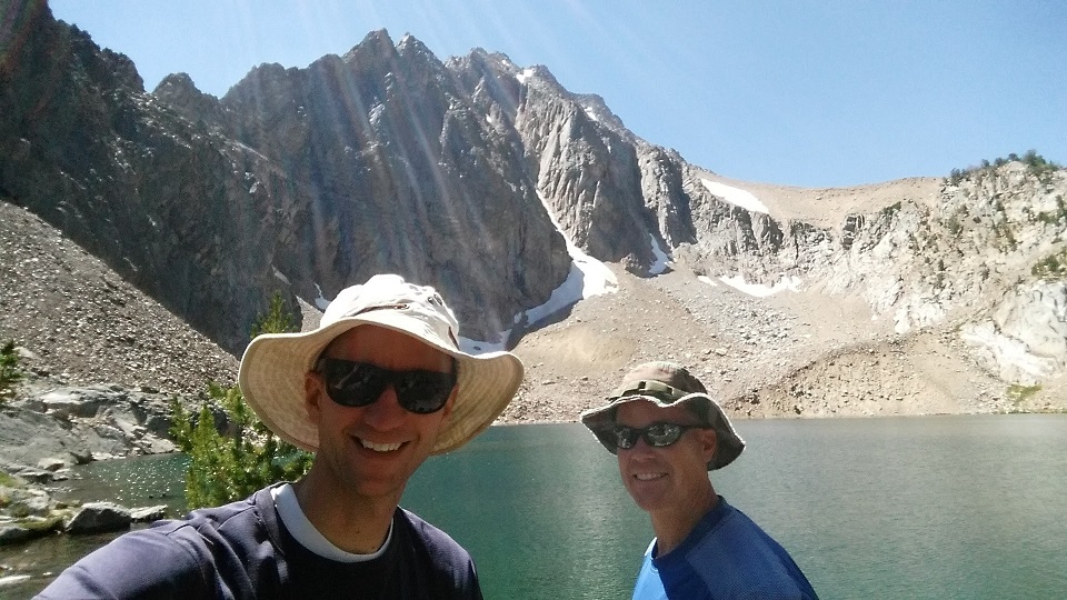
We have some friends who have three children and enjoy camping and backpacking like we do. Early in the summer we set a date to take a little trip with our two families. The date finally came in late August and we set out: two couples and eight children to do a ~2 mile backpacking trip and camp out.
The place we selected was north of Crouch, ID. The Middle Fork of the Payette River flows down a ravine into Crouch, and there are several springs in the area. We were headed to some Hot Springs that were about two miles up a trail in a nice area where a creek flows into the Middle Fork.
We were a bit delayed getting out of town on a Friday afternoon, but after navigating traffic and driving about 23 miles on the road (mostly gravel) north of Crouch, we arrived at our destination.
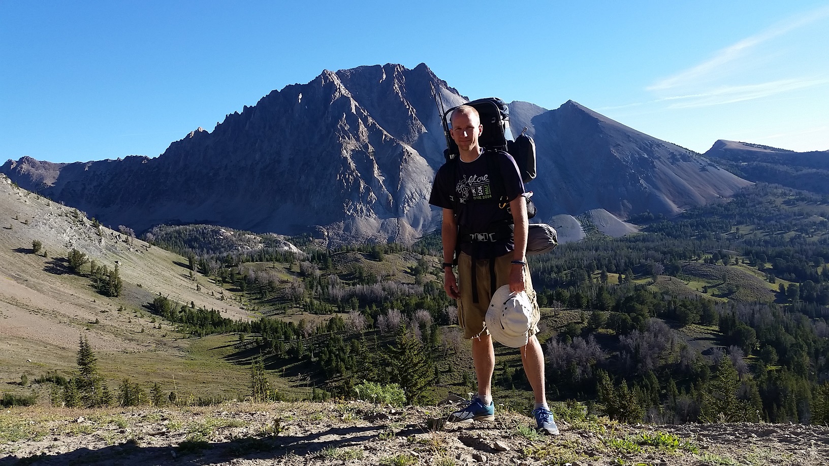
Ready to get started at the trail head; missing one adult
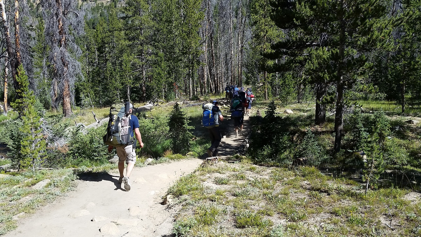
The trail we ended up taking was the Middlefork Trail.
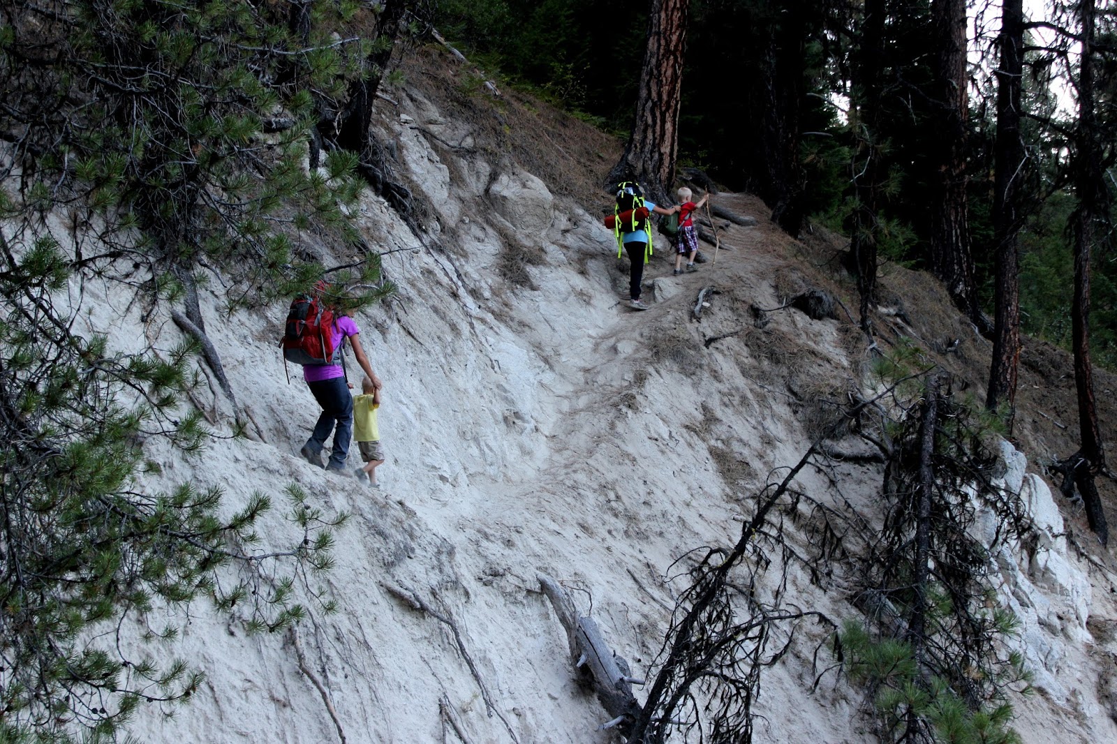
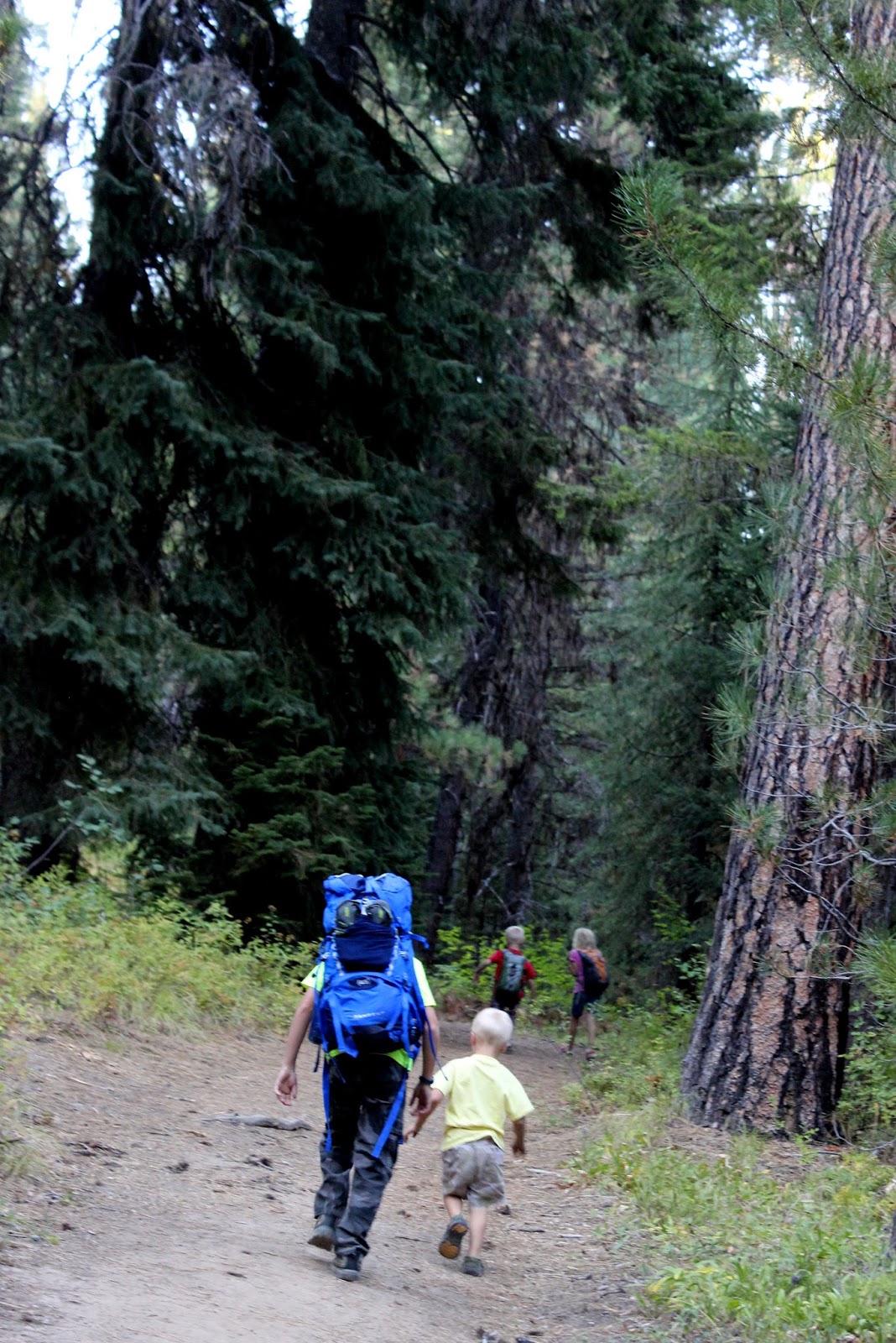
The trail was pretty flat and followed the beautiful, meandering Middle Fork of the Payette River. There were some spots that were a bit difficult for the kids to navigate, but we got through them.
The trail was a little tricky at parts
Fortunately our friends’ children are a bit older and helped out with our little ones. This made the hike go by much more quickly and with minimal complaining from the kids.
The older kids helped the younger kids out
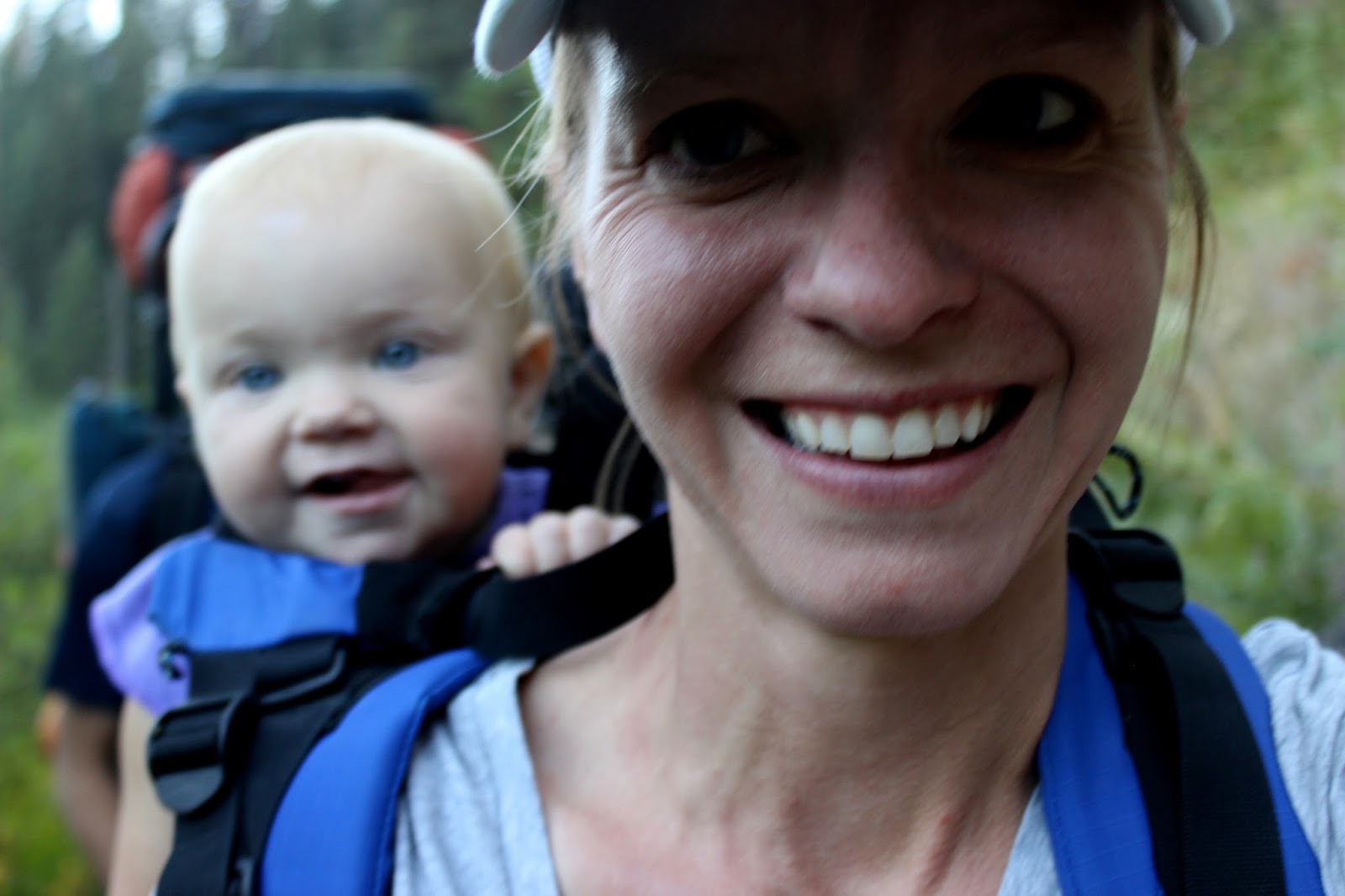
Even the baby was happy in her carrier.
Mom and baby on the trail
We arrived fairly late and immediately set up tents and made dinner. It was 9pm or so when we actually ate. The kids were troopers and fortunately we had raisins and fruit leather that helped hold them over.
Since we have a 15 month old, our family took two tents. I slept in the little tent with the baby so that she didn’t wake up everyone else as easily. She also tends to cry more if she sees her mom (as have all our children), so it was good to separate them. She ended up sleeping really well, all things considered. She awoke briefly at about 1am. Then she woke up at 5am, at which point I just put her in my sleeping bag with me and she slept until I got out of the tent at 7:30am or so. She then took some naps later on.
The other kids also slept really well.
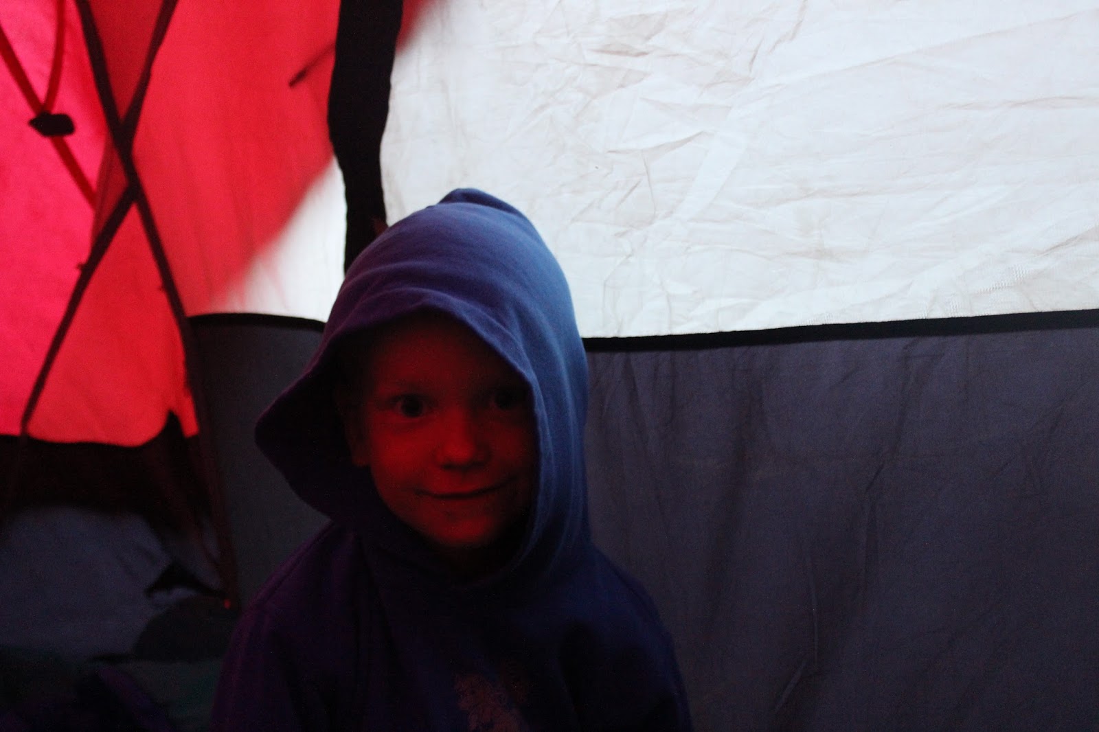
Time to leave the warm tent in the morning
In the morning we ate oatmeal for breakfast and then put our swimsuits on and headed for the main attraction.
Testing out the hot springs
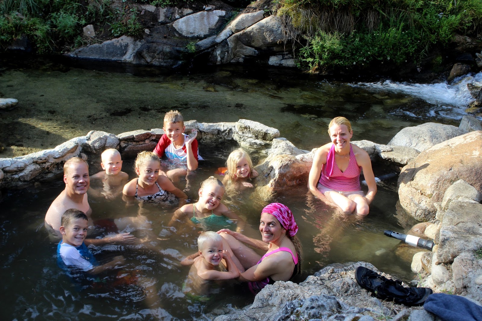
The hot springs tub was pretty awesome. It had some cement to make a quality tub. There was a pipe with super hot water coming in from the spring, and another with cold water coming in from the creek. The water flow was adjustable on both of the pipes. Then there was a big drainage pipe that could be unplugged to flush out all the water.
A crowd in the hot springs tub
We spent a couple hours soaking in the tub and daring each other to jump in the creek.
The creek fed by multiple springs
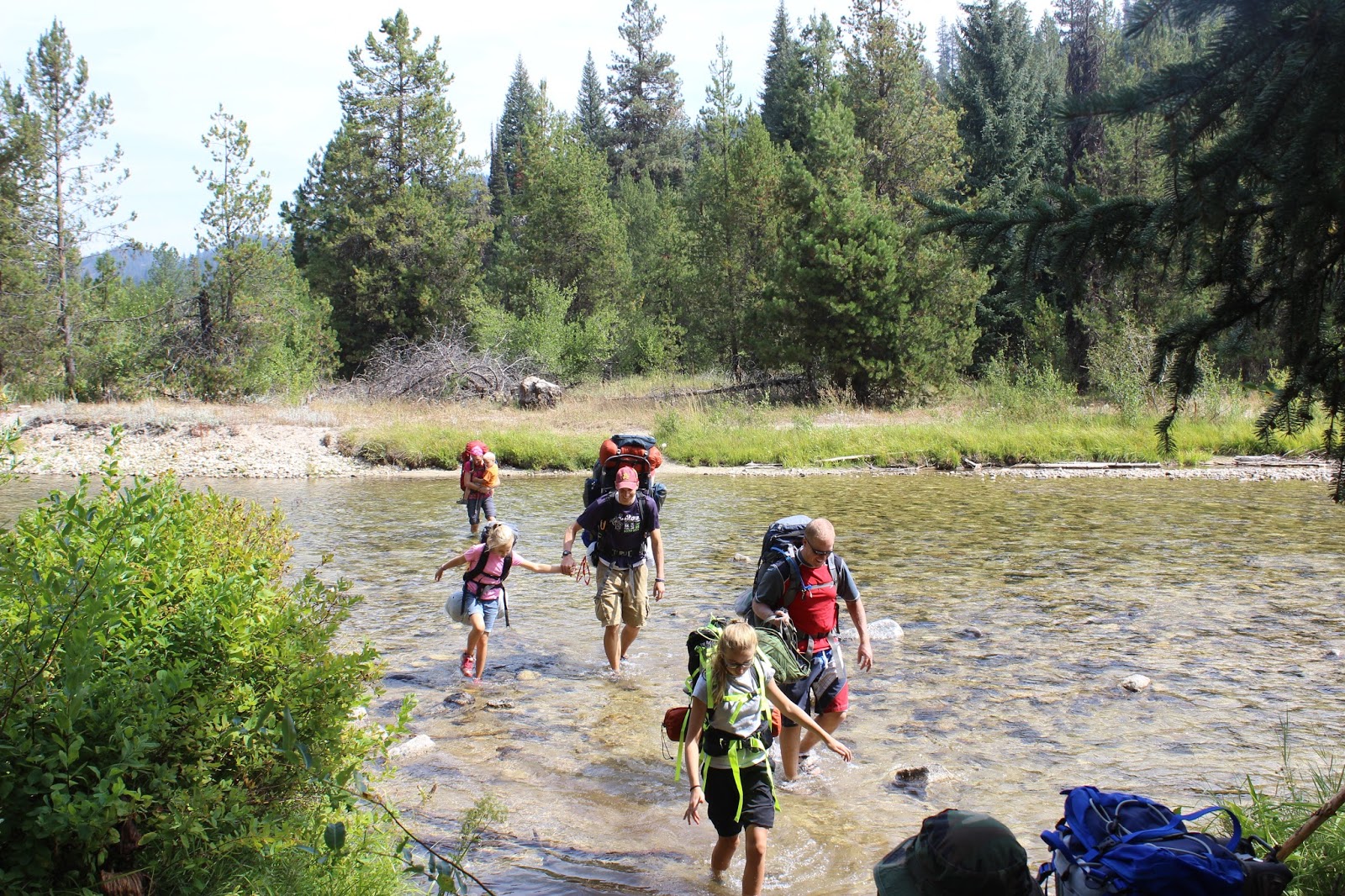
We headed out before noon and took a parallel trail which required a couple river crossings, which were pretty fun.
Part of our crew crossing the Middle Fork of the Payette River
We got back to the car and made it home in time to catch a 4:30pm barbecue.
The fear with a trip like this is mainly the kids. Will they be able to hike without complaining too much? Will they sleep? Will they be safe? Kids almost always love camping, so we’ve found that as long as the parents are prepared, the kids will be just fine. That’s how it turned out this time. Our kids get regular outdoor play time and exercise so they were fine on the hike. We had sleeping arrangements that made for a fairly comfortable night for everyone. Just get them outdoors and things usually work out.
One of my goals is to break 5:00 in the mile again (that is, 1600 meters, which is actually ~9 meters short of a mile).
There’s something about breaking a threshold like a 5 minute mile that makes for an attractive goal. Earlier this year, I was able to break 3:00:00 in the marathon. My main goal was to qualify for Boston, but for some time I had also had my eyes on a sub 3 hour marathon.
While I was still training for that marathon I ran a 5k fun run and realized that a sub 5 minute mile might be within striking distance. Nevertheless, I haven’t done any mile-specific training. Pretty much all of my training has been targeted at improving my marathon time. This includes long runs, temp runs of 4-8 miles, and intervals. The intervals have almost all been 800 meters or longer and at times closer to a 5:40 to 6:15 mile pace.
Nevertheless, I’ve been wanting to test myself in a mile for a few months. I’ve done mile intervals in the morning, but with no competition and doing multiple repeats means that my pace is always slower than my best.
After the XC12K I ran into my former cross country coach, Tracy Harris, who had just finished a training run. He still coaches at the high school a few miles from my house, and I found out that he was planning on a mile time trial in a couple weeks. This immediately piqued my interest.
A couple weeks later I showed up at 7:30pm to run a 1600 with a bunch of high schoolers. I felt a little silly, but I was excited to have someone to compete with. After a couple miles of warming up, it was time to run. I wasn’t very apprehensive until I actually lined up, but once I felt the nervousness I was excited because I knew I needed to be on edge to run my best.
There were actually three groups running, with the fastest running first. I debated which I should join since I didn’t know my capability, but I ultimately decided to join the varsity boys and girls in the first heat. There was a former college runner to pace us, so I wasn’t the only non-high schooler.
The race went really well. My first 200 was at about 37s, and my first 400 was around 74s. My second lap was my slowest at about 80s. Then I began passing some other runners as I quickened my pace back to around 75s for the final two laps. I got pretty light-headed towards the end of the race, but I was quite pleased when I came across in 5:06.
That was just 7 seconds away from my goal! I’m looking forward to doing some shorter intervals and working toward a 4:59. I’m certain that I can achieve it, barring an injury. My PR from high school is 4:34, and part of me is even beginning to wonder about that… but we’ll see how the next year or two go first.
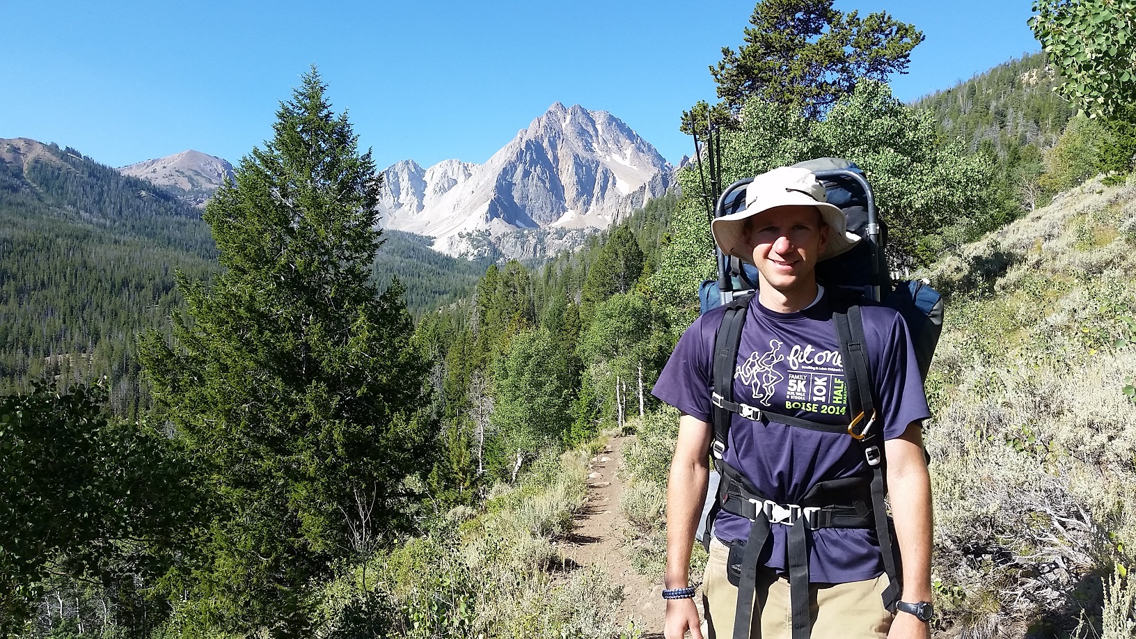
Last week I did another great backpacking trip to Idaho’s White Cloud Mountains. I love the White Clouds and enjoyed the scenery, the challenge, and the chance to spend some time outdoors.
The route I took this year was similar to my backpacking trip to the White Cloud Mountains last year. However, this year I was with a big group of 20 people, including 14 scouts and 6 adults. This is the maximum group size allowed (as of August 2016), and I suspect that the limit will be reduced in the near future. The area was just protected as a Wilderness last year, which led to additional restrictions. My assumption is that more restrictions will go into effect with time.
White Clouds Backpacking Day 1
We left the valley at about 6:30am on Wednesday, August 10. Due to the Pioneer Fire, the road between Banks and Loman was closed, so we took Highway 21 through Idaho City, Loman, and then on to Stanley. We saw the destruction from the Pioneer Fire between Idaho City and Loman. In fact, there was still smoke everywhere and we saw a few burning logs and brush fires.
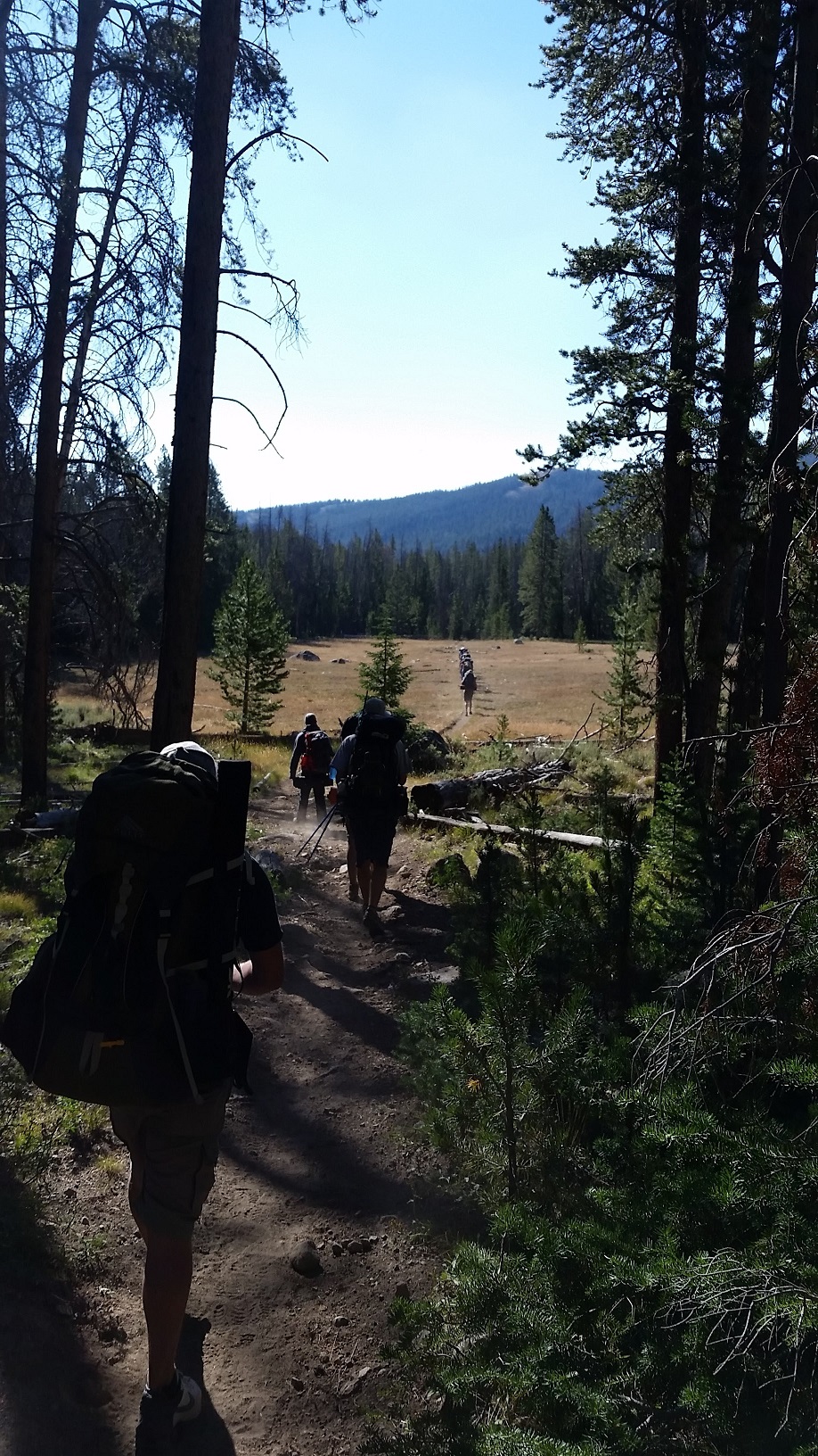
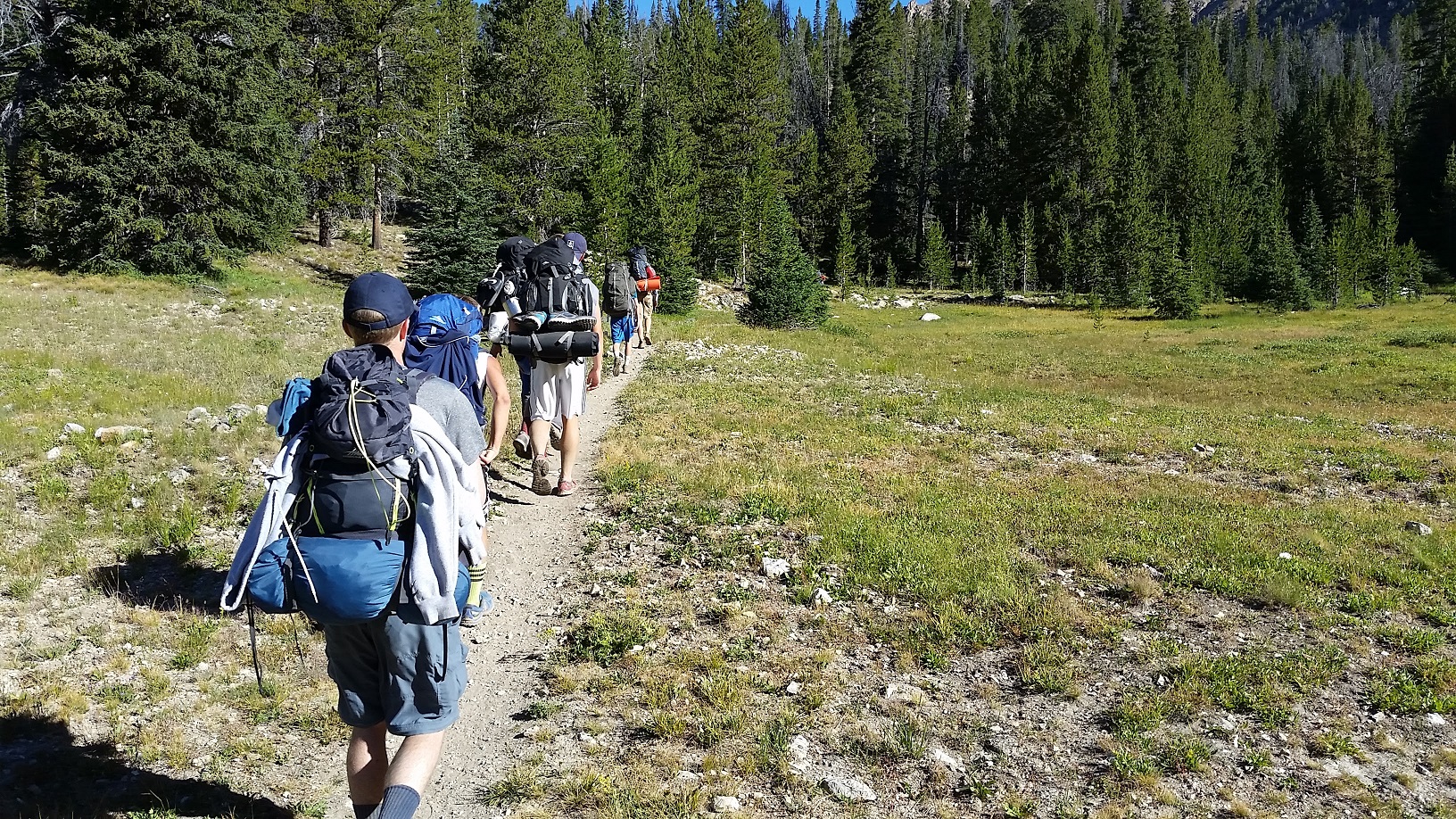
We arrived at the 4th of July Trailhead and started hiking around 11:30am. Everyone was carrying their food for 4 days, so packs were a bit heavy that first day. It also seems to take a day to get broken in for a good backpacking trip.
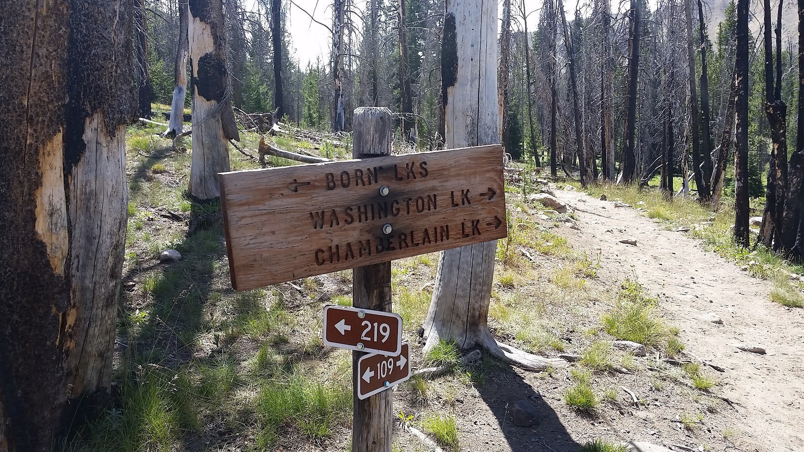
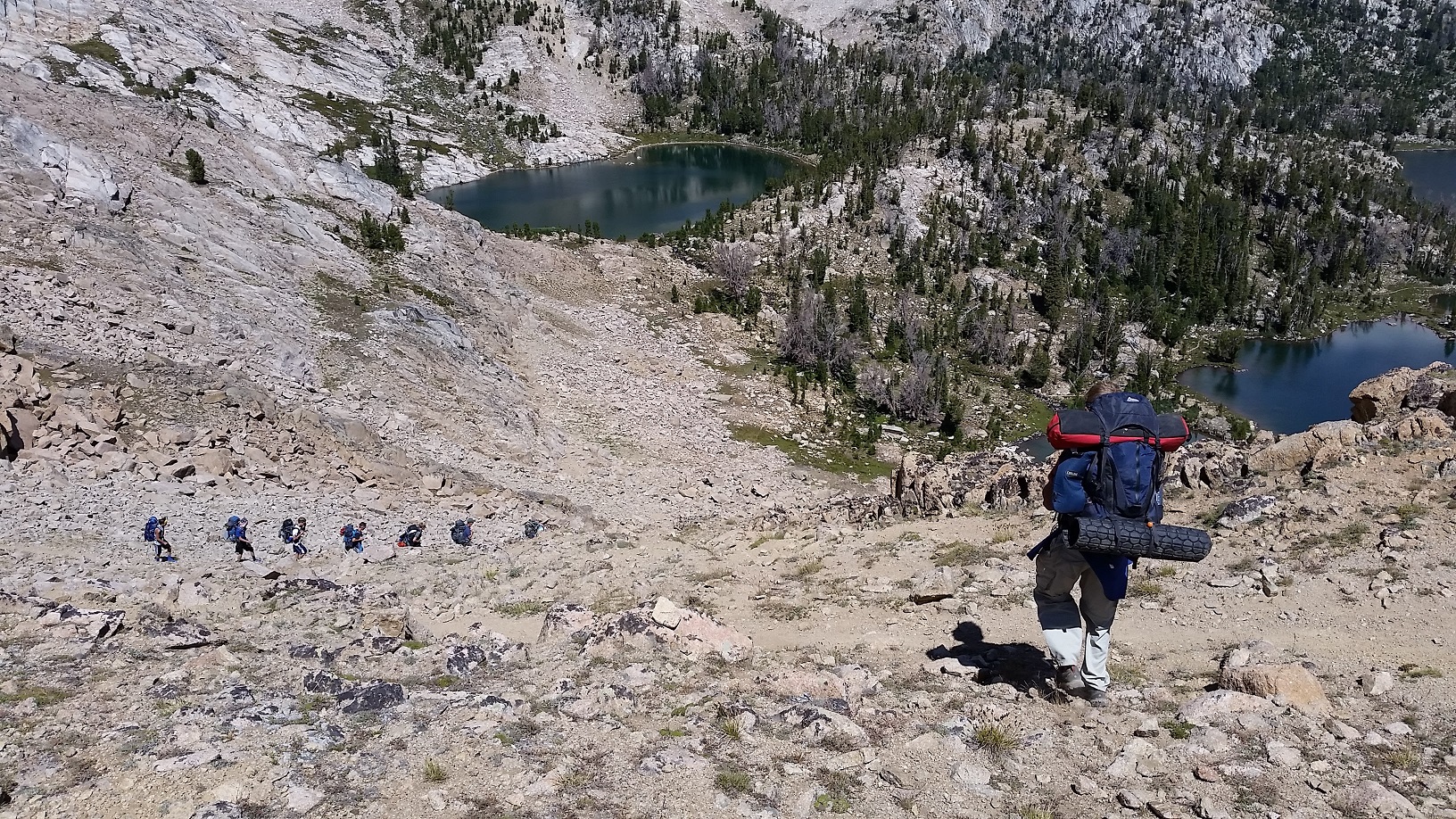
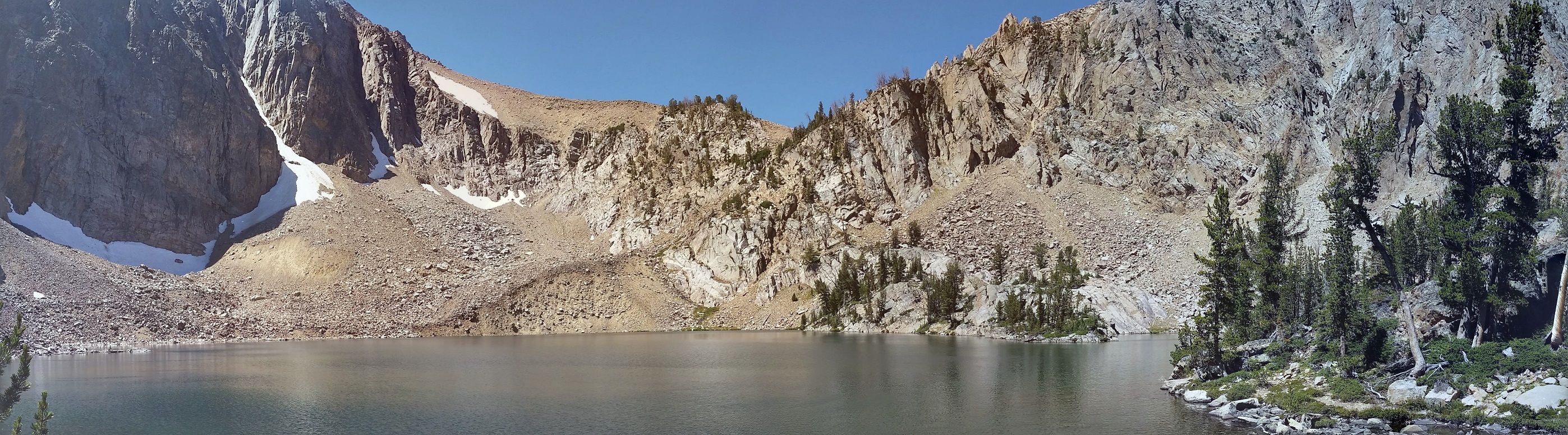
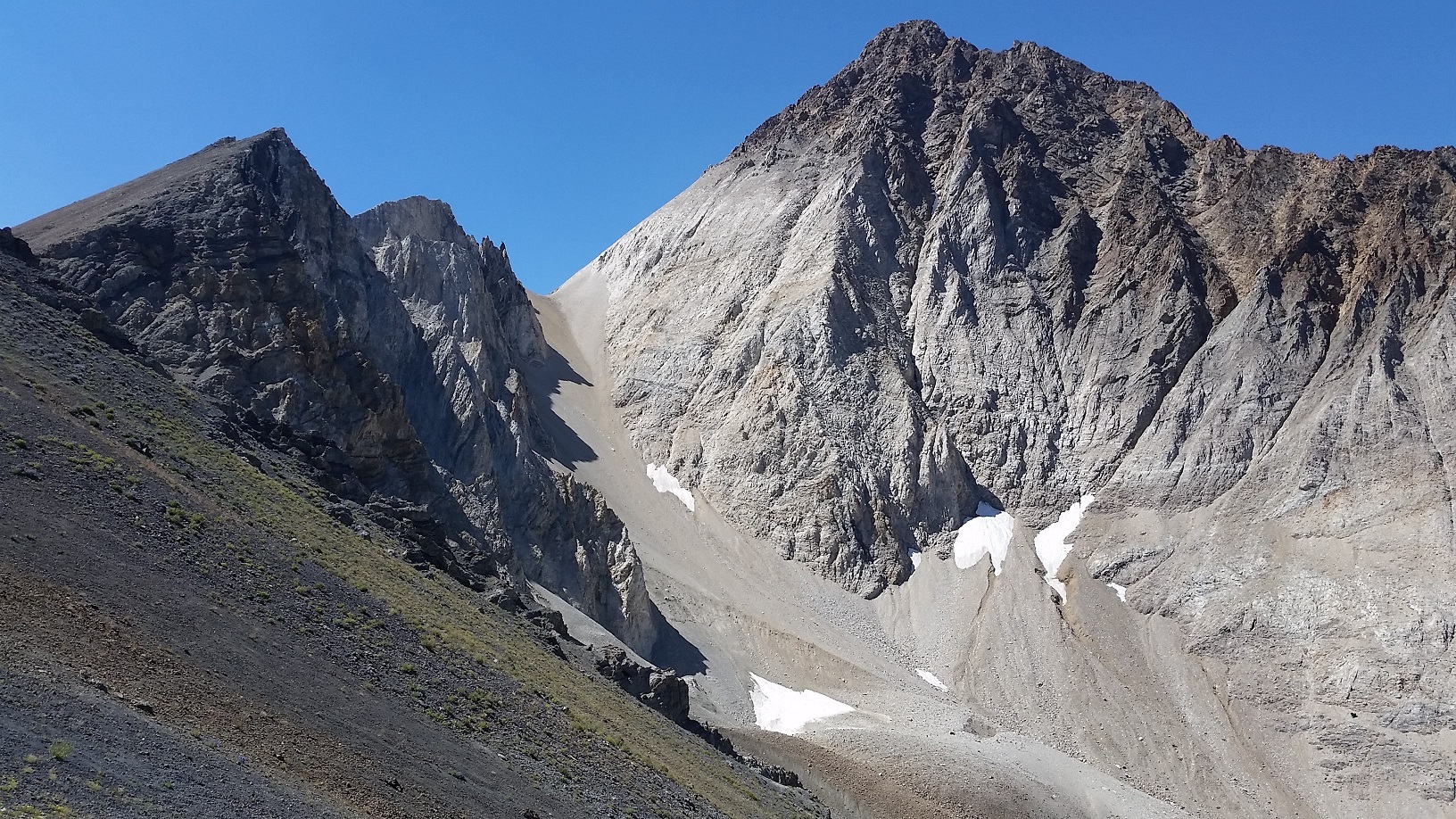
We made our way from the trailhead to 4th of July Lake, but besides a short break to let everyone in the group catch up, we didn’t really spend any time at the lake. The climb to the lake is pretty good, and then the trail continues on to Born Lakes with another significant climb to the top of the ridge. The total climb is around 1200 feet. We spent some time on the ridge taking pictures and hiking to a small peak. I also pointed out Devil’s Staircase to the group, which we would be climbing the next day.
Antz Basin where Born Lakes are located. This view is from the ridge between Antz Basin and 4th of July Lake. You can see Devil’s Staircase as a cut in the lowest point of the far ridge that angles up and to the right.
We then descended down the ridge on the switchbacks and made our way to one of the farther Born Lakes.
Switchbacks into Antz Basin
The Born Lakes are a set of 7-9 lakes nestled in Antz Basin. There are a couple big lakes and the rest are pretty small. The first decent sized lake is about 4 miles from the trailhead and the other bigger lake is about 5 miles. We came across a gentleman who didn’t want us there and said there wasn’t room for all of us at the lake we were headed to. He wanted us to hike down Antz Basin and find another spot. We said we’d check it out, and there was plenty of room for us (as I knew since I’d been here twice before). He also said he came there every year. Interesting how some people want to be the only ones to enjoy beautiful areas such as this. They want to come every year, but find it hard to share with others. I understand that most people don’t want to see other people in the back country, but it’s public land and everyone has a right to it. I’m grateful that my scout leaders introduced me to the White Clouds and Sawtooths and outdoors in general, and the benefits that our scouts got from this trip would stay with them forever.
Hiking in Antz Basin toward Born Lakes
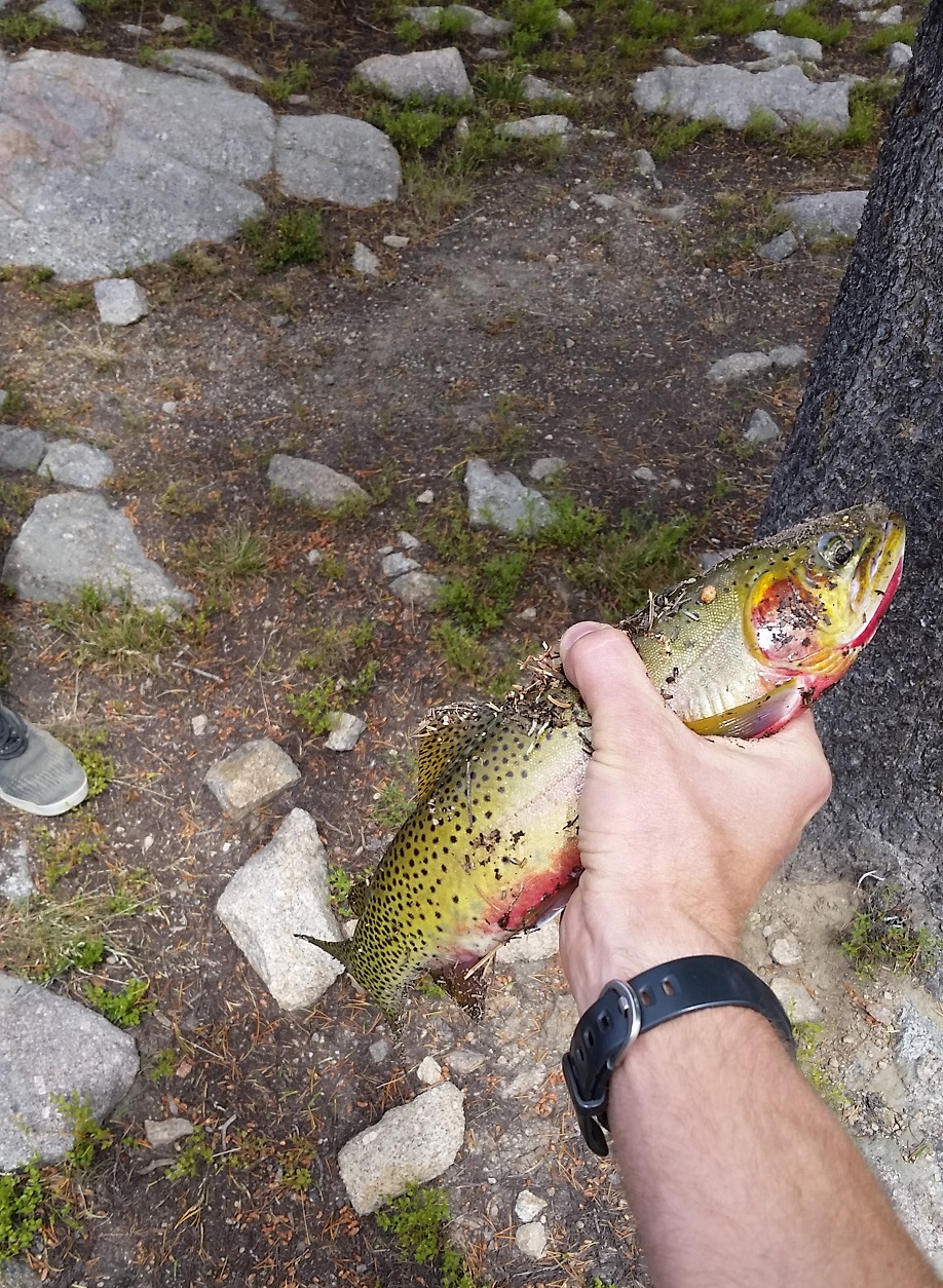
Right after arriving at the lake I started working on catching my first fish. I caught a nice one pretty quickly, which left me satisfied so that I could set up the tent. Some of us also jumped in the lake to rinse off after the 5 mile hike.
First fish I caught on the trip!
After we had set up camp, a ranger came through and made sure our group size was within the limit. He was pretty nice and gave us some instruction on how to properly Leave No Trace. We had reviewed this with the scouts but it was good to go through it again with the ranger.
I didn’t sleep great that night. I was a bit too cold, and I never sleep well camping anyways. I should have worn an extra shirt and some extra socks.
White Clouds Backpacking Day 2 – Born Lakes to Boulder Chain Lakes
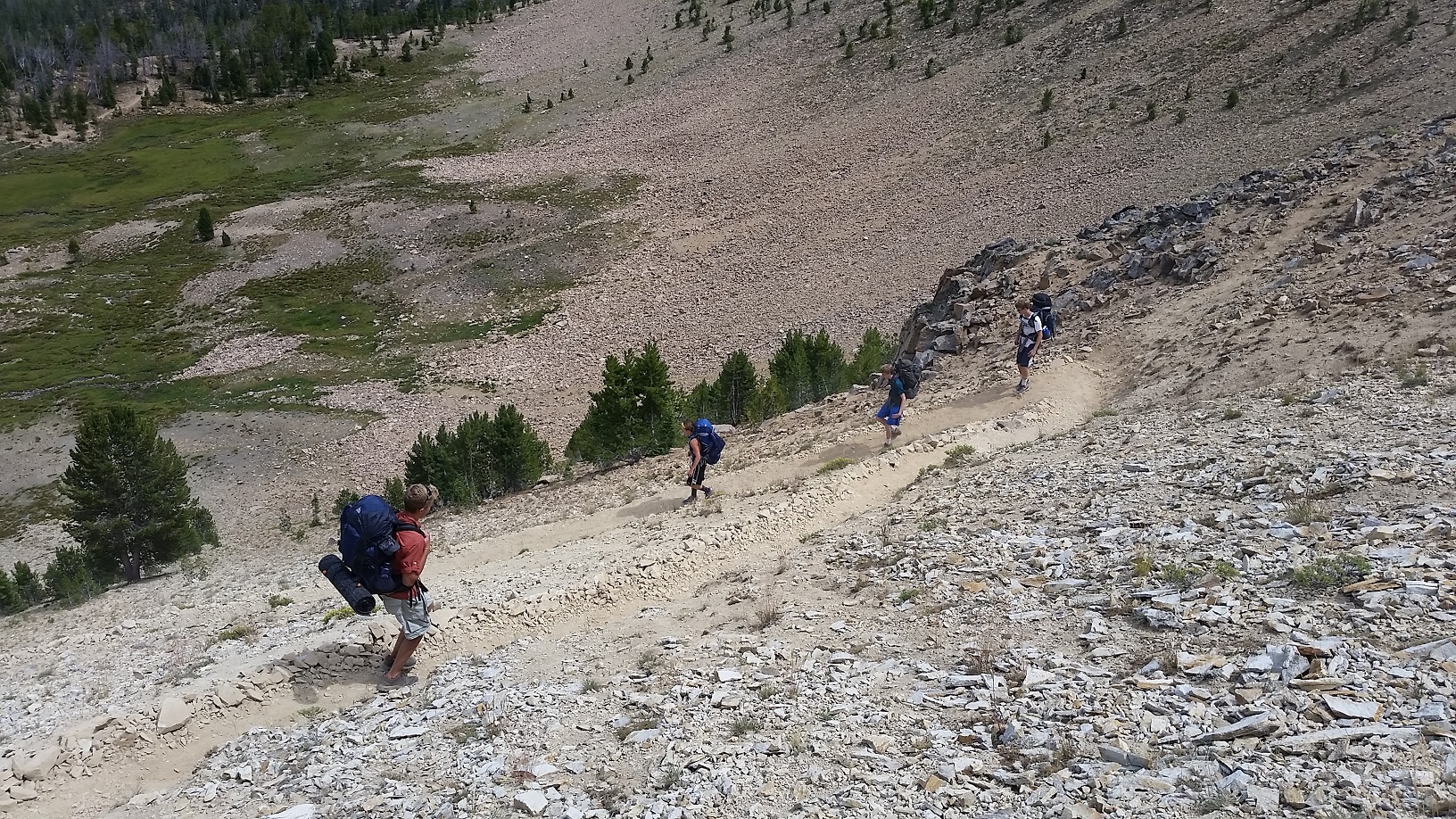
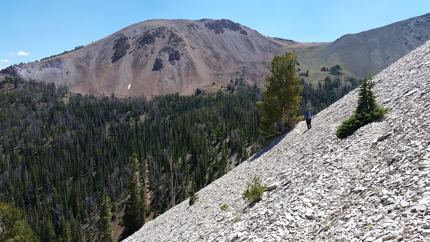
After breakfast on Thursday morning we got ready to ascend Devil’s Staircase. Devil’s Staircase is part of the shale ridge located to the north east of Born Lakes. It’s one of two popular ways to pass the ridge without going all the way around on the trail. The other popular way to get over the ridge is by going east from Born Lakes then crossing over the ridge to the south, leading into Four Lakes Basin.
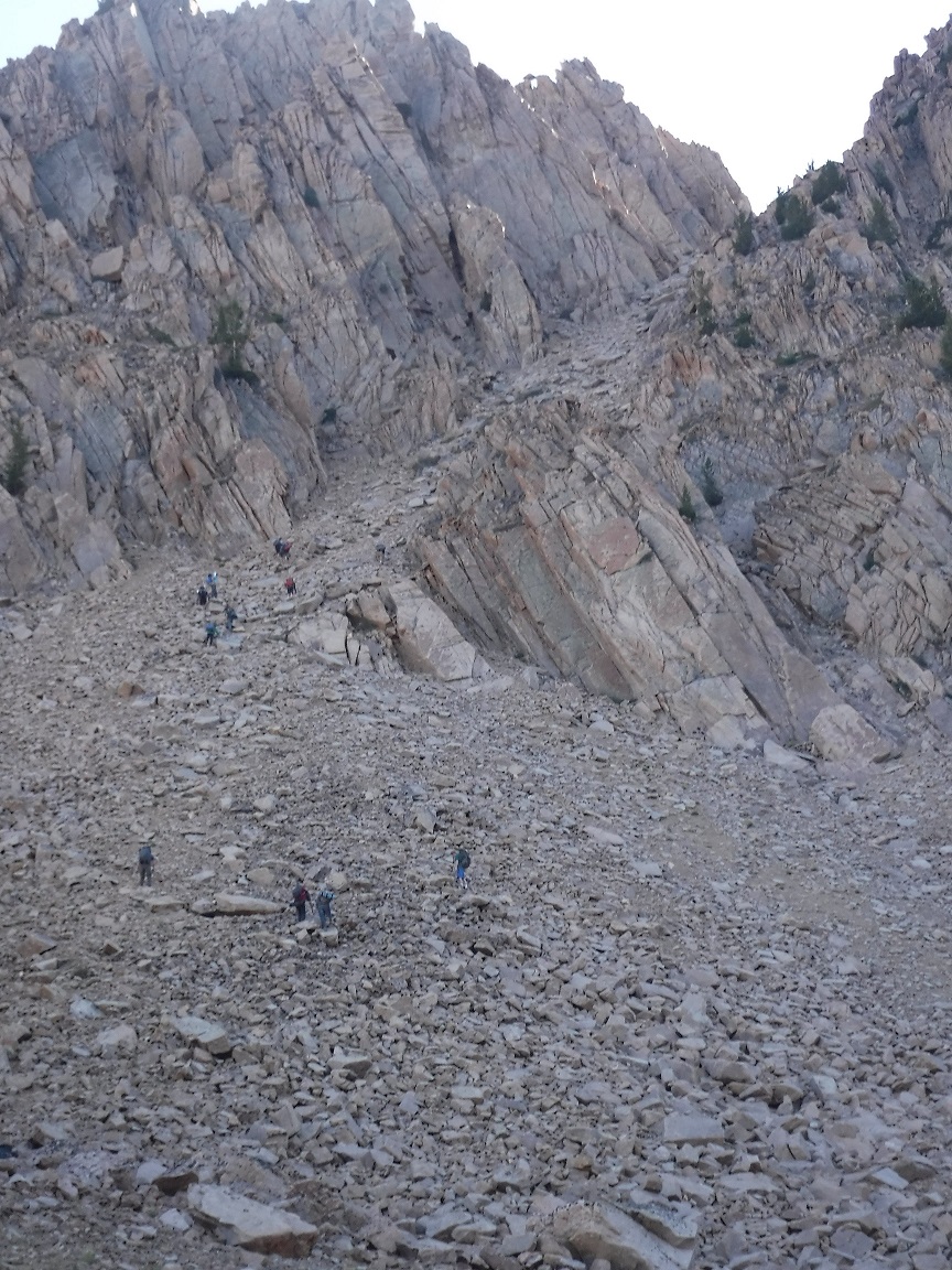
Devil’s Staircase sounds and looks pretty nasty, but it’s really not too terrible. I’ve done it three times now — twice with a full (~50 lb) pack on my back. Still, it has a lot of loose shale and boulders. Since we had a large group, we spread out and attacked the pass about six people at a time spaced a few minutes apart. This worked out pretty well. It helps that Devil’s Staircase is angled up the ridge, so if you’re spread out you won’t be directly above/below other climbers.
Ascending Devil’s Staircase in the White Cloud Mountains
Fortunately for our group, we all made it safely up the ridge and down. One of our 14-year-old scouts got pretty scared at one point, but he was able to finish after taking a break and calming himself down.
Descending Devil’s Staircase toward Shallow Lake and Windy DevilShallow Lake, Scree Lake, and Noisy Lake
From the top of Devil’s Staircase, we headed down the other side toward Windy Devil. Some of us dropped our packs and hiked down to check out Shallow and Scree Lakes. Eventually we all made our way around the top of the basin to Windy Devil. At the top of Windy Devil there’s a nice trail which switchbacks down the shale face and leads into the Boulder Chain Lakes basin. (The trail starts right at the top of Windy Devil.)
My goofy selfie on top of Windy Devil pass with Scoop Lake in the backgroundPart of our group descending Windy Devil in the White Cloud Mountains. Headwall Lake, Scoop Lake, and part of Hummock Lake can be seen in the background.
From Windy Devil there are some nice views of Headwall, Scoop, and Hummock Lakes — some of the upper Boulder Chain Lakes. We were pretty spread out by the time we started arriving at Scoop Lake, so we took a long break there. Some of us decided to check out Lonesome Lake and took a quick side trip up the granite ridge. The views from Lonesome Lake are spectacular and I highly recommend the trip.
Eventually we started to head down toward the lower Boulder Chain Lakes.
Hiking past Hummock Lake in the White Cloud Mountains
We fished and took some breaks, but finally decided on camping at Willow Lake at the bottom of the Boulder Chain.
Willow Lake seemed really cold, but it was worth taking another dip to clean up before bed time.
White Clouds Backpacking Day 3 – Boulder Chain Lakes to Chamberlain Basin
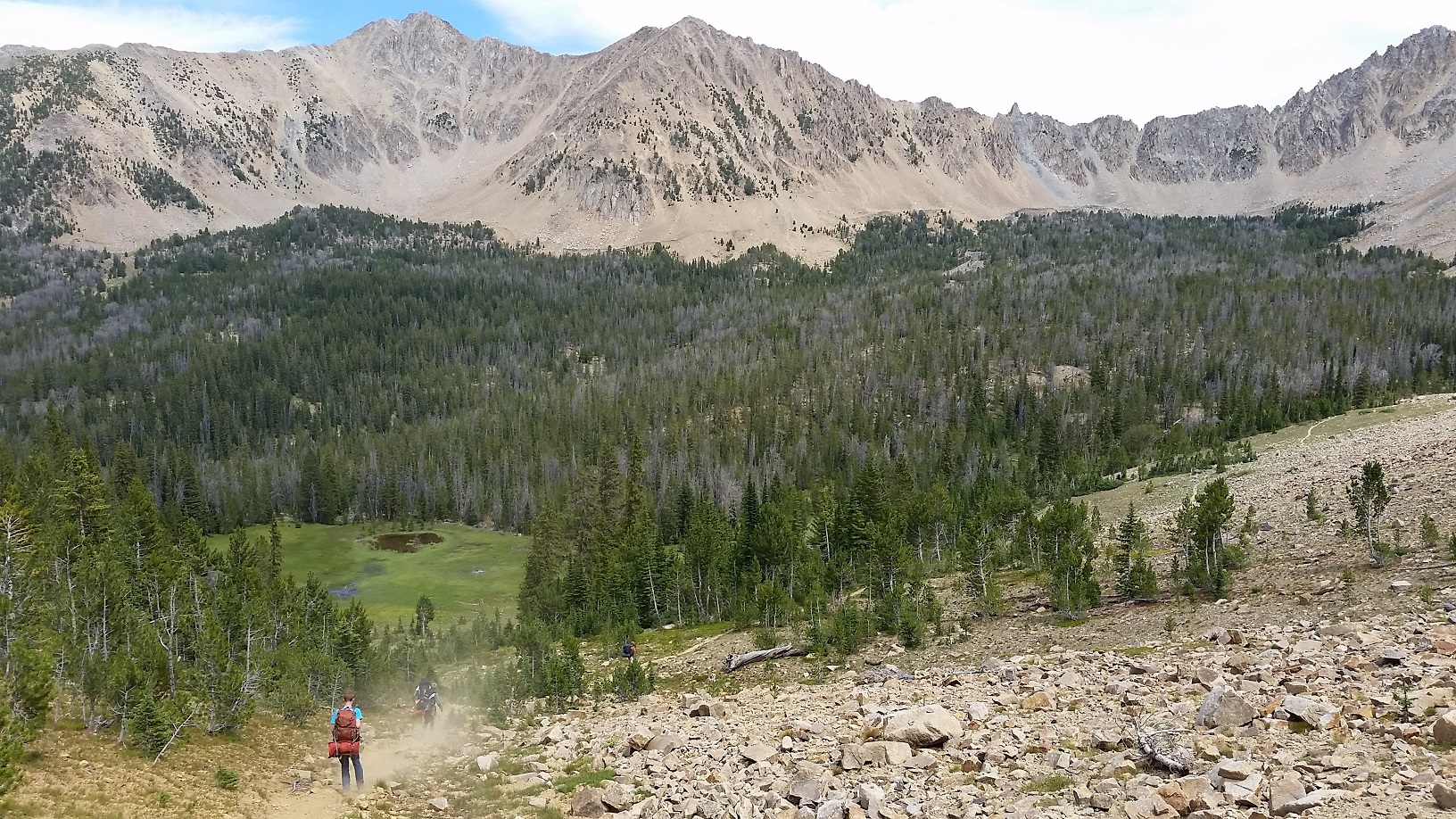
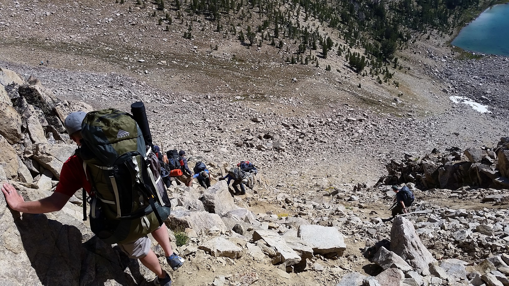
On Day 3 we were ready for a long slog to Chamberlain Basin. Our group set off with high hopes and expectations, but after a couple miles the climb started and some of our boys were bogged down as they made their way up the mountain.
Heading out from the lower Boulder Chain Lakes
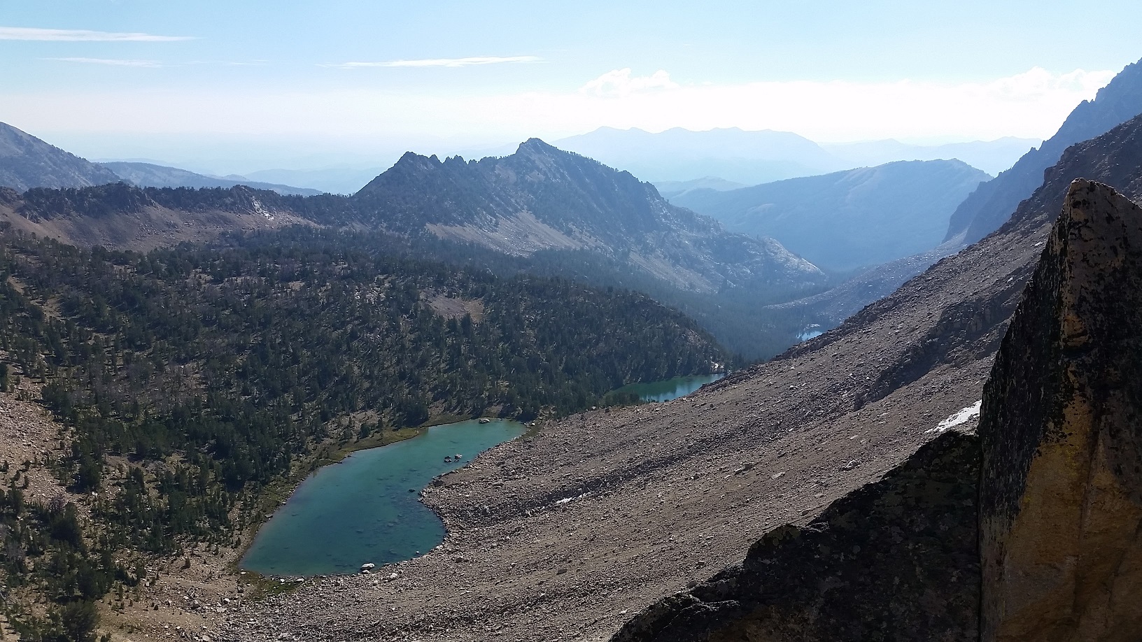
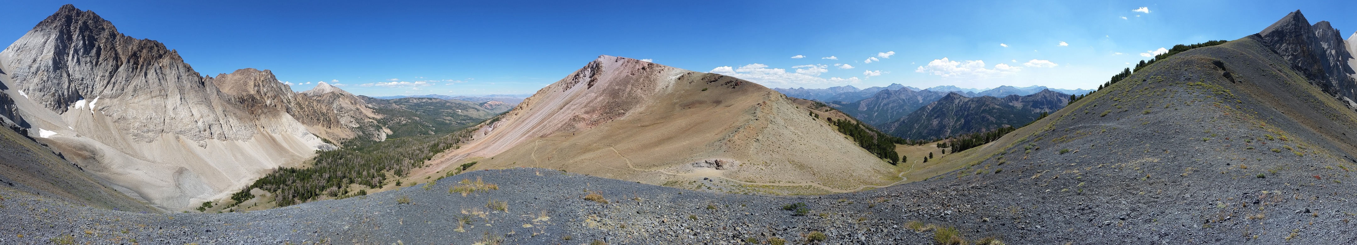
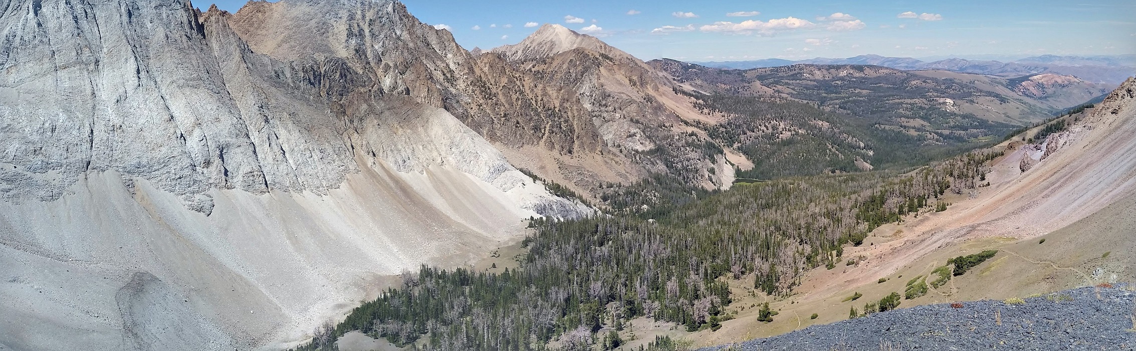
The trail takes backpackers through a lot of forested areas and some meadows. After a mile or so we were graced with an amazing view of Castle Peak.
We got some great views of Castle Peak as we hiked the trail from the Boulder Chain Lakes to Chamberlain Basin. We eventually crossed the ridge to the left of Castle Peak (the spot covered by the tree).
This is when I realized that the ridge just to the southeast of Castle Peak was the one we would be crossing. It was pretty far up. There’s a large creek crossing and then the uphill begins. Initially the uphill is all in the forest. I don’t like this part very much because I can’t see where I’m going.
A view from the trail on our way to Chamberlain Basin
Fortunately there were lots of currants (or gooseberries?) on the side of the trail which kept me distracted. Currants don’t really taste great, but they’re alright and it was a welcome challenge to try to find the ripest berries.
Eventually the trail hits switchbacks up the side of the ridge. However, before starting up the switchbacks, another one of the adults and I decided to take a side trip to Castle Lake. We were in the back of the group, so we didn’t get the chance to talk anyone else into coming with us.
We had our eye on the spot where we would approach Castle Lake, but we weren’t sure if it would work once we got there. Looking at Castle Lake from the trail we were at, we were hoping we could approach it from our left. There are some cliffs with a shale face above it that we hoped we could traverse. We dropped our packs, grabbed our fishing gear, water, and some snacks, and headed for the lake. To our delight, we discovered a trail right in the spot we were aiming for that traversed the shale area. Even though there was a trail, it was a little freaky. If I looked down when we were above the cliffs I actually got some vertigo — I think due to the crazy angles and drop-offs.
The freaky trail around the spur of the mountain to Castle Lake. The trail really wasn’t too bad. Just don’t look down.Return trip from Castle Lake
The trail took us right to Castle Lake, and we hardly changed elevation from where we dropped our packs. It was a pleasant surprise as we expected a challenging climb. Castle Lake is beautiful. Nestled between Castle Peak and Merriam Peak, two thirds of the lake is surrounded by mountains with the remainder opening up to the basin below.
Michael and I at Castle Lake in the White Cloud MountainsCastle Lake Panorama – doesn’t do it justice
After an enjoyable time at Castle Lake, we headed back out to the main trail. We worked our way up Castle Divide and then down the other side into Chamberlain Basin, where we finally met up with the rest of our group.
A 360 degree panorama from Castle Divide in the White Cloud MountainsThe southeast side of Castle Peak from Castle Divide. You can see some of the trail we hiked up on the right.Castle Peak from the southeast
Actually, just as we arrived at the first big Chamberlain Lake, we were met by another ranger and a film crew. They were filming for Outdoor Idaho, a PBS series. They interviewed me and my hiking partner and got some footage of the ranger telling us about Leave No Trace principles.
As we wrapped up with the film crew, a few of the guys from my group arrived from camp in their running clothes. They had ran each day of our trip, and thus far I hadn’t gone with them since I was still trying to recover from the Morgan Valley Marathon and the XC12K. However, I was feeling up to it at this time and I wanted to see the upper lakes anyways, so I asked them to wait for five minutes while I headed for the brush to change into my running shorts and drop my pack.
The run was amazing (unfortunately I don’t have a GPS track of it). We saw all the upper Chamberlain lakes and headed all the way to the bottom of the ridge at the top of the basin. It brought back memories as I had once been to one of the upper lakes when I was a teenager (we came over the ridge from Washington Lake but didn’t go far down the basin). It was nice to get a little run in and felt much different on my legs than all the backpacking. I was quite sore as we ran back down towards camp, but it was worth it and felt wonderful.
It was also nice to warm up right before jumping in the lake.
I really enjoyed dinner that night — mashed potatoes and soup. I slept ok.
White Clouds Backpacking Day 4 – Chamberlain Basin Past Washington Lake and Back to 4th of July Trail Head
Our plan for Saturday was to wake up a little extra early and head out in small groups to give the slower hikers a bit of a head start.
The first group of 6 or so headed out at 7:30. I was in the next group at 7:45. The last group left at 8:00.
The hike starts with a gentle incline and passes one of the nastiest looking lakes I saw on our trip — a small lake with no outlet and no apparent inlet. After that lake we got a nice view of the ridge we would have to surmount. It was warming up so we changed into cooler clothes and headed up. At the bottom we saw the group ahead of us, and at the top we saw the group behind us.
Castle Peak from Chamberlain Divide
As usual, there were some awesome views at the top of the ridge and we snapped some photos before descending down the other side. There was some nice downhill (much of which we jogged) and then a gradual uphill to Washington Lake. I really wanted to do a little excursion to the small lake southwest of Washington Lake, but I didn’t have anyone to go with me and I didn’t want to keep the others waiting.
Hiking towards Washington Lake from Chamberlain LakesWashington Lake
Our whole group met up at 4th of July Lake and we snapped some group photos. Finally we headed down the last stretch of trail to get back to our cars.
Hiking our last stretch out of 4th of July Lake to the trail head
What I Ate During the Backpacking Trip
I thought it would be useful to list what I ate during the trip, since it’s sometimes hard to get good ideas.
Breakfast
I kept breakfast pretty simple: two oatmeal packets and hot cocoa. This was easy as I just needed to boil 2-3 cups of water and I had a warm meal ready.
Lunch and Snacks
I had a peanut butter honey bagel sandwich for lunch every day. I also had the following to supplement lunch and eat as snacks each day: three granola bars, ~1/3 lb trail mix, dried peaches, and raisins or corn nuts.
Dinner
Mountain House meals are easy but expensive. I used a Mountain House one day.
Another day I used a $1 package of dinner noodles from Walmart. These are just as tasty as Mountain House, but the downside is they have to simmer for 7 minutes. Some of them also use milk, so I had some powdered milk to add as well.
The last day I did instant potatoes and some stew. The potatoes just require boiled water and a $1 package was very filling (2 cups). The stew had to simmer for 10 minutes, but it was very tasty.
Treats
I made pudding one night which was quite good. It just requires pudding, powdered milk, and cold water. Mix it all in a ziplock bag.
I also packed in my traditional tortilla chips and a jar of Salsa con Queso, which is not backpacking food at all but was really delicious!
Cost
Total cost of food for the three night backpacking trip was about $25. Not bad at all! The Mountain House was about 1/3 of that. I hiked out with a spare package of Top Ramen and two spare granola bars.
Wrap Up
The trip was a huge success. There were 20 people in our group and no one got injured or lost. There were no arguments or issues with the boys. Everyone had a good time and carried their own packs the whole way. Some of the boys struggled on the hikes a bit, but they all made it and still got to have some great experiences.
I had a wonderful time. There is something about high mountain peaks and mountain lakes that makes me love going back again and again. I’ve now seen almost every lake in the lower White Clouds, so I hope to hit some different areas next time around. That said, I wouldn’t hesitate to do this same trip again.
Today I was my 34th birthday. What better way to start a birthday than with a fun race in the morning? I ran in the XC12K for the third time and had some fun, along with some painful racing.
(XC12K = Cross Country 12K)
XC12K Background
The XC12K takes place every year on the first Saturday of August. I first became aware of it in 2013 when they put a flyer in the packet for the Race to Robie Creek. I ran it in 2013, 2014, then again this year (2016). One thing I love about it is that it’s only $25 if you sign up early!
The ~8 mile course is pretty fun. It starts at Fort Boise then goes right into the foothills. The course has some steep uphill during the first four miles, then some steep downhill and a little uphill in the second four miles. Except for the first and last half mile, the course is all on a trail. There are some fun points where the hills and switchbacks let you see runners ahead and behind you. There are also four water stations, which are nice during the warm and dry August weather.
The XC12K is organized by the Bogus Basin Nordic Team (I think). The organizers offer some prize money as well: $100 for 1st place, $50 for 2nd place, $25 for 3rd place, and $25 to the first runner to hit the top of the first steep hill (at about 2 miles). (All the prizes are for both male and female runners.)
Pre-Race
I signed both Cyndi and me up for the 2016 XC12K. This meant we would need a babysitter, and fortunately my mom was able to come to our house at 6:50am so we could pick up our bibs and get ready before the 8am start time.
I was excited for the race this year as I thought I had a chance at a top 3 finish. However, I was unsure of how I’d be able to perform after running the Morgan Valley Marathon last Saturday. I have never ran more than ~7 miles the Saturday after a marathon, and this race would require about 8 at full effort.
To prepare, I did some light workouts in between the marathon and the XC12K:
Sunday and Monday I rested.
Tuesday: 17 minutes on the elliptical followed by a 30 minute stationary bike ride.
Wednesday: 30 minutes on my bike followed by a 1 mile light jog.
Thursday: 4.75 miles with the first three miles progressively faster and the fourth mile pretty hard. It was a mix of recovery and speed.
Friday: rested.
This was definitely the best I’d ever felt the week after a marathon, due in part to my 95% (rather than 100%) marathon effort and in part to being in better shape. I really didn’t hit the wall in the marathon so my muscles weren’t as shredded as usual.
Packet pick-up before the race was fine. I did a little warm up and Cyndi and I snapped a pre-race photo. We lined up and started running at 8am.
Cyndi and I getting ready to run the XC12K
2016 XC12K
The start of the XC12K was really fast, as usual. I thought I could do the race anywhere from a 6:00 to a 6:40/mile average pace, but I knew the pace would be volatile due to the big hills. I could tell everyone was moving fast and my watch was showing ~5:40/mile pace. I tried to hang back a little, but I also didn’t want to separate too much from the lead group in this relatively short race. After about a half mile I was in about 10th place. However, I started passing a few people and runners especially slowed down once we hit the first big hill. On the hill I was able to get to 4th or 5th place.
The top runners extended their lead and by the top of the first big hill before Mile 2 I could see that I was a couple hundred yards back. I settled into 4th place and the runners continued to spread out, including the space between 3rd place and myself.
At Mile 2.5 there is a steep half mile hill, and I noticed that I gained some ground back on runner #3. I also noticed that my quads were really burning already, and it occurred to me that I haven’t done much hill training lately and I was going to pay for this. I figured the guys around me also had burning quads, so I should just keep going.
There’s a nice section from Mile 3 to 3.5 that goes around a big hill while maintaining about the same altitude. I really enjoy this portion of the course and I was able to maintain or gain a little ground on the runner ahead of me. I also noticed that we were extending our lead from the #5 runner and beyond. Meanwhile, runners 1 and 2 were extending their lead on the rest of us.
At Mile 3.5 there’s a really steep hill. I hit it hard and was able to move into 3rd place part of the way up the hill. I also felt like I was gaining on runner number 2. I was very relieved when the hill crested and the descent began. I was now half way and it was (almost literally) all downhill from here.
I soon felt noticeable effects of my marathon the previous week. My legs, especially my quads, were much tighter than I expected and I was feeling a little weak and dizzy. I focused to stay on my feet and keep pushing the pace. It also got pretty warm as the sun was shining and the temperature was 68F at the start.
In fact, runner #4 was still close behind me and I was scared he’d pass me. I tried to accelerate hard after any curves or uphill sections of the trail. I found my lead slowly, but surely, expanding as we crossed through Miles 6 and 7. I also found that any hopes of 2nd place were being dashed as the second place runner was getting pretty far ahead of me.
Finally we were approaching the end of the race. The last time I checked I had a comfortable lead and I was relaxing a bit. With about 1/3 mile to go I sneaked a peek back and saw 4th place closing the distance and coming up fast. It startled me and I immediately kicked into my highest gear, running scared. I really wanted that $25!
I checked again after 150 yards or so and saw that my kick must have demoralized his sneak attack as he had let up. I was very relieved that I didn’t have to fight any harder, and even more relieved when I could finally stop after crossing the finish line.
My time was about 53:22, which works out to a 6:37 pace according to my watch. I’m not sure my watch was very accurate on the distance though, so my pace may have been slower than that.
Cool Down
I really love the XC12K and look forward to running it in the future. I don’t do many trail runs, and they are generally more interesting than running on a road. I was surprised by the difficulty of the race this year. I really wanted to walk a few times, and the runner behind me didn’t let me take it easy on my pace.
After shaking hands with the guys in front of me and behind me, I got some water and some post-race snacks. Then I started a slow cool down jog as I waited for Cyndi. I headed to my car to grab my phone and I was pleased to see my high school cross country coach, Tracy Harris. I hadn’t seen him in quite a while so it was good to catch up with him.
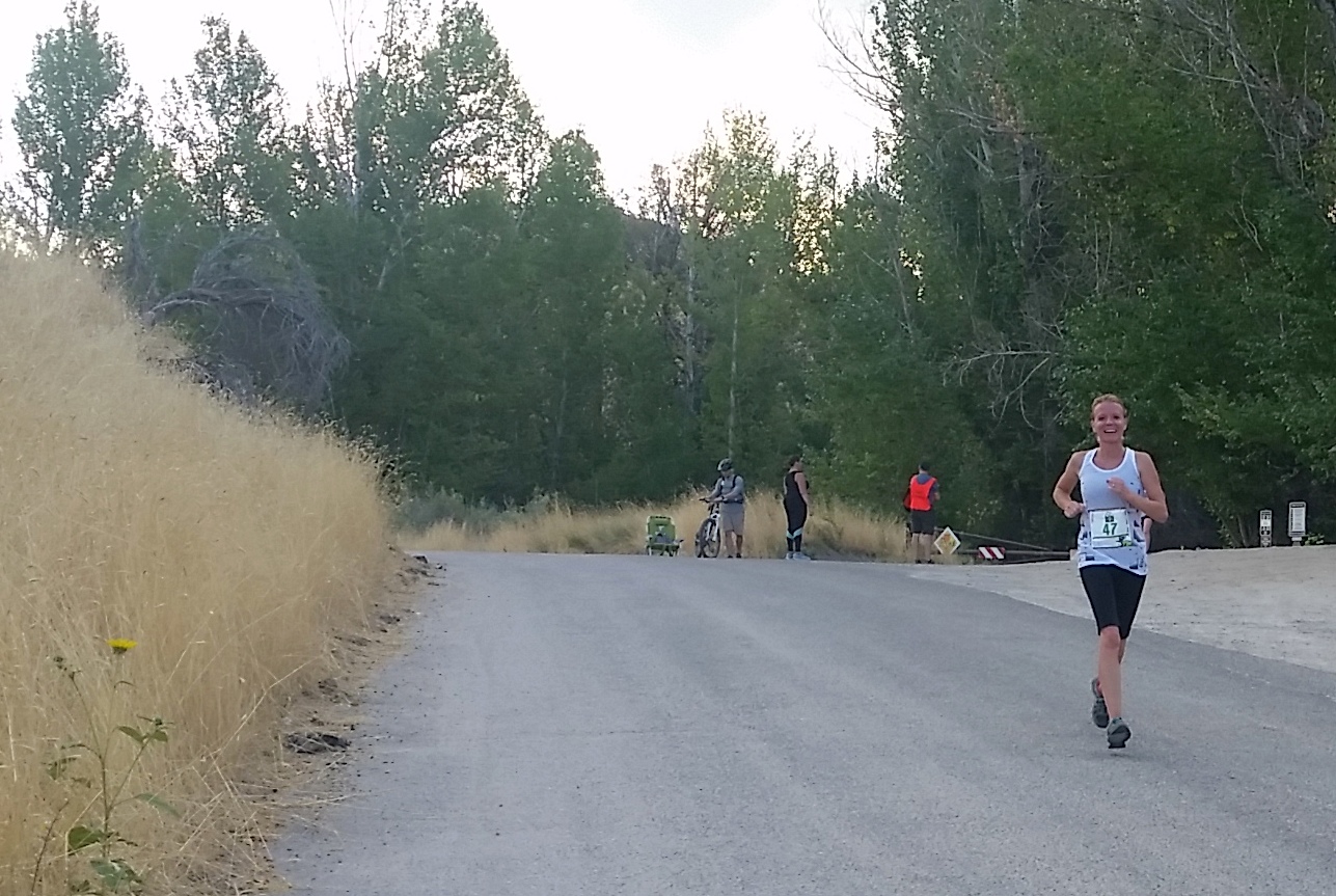
I doubled back on the course and was able to get some good photos of Cyndi as she finished her race.
Cyndi nearing the finish of the XC12K. This is at ~Mile 7.5, which is the only road portion of the course.
We waited around for the raffle and awards. Unfortunately we didn’t win the raffle, but I was quite happy about the $25 cash that effectively reimbursed my entry fee 🙂
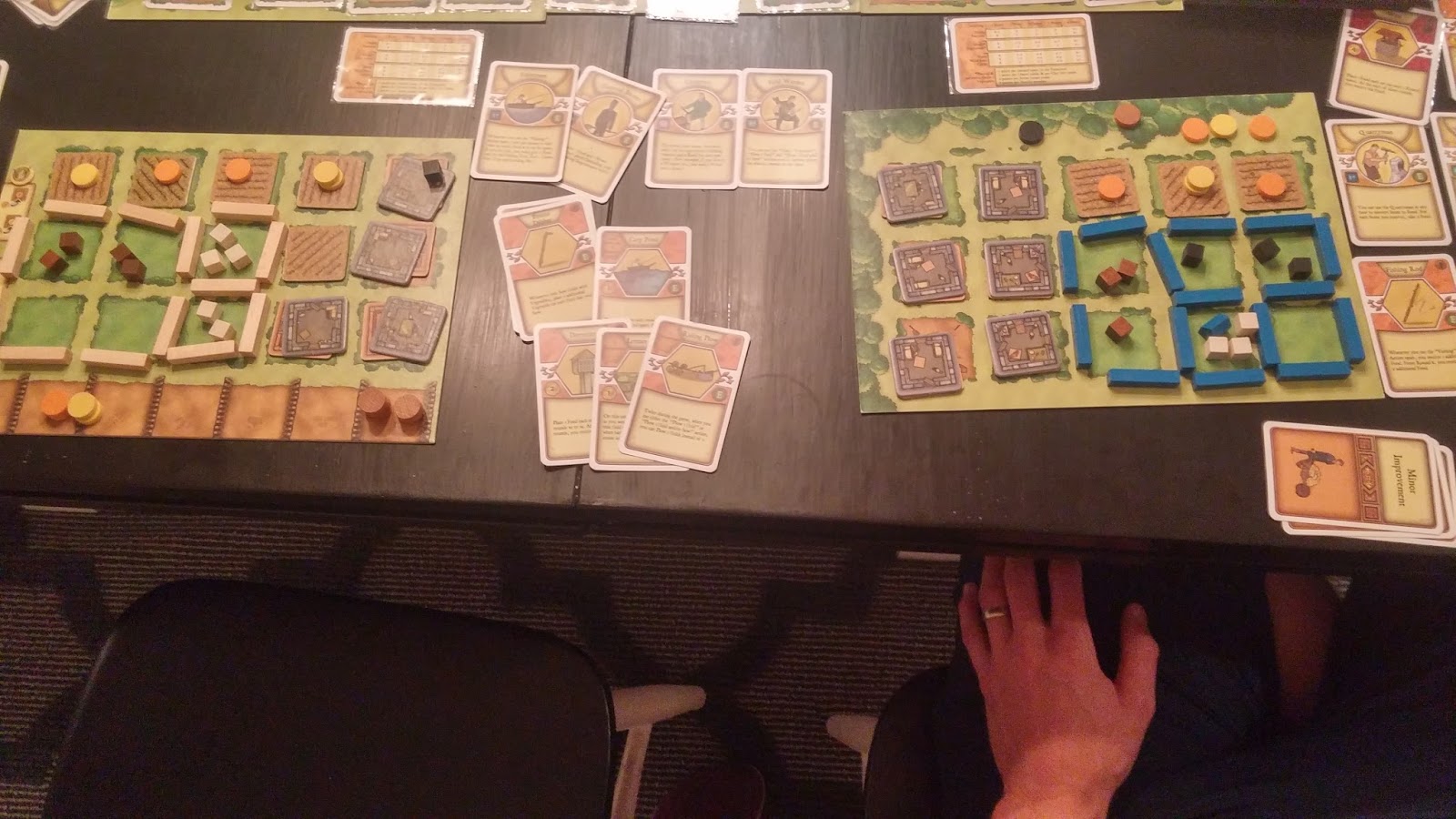
Then we headed home where I could finish out my birthday with some presents, yard work, cake, free root beer floats at A&W, processing peaches from our tree, a BBQ, and a fun board game with Cyndi and friends.
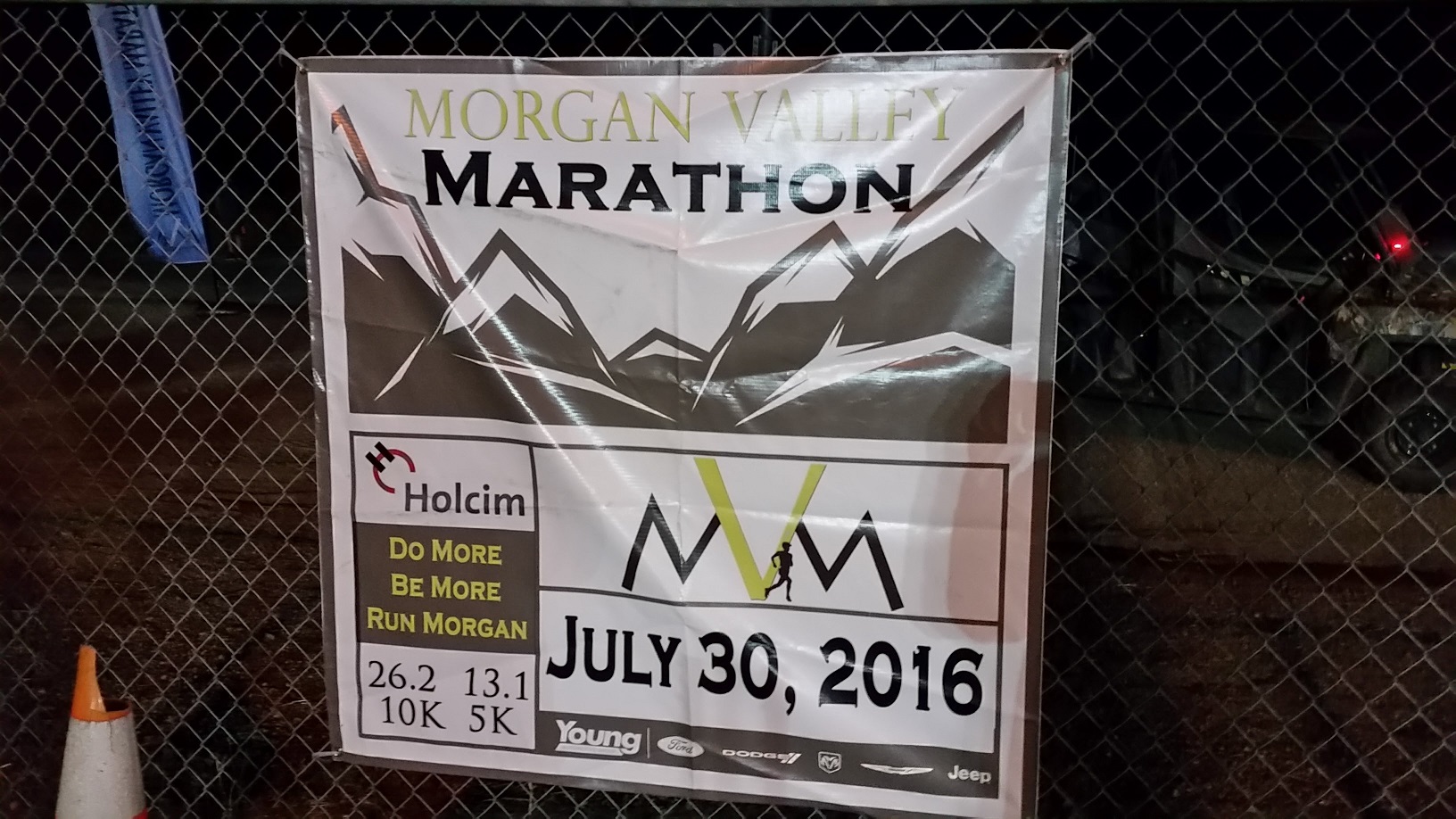
A shooting star, a skunk, some angry dogs, a beautiful sunrise, verdant farms, goats, little rolling hills, magnificent mountains in every direction, great organization: these were some of the things that made the Morgan Valley Marathon a memorable event that I would happily do again.
Background
My youngest brother, Jake, was getting married on July 30 in Utah. Since Utah is chock full of marathons and Idaho (my home state) isn’t, I decided it might be worth seeing which events were happening around that time. (I might as well run a marathon if I’m going to be in Utah, right?) I found two prospective marathons: the Deseret News Classic on July 25th and the Morgan Valley Marathon on July 30th.
I’ve wanted to run Deseret News for some time, but it was looking to be a busy week at work so I didn’t think I could get away for a whole week. It took place on Monday this year in conjunction with Utah’s Pioneer Day.
That left the Morgan Valley Marathon. It’s a fairly small event — about 100 runners in the marathon, but more than that in the Half and also some in the 10k and 5k. I only found one or two reviews of the marathon online, and they were very positive. I finally decided to sign up about two weeks before the race as I didn’t have any injuries and felt that I could have a good run. We had actually ran/driven through the area during the Ragnar Wasatch Back in June and I knew it was a nice area.
The Morgan Valley Marathon Course
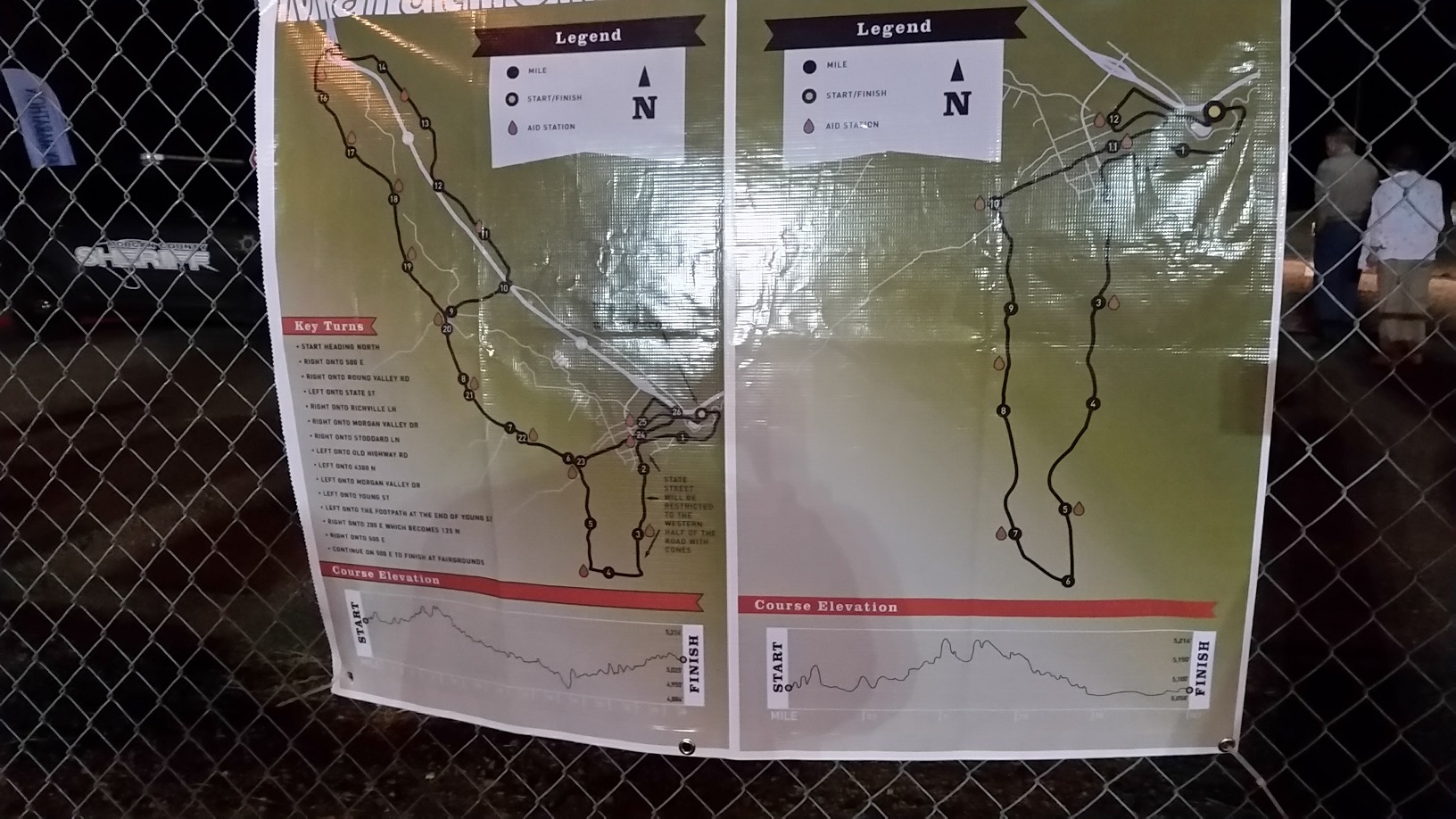
The Morgan Valley Marathon course is a little challenging. It takes place around 5.000 feet, with some little rolling hills throughout the course. No big hills, just little rollers. The course is basically a loop, although there is a little backtracking on one section. Net elevation change, therefore, is zero, but the gross elevation gain (total climbing) was about 620 feet according to my Garmin.
I checked out the Morgan Valley Marathon course map while I was milling around near the starting line
That describes the course’s difficulty, but not its beauty. The course turned out to be right up my alley. Most of the course is on along a lightly used country road with hills on one side and green farms on the other. There were American flags proudly displayed, tethered goats taking care of weeds, cows, horses, deer, and even a skunk. As if that wasn’t enough, the course is in a valley which means huge, rocky mountains in every direction. Moreover, since the start time was at 5:30am, we were graced with a gorgeous sunrise on a thin layer of stratus clouds. The only downside to the course was a ~4 mile stretch near a freeway which was a little noisy. Otherwise it was amazing.
Here’s a shot of part of the course, but imagine it under a morning sunrise:
I think the Morgan Valley Marathon course was my favorite I’ve ran so far. I probably preferred it to the St. George Marathon.
Tapering and Preparation for the Marathon
Given that this wasn’t a great course for a personal record (elevation, rolling hills), I decided to do a softer taper than normal. I didn’t want to do a full taper and interrupt my training too much. I went backpacking to Hell Roaring Lake two weekends before the marathon, which meant no long run that weekend (although I did do a 14 miler on the Wednesday before backpacking). The week before marathon week, I did 13 miles on Monday, 9.5 miles on Wednesday, and 14 miles on Friday. I also cross trained and did a little recovery running on the other days. I’d never done a 14 miler the weekend before a marathon, so that was somewhat experimental.
I did a full taper the week of the marathon: 6.5 miles Monday, cross training Tuesday, 5 miles Wednesday, 4 recovery miles Thursday, and resting on Friday (actually driving).
I caught a cold starting on Tuesday, so I did everything I could to shake it. This included drinking a ton, some vitamin supplementation, medicine, and zinc lozenges. My main fear was getting a cough, but I was very blessed to be feeling mostly better on Friday as we drove to Utah.
We had a pretty big family lunch of pizza, salad, and fruit on Friday. I only ate three slices of pizza but I ate a lot of salad and watermelon. Since my brother was getting married on Saturday, we had a little bachelor party for him on Friday evening. They all wanted to do sushi, so I joined in despite never having really tried sushi. It was pretty good and I ate quite a bit — a variety of rolls mostly. I figured the rice would work well for the carbs, although all the fish was more questionable.
I got to bed a little before 11pm on Friday, and then I woke up at 2:45 (ugh). We were staying with a friend in Springville, UT, which is 1.5 hours from Morgan, UT. I hit the road just after 3am, all alone, and arrived in Morgan at about 4:30am to pick up my packet and get ready.
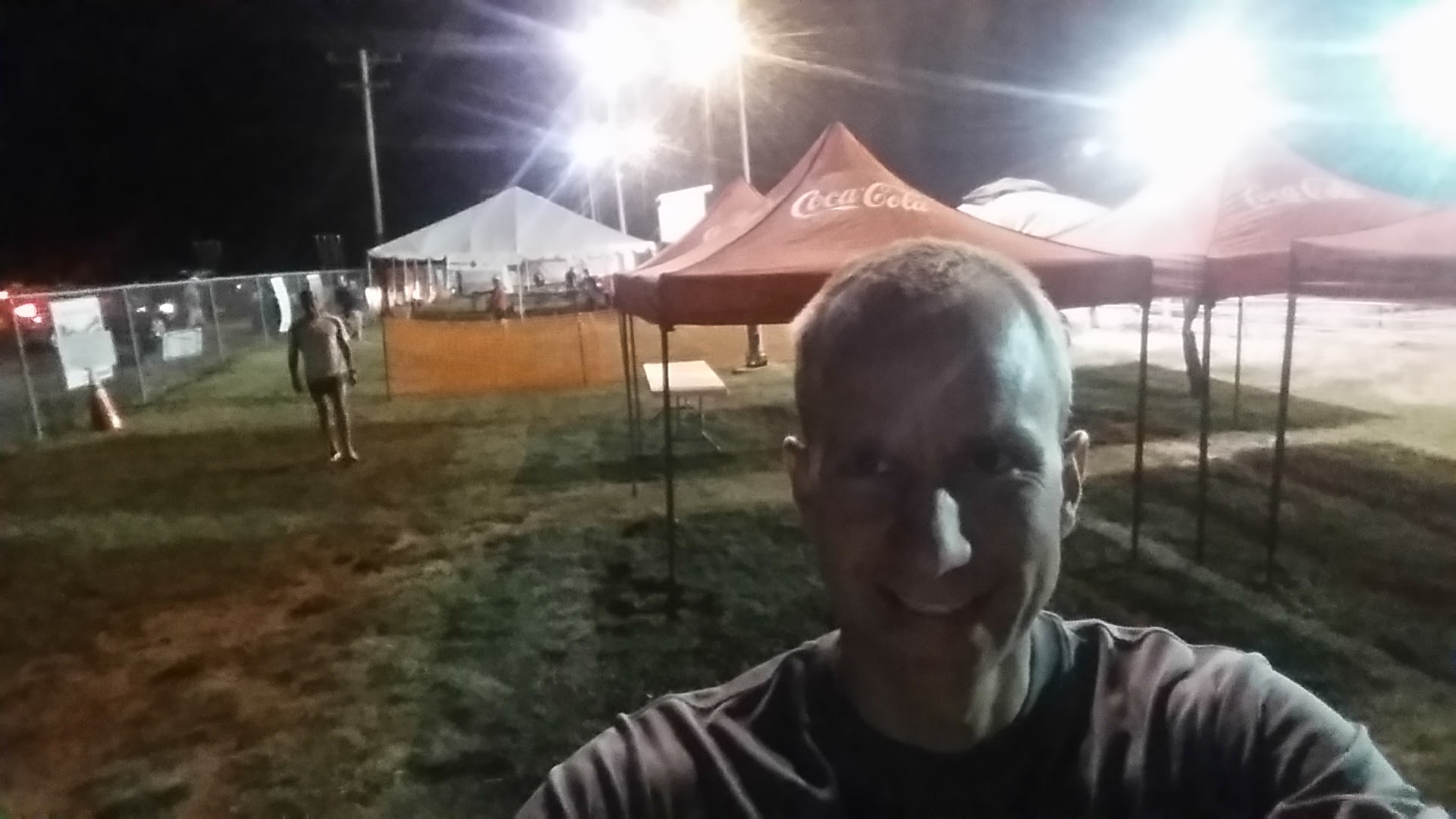
Picked up my packet in the wee hours of the morning at the Morgan Valley Marathon.
I started finally feeling pumped at about 5am. Up until that time I was a little concerned about my unusual taper, my cold, and my lack of sleep.
Is that a Creamies trailer I see? Something to look forward to after the Morgan Valley Marathon.
I lined up with just under 100 other runners at about 5:25. I talked to a guy named David who told me he had ran a 1:21 half in Wyoming (at high elevation) and did a lot of trail running in the mountains. This was his first marathon.
The Race
The gun fired and we began the Morgan Valley Marathon. I really didn’t want to go too hard in this race, particularly early on. About a quarter mile from the start I saw a nice meteor cross the twilight sky to my right, which I thought was pretty cool. I held myself back really well for the first half mile as three runners took the lead ahead of me: a lady named Rosy, David, and another guy named Matt. They ran stride for stride about 30 yards ahead of me for a while, so I decided to catch up with them. I did so at about Mile 1, but then I let them go again as they were going too fast for my liking. I figured the lady meant business since I haven’t seen many women go out that fast in a marathon.
A police officer in an SUV with the police lights on escorted us for the first 3 miles or so. We went through a neighborhood from about Mile 1 to Mile 2. I trailed the three leaders by 50-100 yards. After the neighborhood we started running by houses on farms. Then at about Mile 3, I heard some dogs and saw the three runners ahead of me have to stop and shoo away two big dogs that were in the road from a nearby house. Luckily the police escort noticed. He got out of his car and was yelling at the dogs by the time I got there. He guided them back to the house and presumably knocked on the door and woke the family up so they would get their dogs on a leash.
There was a right turn at mile 3.5 and I noticed that Matt started to fall back from David and Rosy. I stayed about 100 yards behind Matt for the next few miles while David and Rosy slowly pulled away.
Around Mile 4.5 of the Morgan Valley Marathon we made another right turn and this is where I really started falling in love with the course. There was a hillside on our left and beautiful farms along our right. The road wasn’t closed, but there was hardly any traffic. It was a little curvy and very rural. I saw a deer at in the hills at one point, and I’m sure I could have seen more had I opened my eyes a bit more.
There were also a lot of goats near the road. They would be tethered to a tree or pole in order to keep the weeds down (I presume).
Right at Mile 7 I was minding my own business when I spotted a skunk crossing the road ahead of me on a direct intercept course. I’m so glad I noticed it! I would have ran right into it. I quickly moved to the other side of the road and even stopped to wait for it to cross. It raised its tail but luckily didn’t spray me. I passed by once it ducked into the weeds.
There were plenty of aid stations. They were placed about every two miles along the course. I was worried about hydration since the low on Friday night was 62F, and I figured it would heat up in the last hour of the race. I drank Powerade at several aid stations and water at some of them. When I woke up at 3am, I had downed a Gatorade and then some extra water before the race.
I noticed I was started to gain a little on Matt. It was just a few yards per mile, but I was definitely closing. We turned right again after Mile 9 and made our way through a little town called Stoddard, established 1860 if I remember correctly. I liked this since I live right by Stoddard Road (in Idaho). We approached the freeway and crossed it over an overpass. I spotted Rosy and David as they turned left after the overpass and determined that they were about 3 minutes ahead of me at this point.
Around Mile 12 there was a quarter mile hill. Not too steep, but probably the hill I noticed most. I worked my way up and then went down pretty fast.
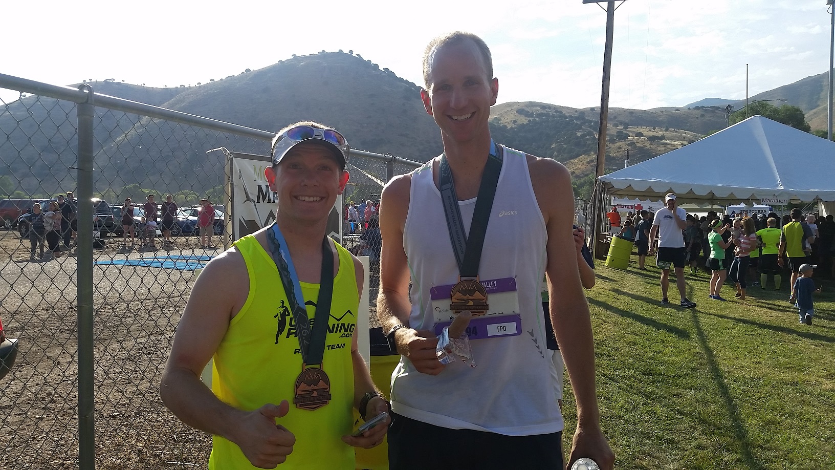
I finally caught Matt after the half way mark. That’s when I first learned his name and we talked a bit. He had done even less tapering than me, although he said he normally ran 70-80 miles per week, which is a lot more than me. After talking to him a bit, I found that we had many similarities: we’re both in our mid-30s, we had both PR’d and BQ’d on May 21st with sub 3 hour marathons, and we were both just hoping for low 3:00’s in this Morgan Valley Marathon. He was very friendly and it was nice to talk to him after running behind him for the last 13 miles. We stuck together until around Mile 15, at which point I sped up a bit and started to separate from him.
Post race photo with Matt
I felt some tightness around Mile 13, but I still felt good. In miles 15-18 I felt pretty strong and the tightness hadn’t worsened. I tried to surge a bit to take advantage of it while I could. I don’t think I actually sped up, but I did hold my pace pretty well.
Around Mile 15 I noticed the sun was shining. From then on the temperature slowly increased. However, it wasn’t as bad as I expected. It was a bit warm in the last three miles, but I didn’t feel like it affected me. I think my focus on drinking extra fluids paid off.
Around Mile 18 I choked down a Gu that I had picked up earlier on the course. I felt like my stomach could handle it, which was unusual for me this late in a marathon. I wanted the caffeine boost and the nutrition for the last few miles. A couple miles later I ate my last piece of Gu Energy Chew. The total consumption for my marathon included: two packs of Gu Energy Chews, one Honey Stinger Waffle (Gingersnap), one Gu, and a bunch of Powerade.
There was a little more uphill in the second half of the marathon, but it really wasn’t too bad. I didn’t mind the little rolling hills as they provided a little variation.
After Mile 20 I found myself slowing down unintentionally a few times. My mind would wander and my cadence would slow. When I realized it, I would immediately pick it back up, mainly by focusing on faster cadence.
I looked back a couple times for cars and for other runners. I had pulled away from Matt, but I could still see him and I was worried I would slow down and he wouldn’t.
At Mile 23 we turned left and joined up with the half marathoners. This was nice to have some company and a little more excitement. My pace was faster than the half marathoners at this stage, so I was passing people from this point forward.
One word on the Morgan Valley Marathon organization: it was spectacular. There was a volunteer at every turn and I never really had to worry that I was off track. This was important since the marathon was so spread out. I literally only saw three other marathon runners after the first half mile. I only saw Matt from Mile 13 to Mile 20. Then it was just me and the half marathoners that I saw.
The only issue I had with organization is that on the left turn at Mile 23, the aid station was on the wrong side of the road. I would have had to cross the road to grab a water, and I really didn’t want to, so I just didn’t drink at that point. It wasn’t a huge deal since I was almost done and I had consumed so much water already, but it was the one spot I thought could be improved.
I was doing a lot of math in my head to see where I’d end up. I had already eliminated the idea of matching my PR, but I was thinking about hitting sub 3:00:00. It seemed like I was about 30 seconds slow, which I didn’t think I could make up in the last couple miles, but I kept pushing.
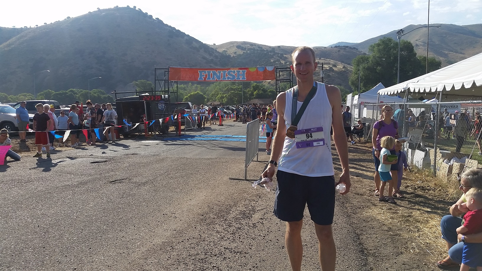
This was by far the strongest I’d felt in the last miles of a marathon. I pushed hard for the last mile, and saw that I actually did have a shot at a sub 3 hour marathon. After Mile 26 I picked it up even more, but alas, I came in at 3:00:08, just 9 seconds shy of 2:59!
Post Race
Standing in front of the Morgan Valley Marathon finish line… with a Premium Creamy in my hand.
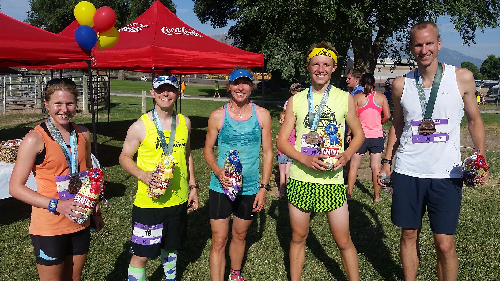
I was really happy with my time at the Morgan Valley Marathon, and with my 2nd place male finish. David and Rosy ended up finishing at 2:53. This was the second marathon in which I had taken 2nd to a first time marathoner that I talked to before the race (the first was the Mt. Nebo Marathon). Of course, since Rosy beat me I was 3rd overall.
Top 3 male and top 2 female finishers of the Morgan Valley Marathon
Matt finished just two minutes behind me. He had a great race as well and I’m guessing he’ll PR again in his fall marathon when he’s more rested and has an easier course. I’m hoping to do so as well, although I need to pick a marathon to run first.
I drank some chocolate milk and ate a couple Premium Creamies and chatted a bit with Matt and David. They handed out awards pretty fast, and we snapped some photos afterwards.
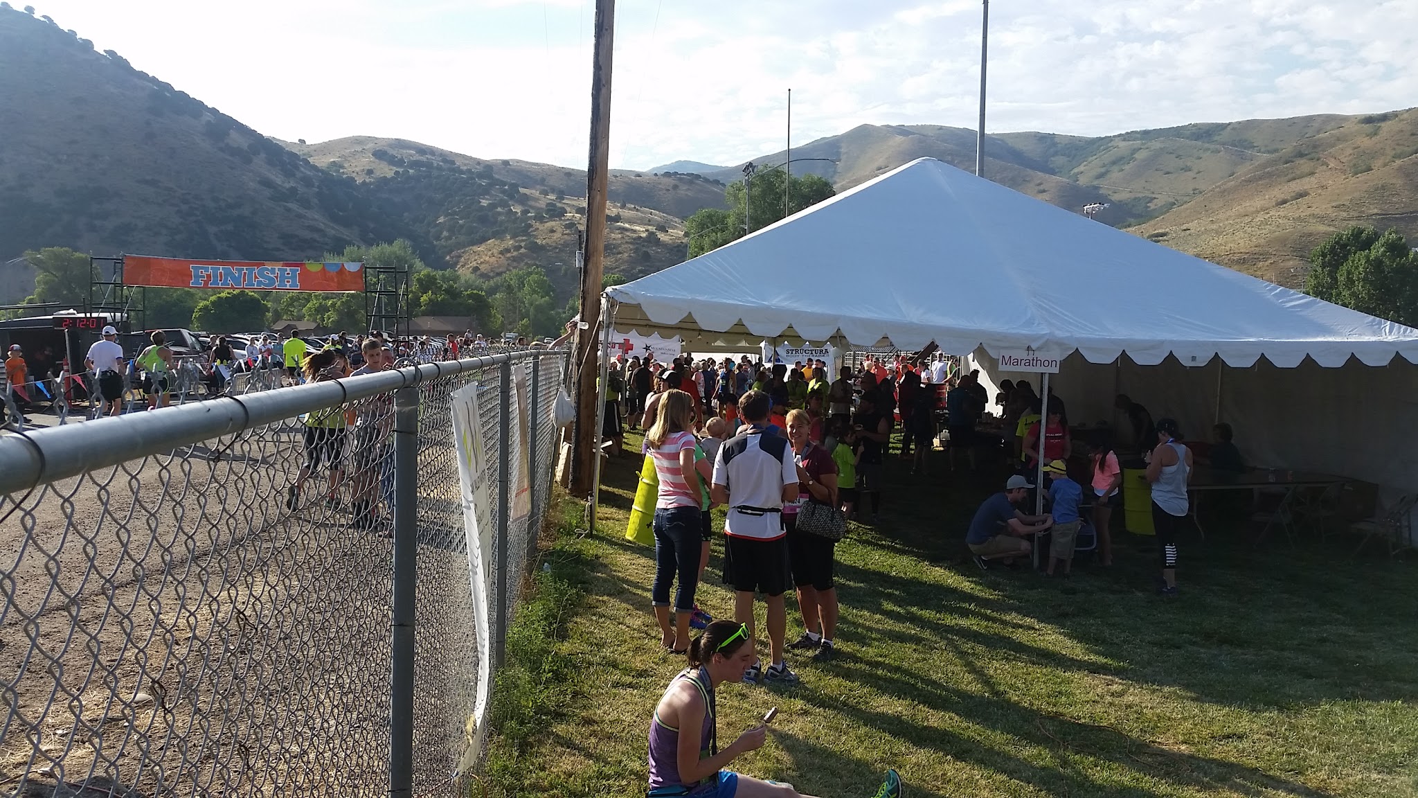
Morgan Valley Marathon finish line and post race party
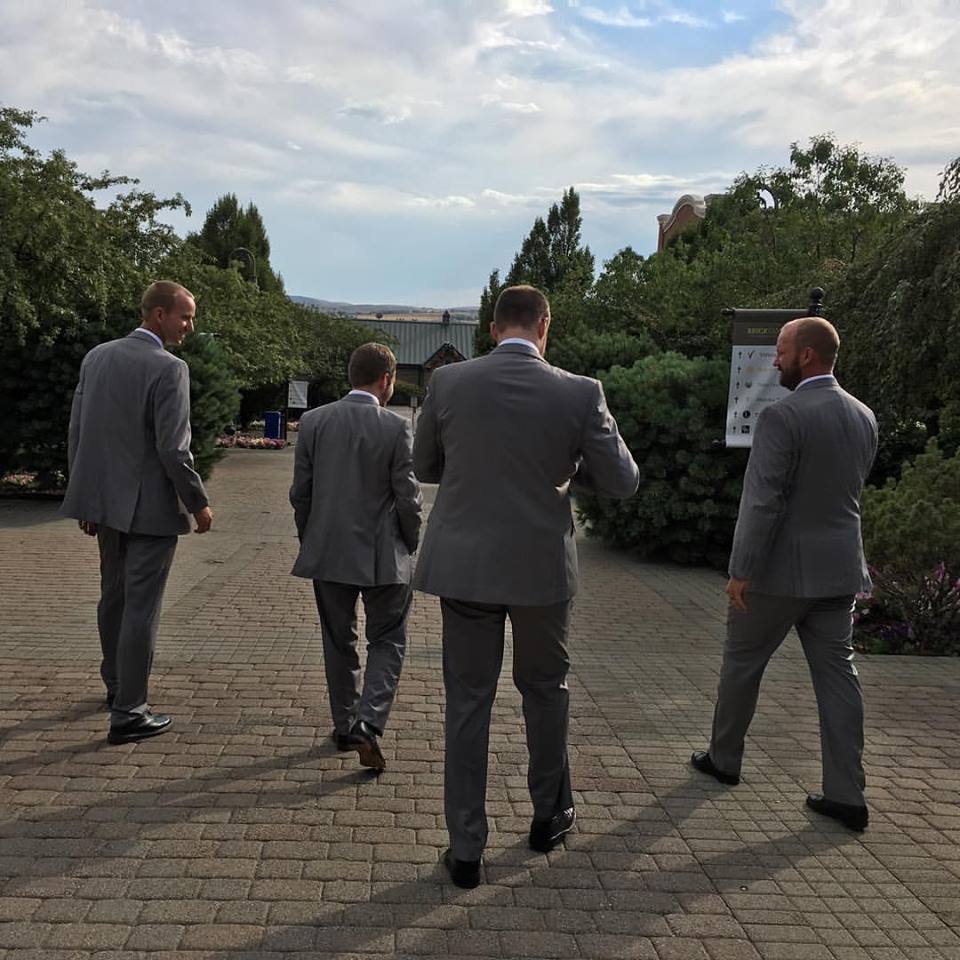
By 9:30am I was back in the car to make the 1.5 hour drive back to Springville. I spend some quality time with family that afternoon and had a fun time at my brother’s wedding that evening.
After the Morgan Valley Marathon I went to be a groomsman at my brother’s wedding.
The Morgan Valley Marathon was a great experience. Kudos to the race organizers who put on a great event. The course was striking and fun to run. Between the Morgan Valley Marathon and the Ragnar Wasatch Back, I have a new appreciation for that area of Utah.