
Last week I did another great backpacking trip to Idaho’s White Cloud Mountains. I love the White Clouds and enjoyed the scenery, the challenge, and the chance to spend some time outdoors.
The route I took this year was similar to my backpacking trip to the White Cloud Mountains last year. However, this year I was with a big group of 20 people, including 14 scouts and 6 adults. This is the maximum group size allowed (as of August 2016), and I suspect that the limit will be reduced in the near future. The area was just protected as a Wilderness last year, which led to additional restrictions. My assumption is that more restrictions will go into effect with time.
White Clouds Backpacking Day 1
We left the valley at about 6:30am on Wednesday, August 10. Due to the Pioneer Fire, the road between Banks and Loman was closed, so we took Highway 21 through Idaho City, Loman, and then on to Stanley. We saw the destruction from the Pioneer Fire between Idaho City and Loman. In fact, there was still smoke everywhere and we saw a few burning logs and brush fires.
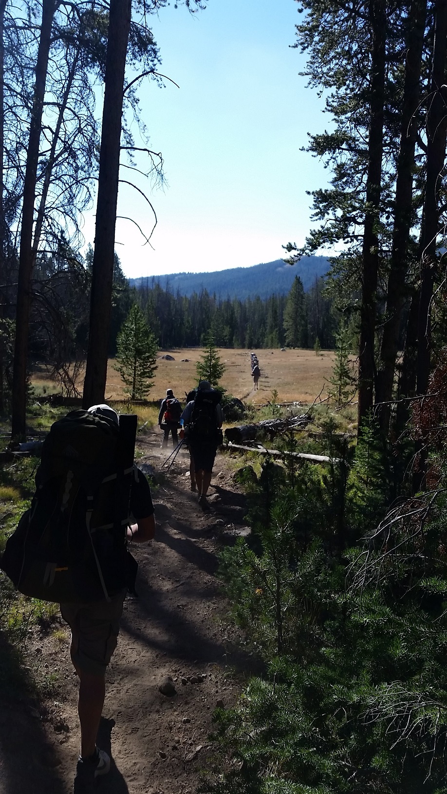
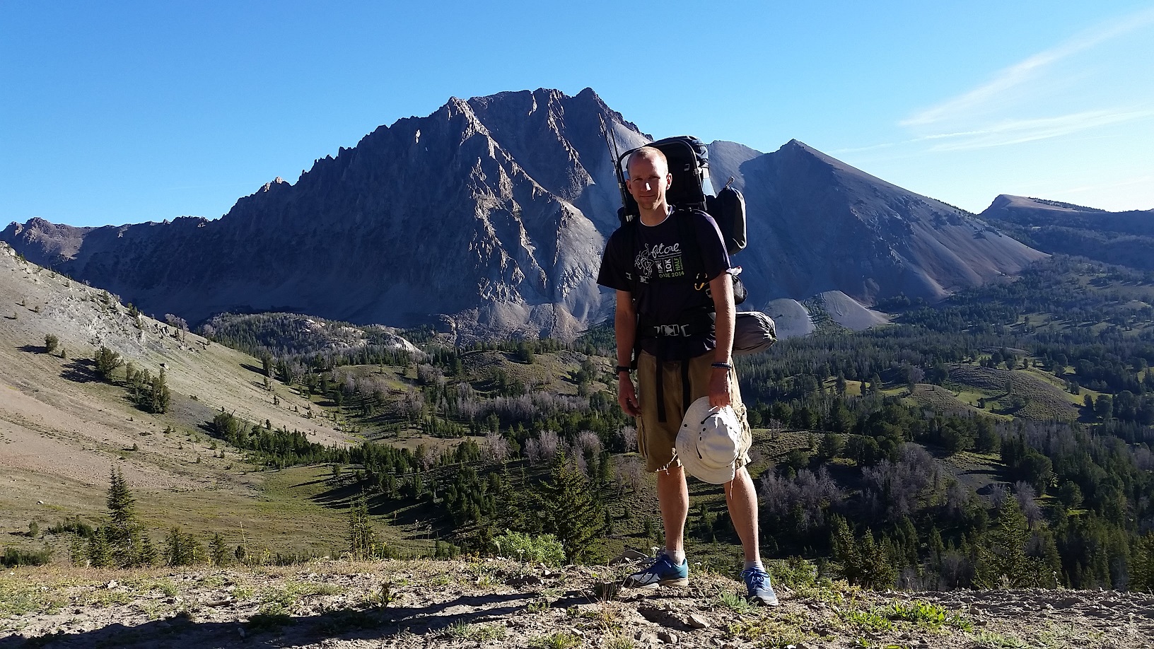
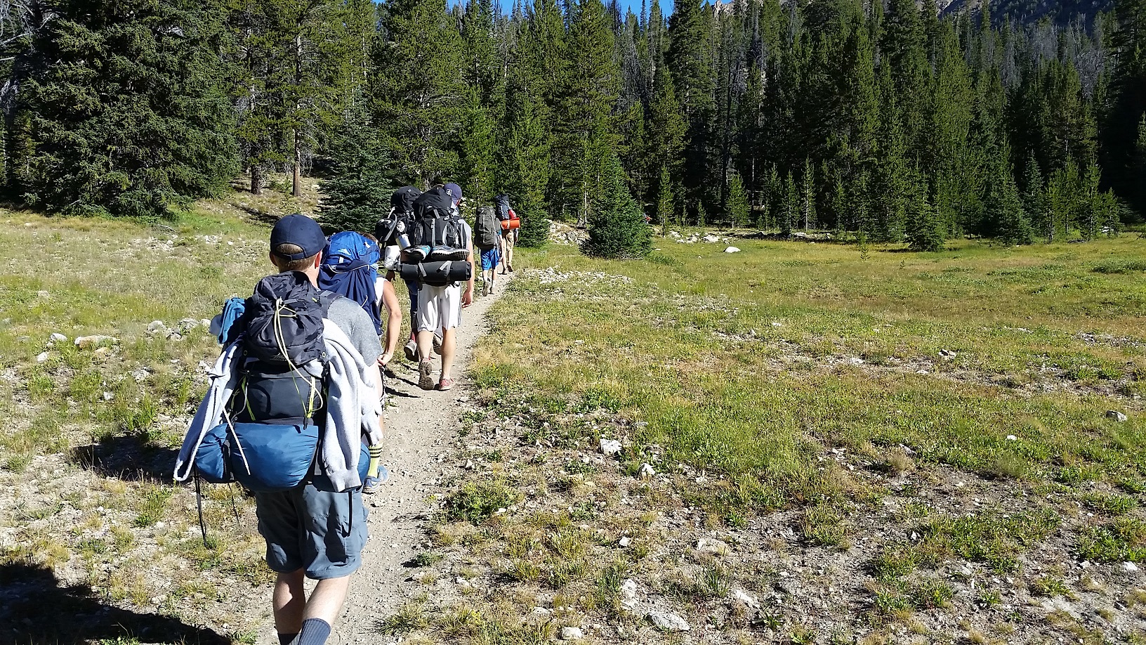
We arrived at the 4th of July Trailhead and started hiking around 11:30am. Everyone was carrying their food for 4 days, so packs were a bit heavy that first day. It also seems to take a day to get broken in for a good backpacking trip.
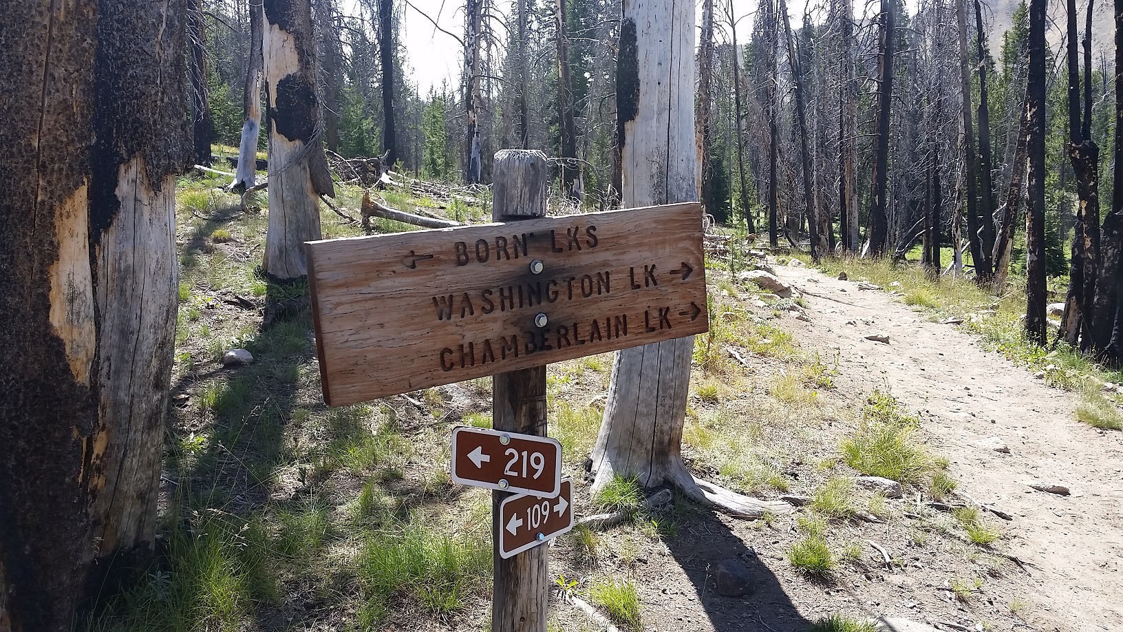
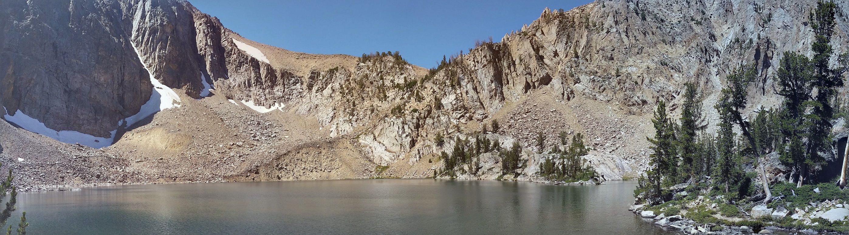
We made our way from the trailhead to 4th of July Lake, but besides a short break to let everyone in the group catch up, we didn’t really spend any time at the lake. The climb to the lake is pretty good, and then the trail continues on to Born Lakes with another significant climb to the top of the ridge. The total climb is around 1200 feet. We spent some time on the ridge taking pictures and hiking to a small peak. I also pointed out Devil’s Staircase to the group, which we would be climbing the next day.

We then descended down the ridge on the switchbacks and made our way to one of the farther Born Lakes.
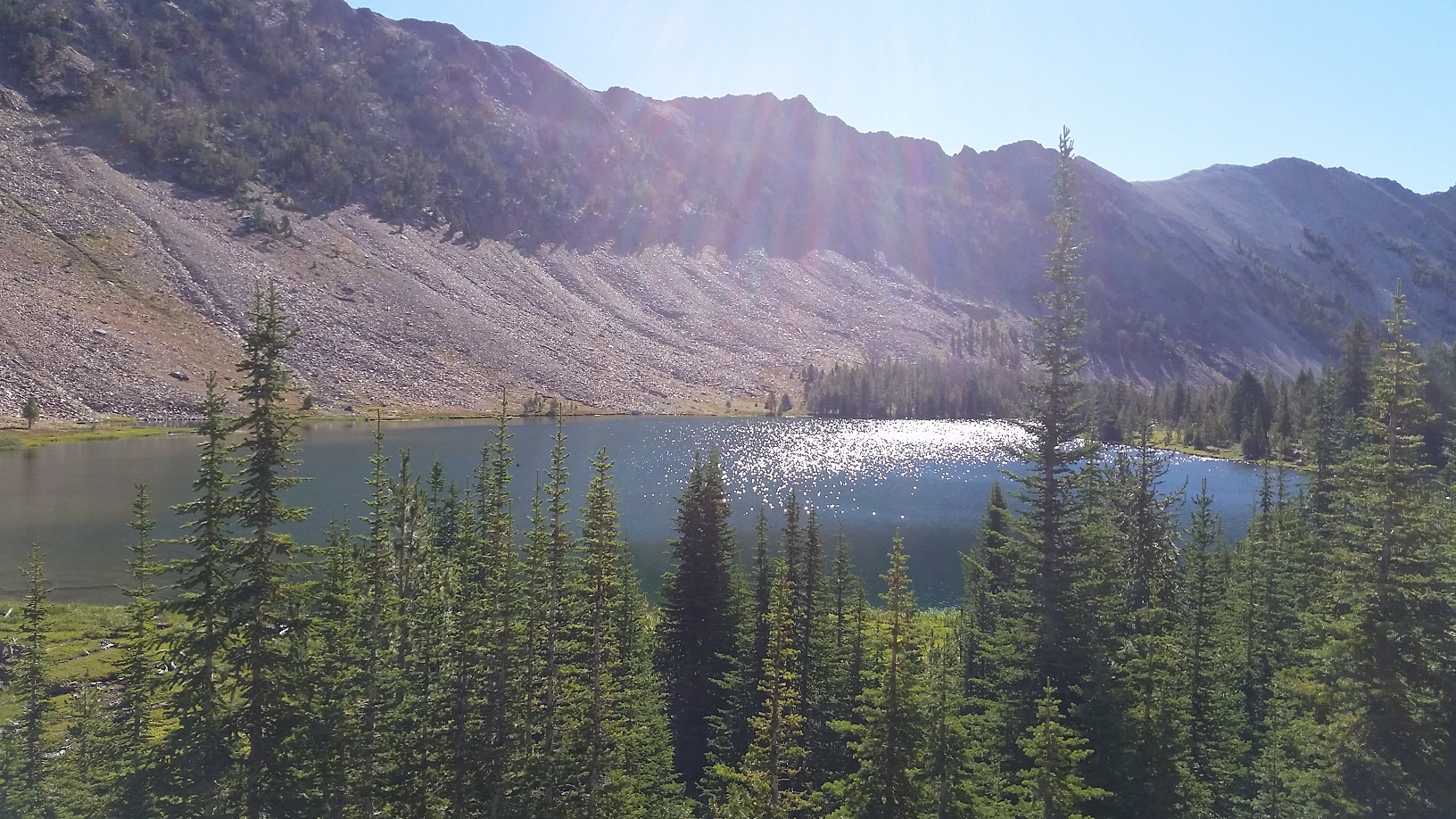
The Born Lakes are a set of 7-9 lakes nestled in Antz Basin. There are a couple big lakes and the rest are pretty small. The first decent sized lake is about 4 miles from the trailhead and the other bigger lake is about 5 miles. We came across a gentleman who didn’t want us there and said there wasn’t room for all of us at the lake we were headed to. He wanted us to hike down Antz Basin and find another spot. We said we’d check it out, and there was plenty of room for us (as I knew since I’d been here twice before). He also said he came there every year. Interesting how some people want to be the only ones to enjoy beautiful areas such as this. They want to come every year, but find it hard to share with others. I understand that most people don’t want to see other people in the back country, but it’s public land and everyone has a right to it. I’m grateful that my scout leaders introduced me to the White Clouds and Sawtooths and outdoors in general, and the benefits that our scouts got from this trip would stay with them forever.
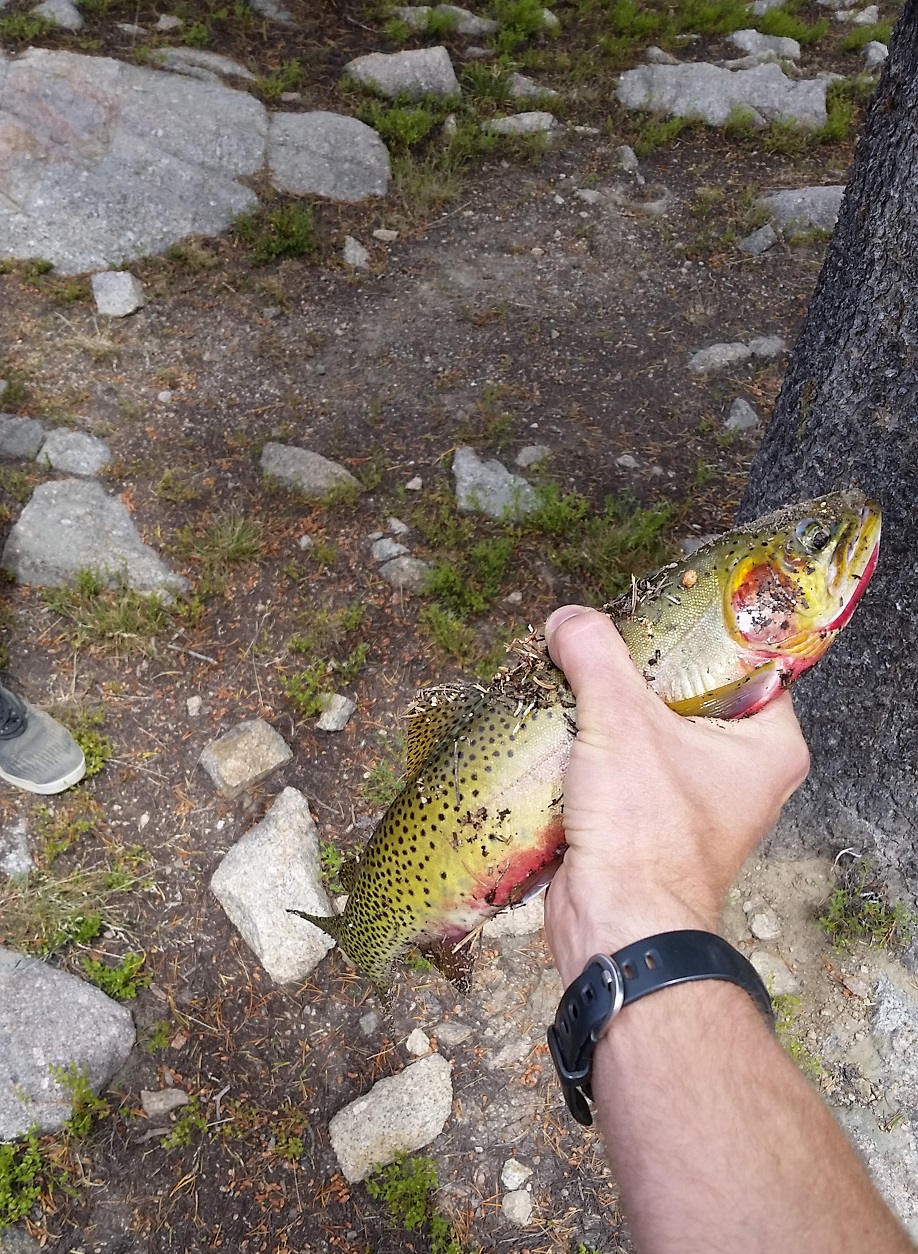
Right after arriving at the lake I started working on catching my first fish. I caught a nice one pretty quickly, which left me satisfied so that I could set up the tent. Some of us also jumped in the lake to rinse off after the 5 mile hike.
After we had set up camp, a ranger came through and made sure our group size was within the limit. He was pretty nice and gave us some instruction on how to properly Leave No Trace. We had reviewed this with the scouts but it was good to go through it again with the ranger.
I didn’t sleep great that night. I was a bit too cold, and I never sleep well camping anyways. I should have worn an extra shirt and some extra socks.
White Clouds Backpacking Day 2 – Born Lakes to Boulder Chain Lakes
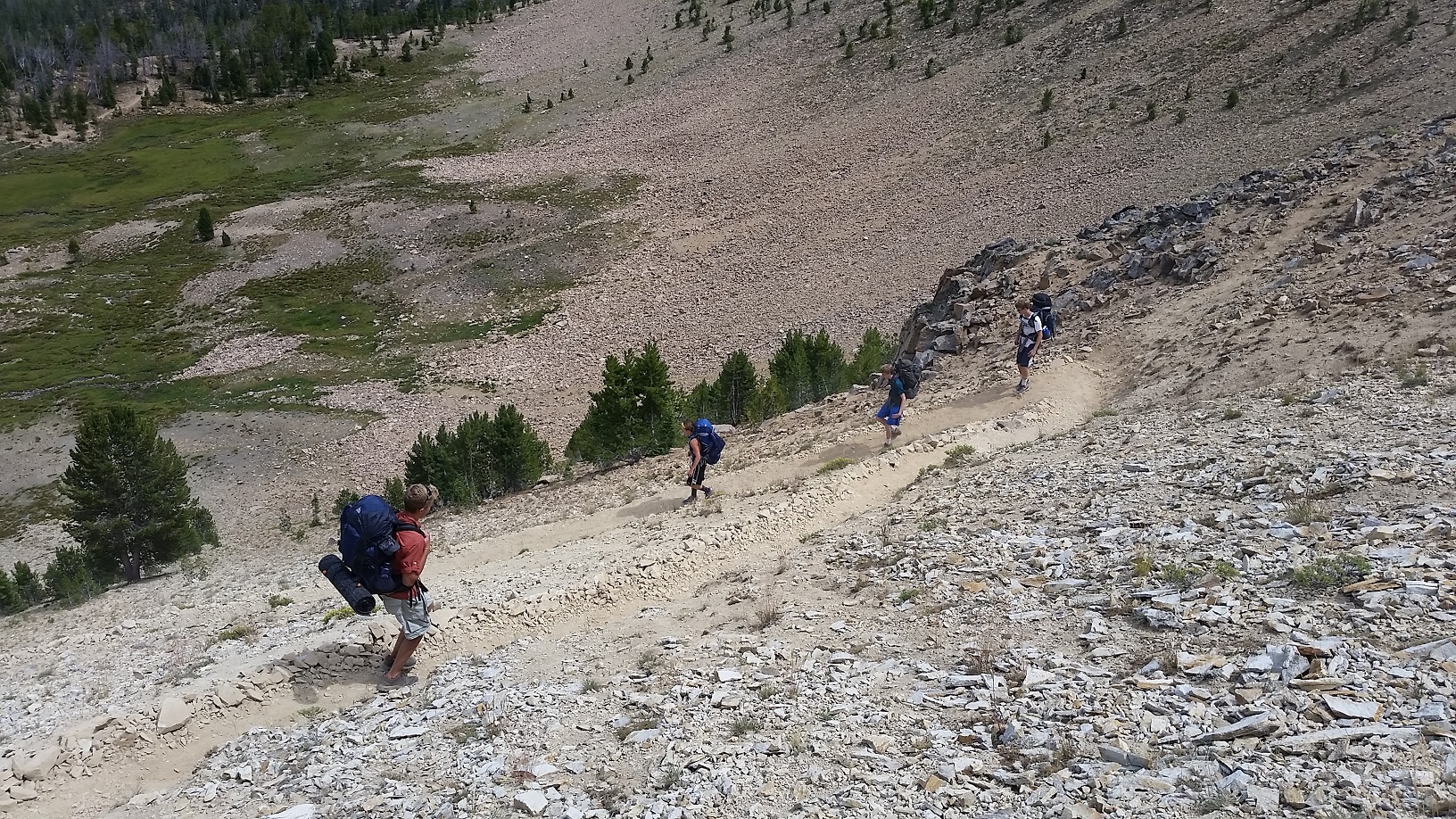
After breakfast on Thursday morning we got ready to ascend Devil’s Staircase. Devil’s Staircase is part of the shale ridge located to the north east of Born Lakes. It’s one of two popular ways to pass the ridge without going all the way around on the trail. The other popular way to get over the ridge is by going east from Born Lakes then crossing over the ridge to the south, leading into Four Lakes Basin.
Devil’s Staircase sounds and looks pretty nasty, but it’s really not too terrible. I’ve done it three times now — twice with a full (~50 lb) pack on my back. Still, it has a lot of loose shale and boulders. Since we had a large group, we spread out and attacked the pass about six people at a time spaced a few minutes apart. This worked out pretty well. It helps that Devil’s Staircase is angled up the ridge, so if you’re spread out you won’t be directly above/below other climbers.
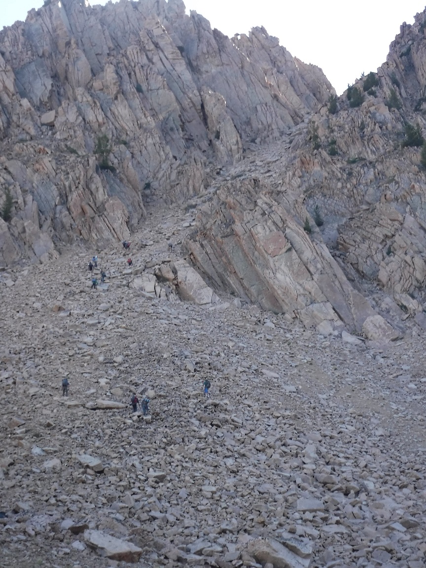
Fortunately for our group, we all made it safely up the ridge and down. One of our 14-year-old scouts got pretty scared at one point, but he was able to finish after taking a break and calming himself down.
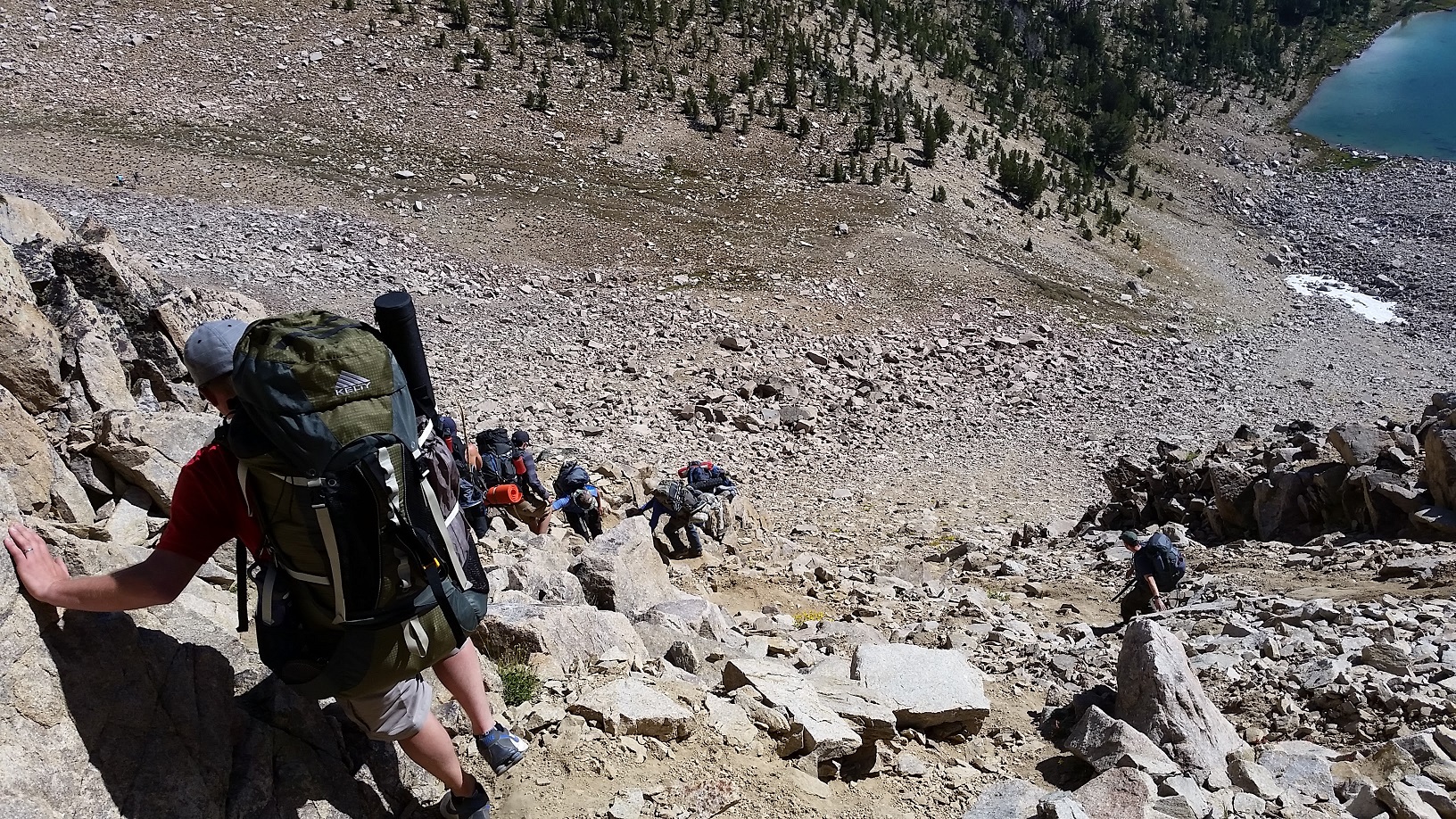
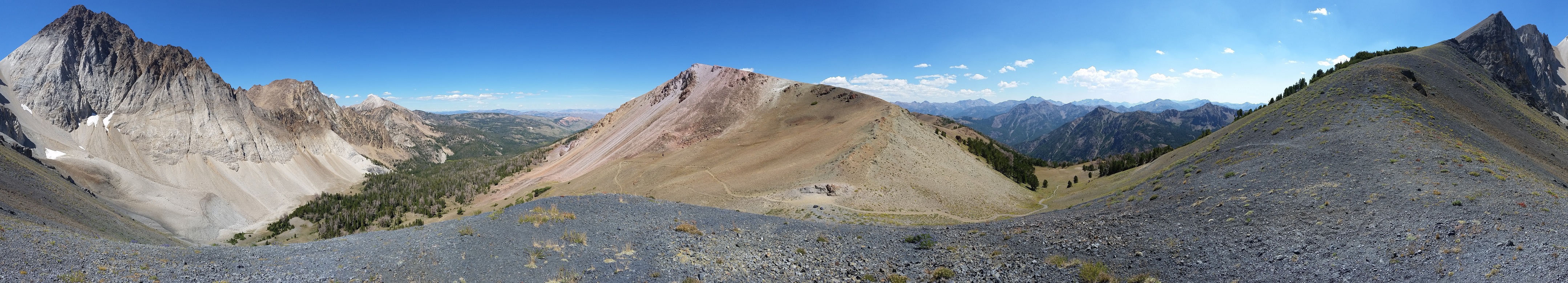
From the top of Devil’s Staircase, we headed down the other side toward Windy Devil. Some of us dropped our packs and hiked down to check out Shallow and Scree Lakes. Eventually we all made our way around the top of the basin to Windy Devil. At the top of Windy Devil there’s a nice trail which switchbacks down the shale face and leads into the Boulder Chain Lakes basin. (The trail starts right at the top of Windy Devil.)

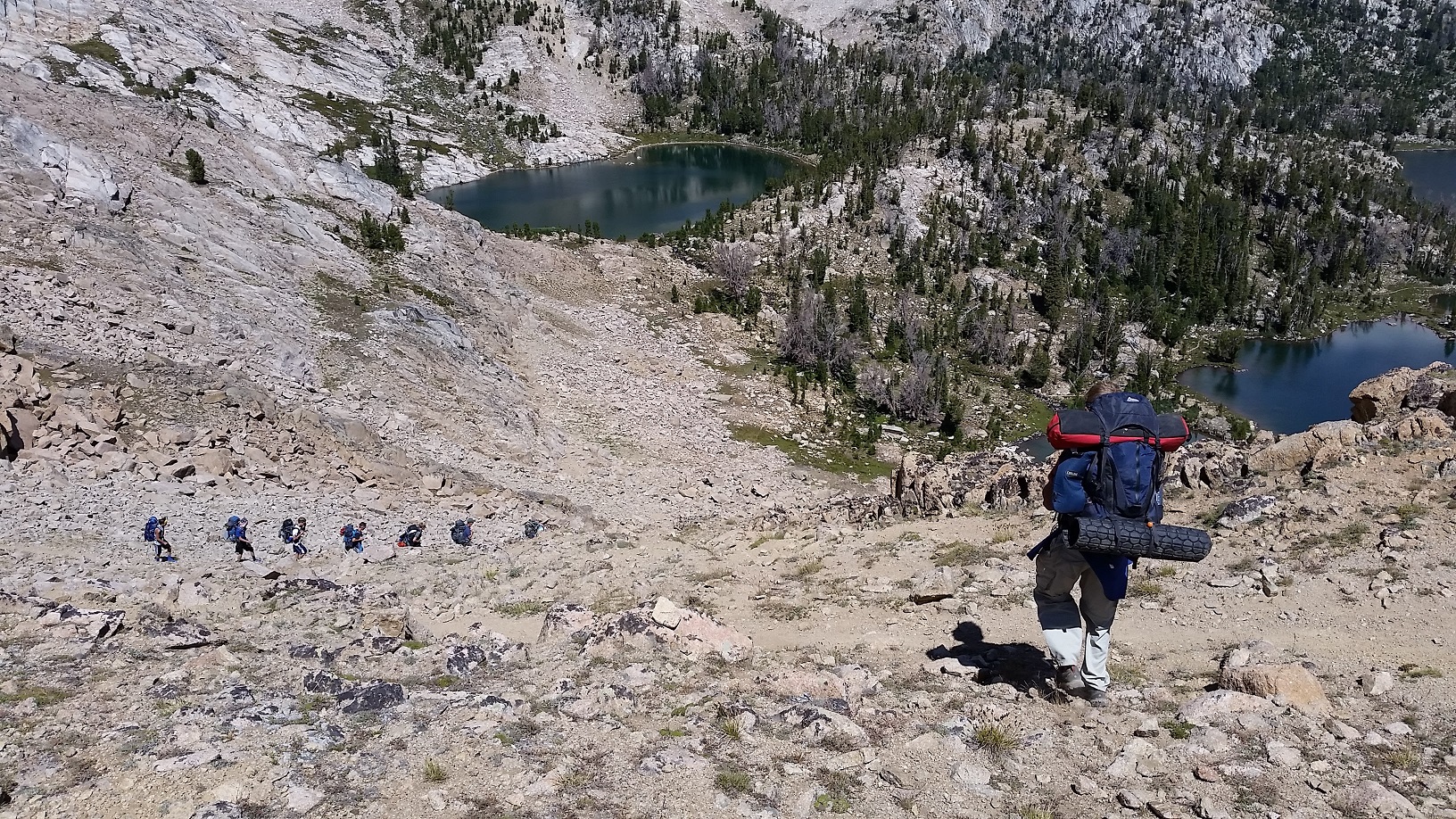
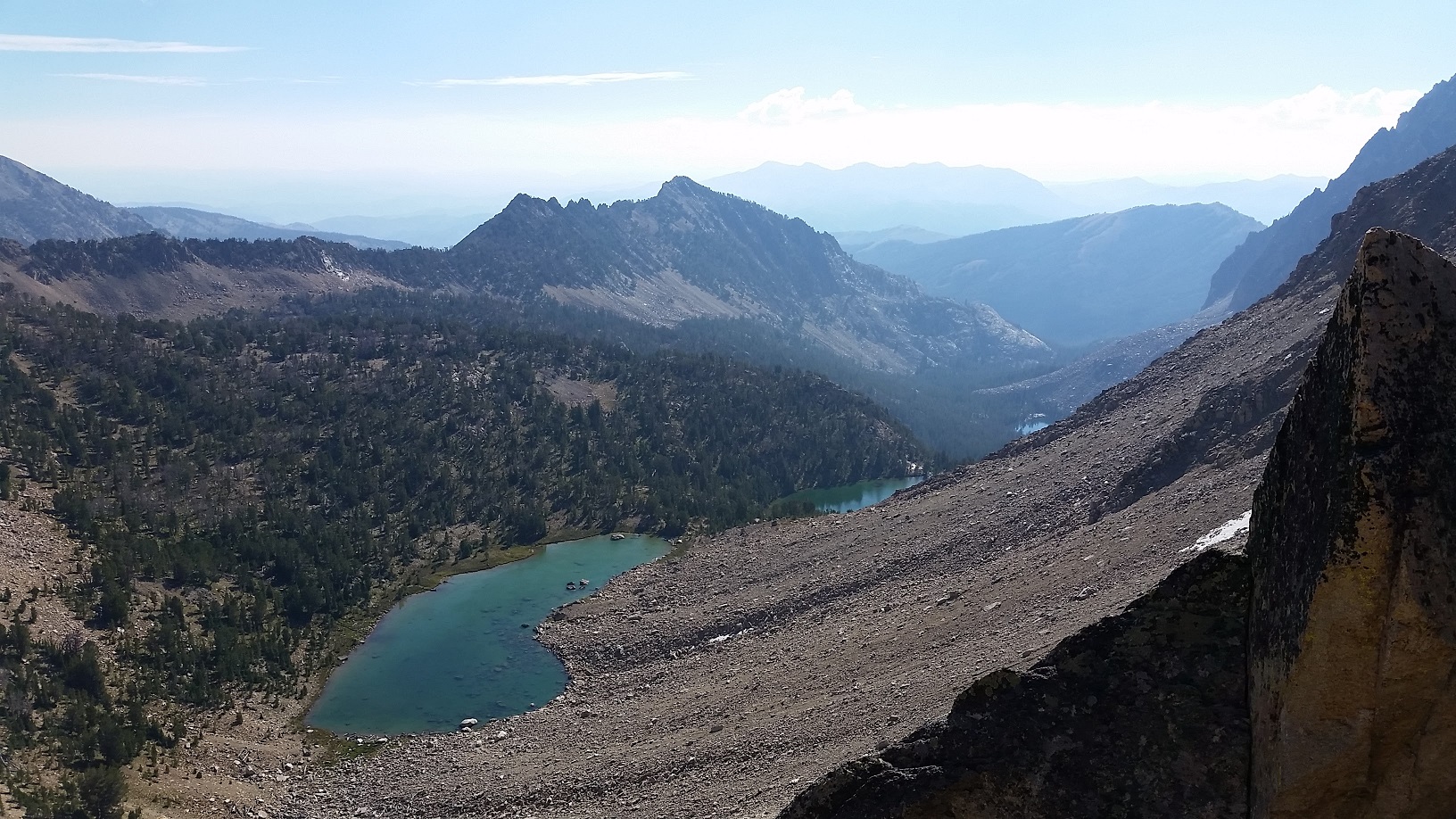
From Windy Devil there are some nice views of Headwall, Scoop, and Hummock Lakes — some of the upper Boulder Chain Lakes. We were pretty spread out by the time we started arriving at Scoop Lake, so we took a long break there. Some of us decided to check out Lonesome Lake and took a quick side trip up the granite ridge. The views from Lonesome Lake are spectacular and I highly recommend the trip.
Eventually we started to head down toward the lower Boulder Chain Lakes.

We fished and took some breaks, but finally decided on camping at Willow Lake at the bottom of the Boulder Chain.
Willow Lake seemed really cold, but it was worth taking another dip to clean up before bed time.
White Clouds Backpacking Day 3 – Boulder Chain Lakes to Chamberlain Basin
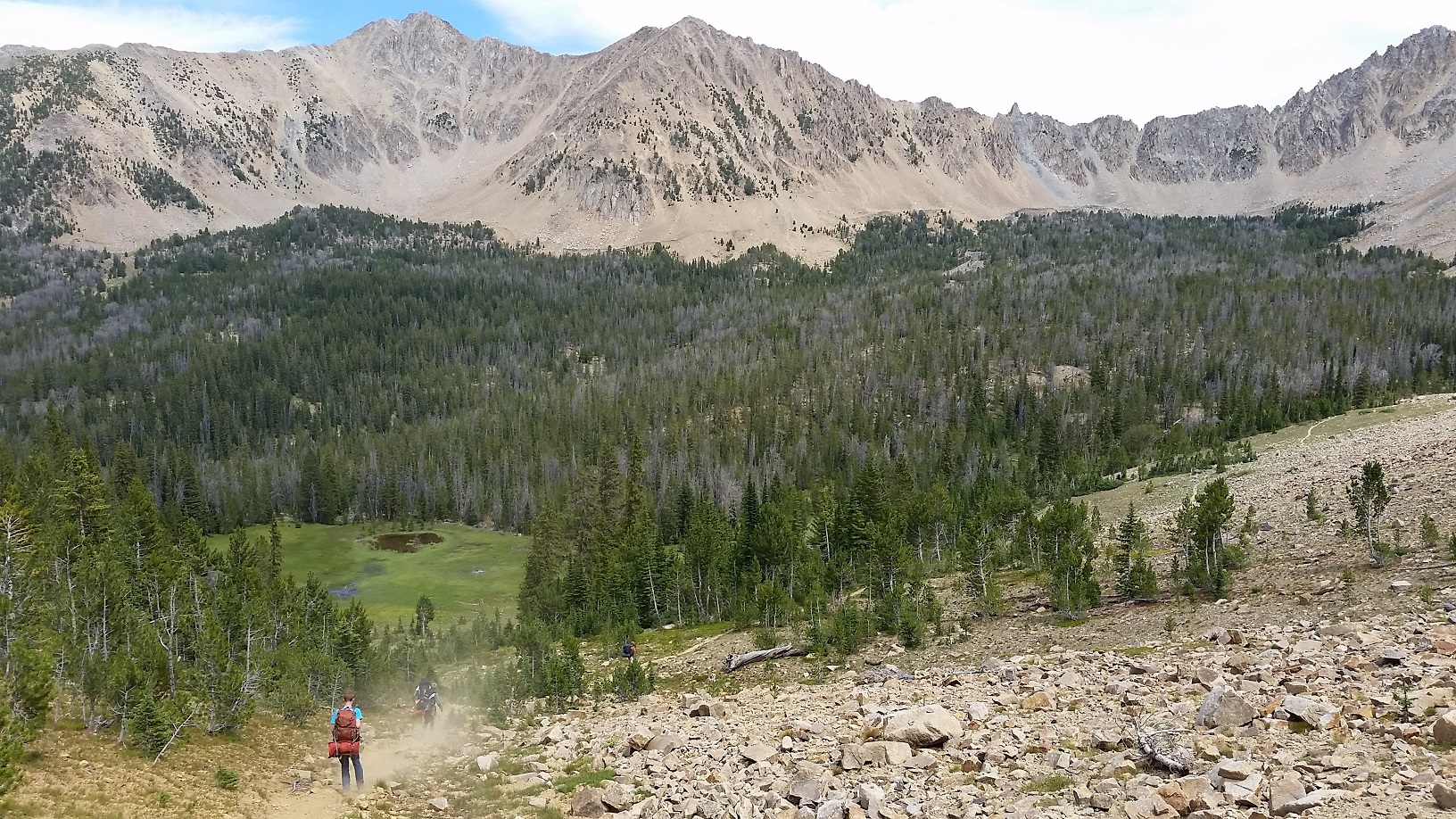
On Day 3 we were ready for a long slog to Chamberlain Basin. Our group set off with high hopes and expectations, but after a couple miles the climb started and some of our boys were bogged down as they made their way up the mountain.
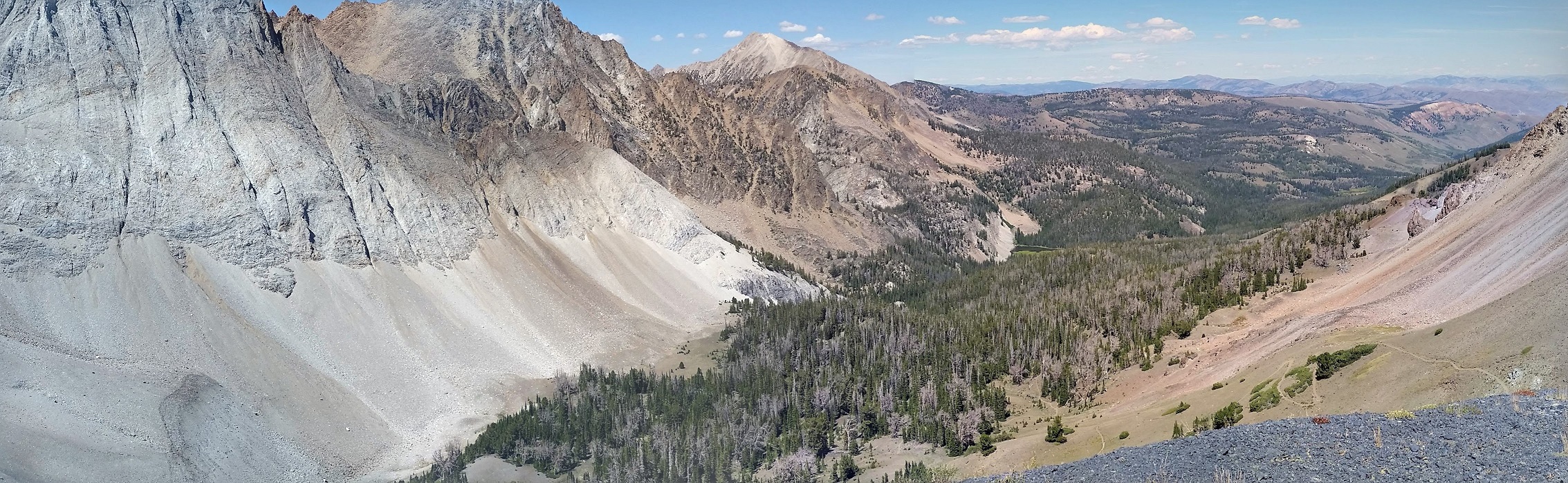
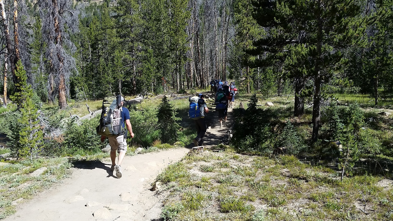
The trail takes backpackers through a lot of forested areas and some meadows. After a mile or so we were graced with an amazing view of Castle Peak.
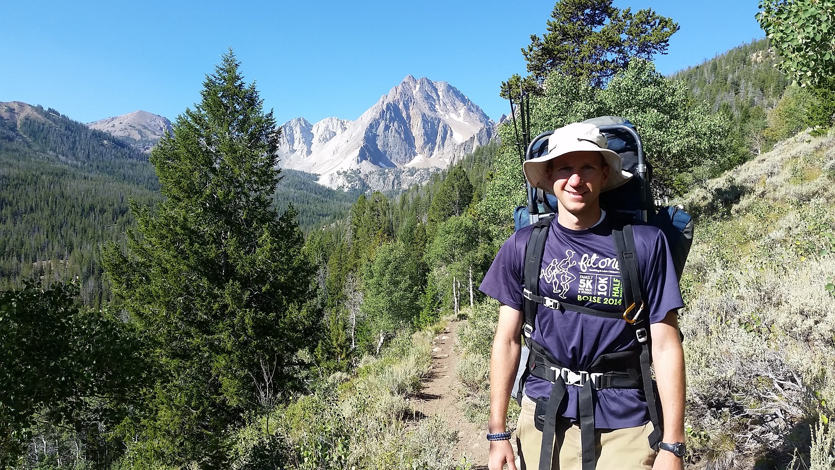
This is when I realized that the ridge just to the southeast of Castle Peak was the one we would be crossing. It was pretty far up. There’s a large creek crossing and then the uphill begins. Initially the uphill is all in the forest. I don’t like this part very much because I can’t see where I’m going.

Fortunately there were lots of currants (or gooseberries?) on the side of the trail which kept me distracted. Currants don’t really taste great, but they’re alright and it was a welcome challenge to try to find the ripest berries.
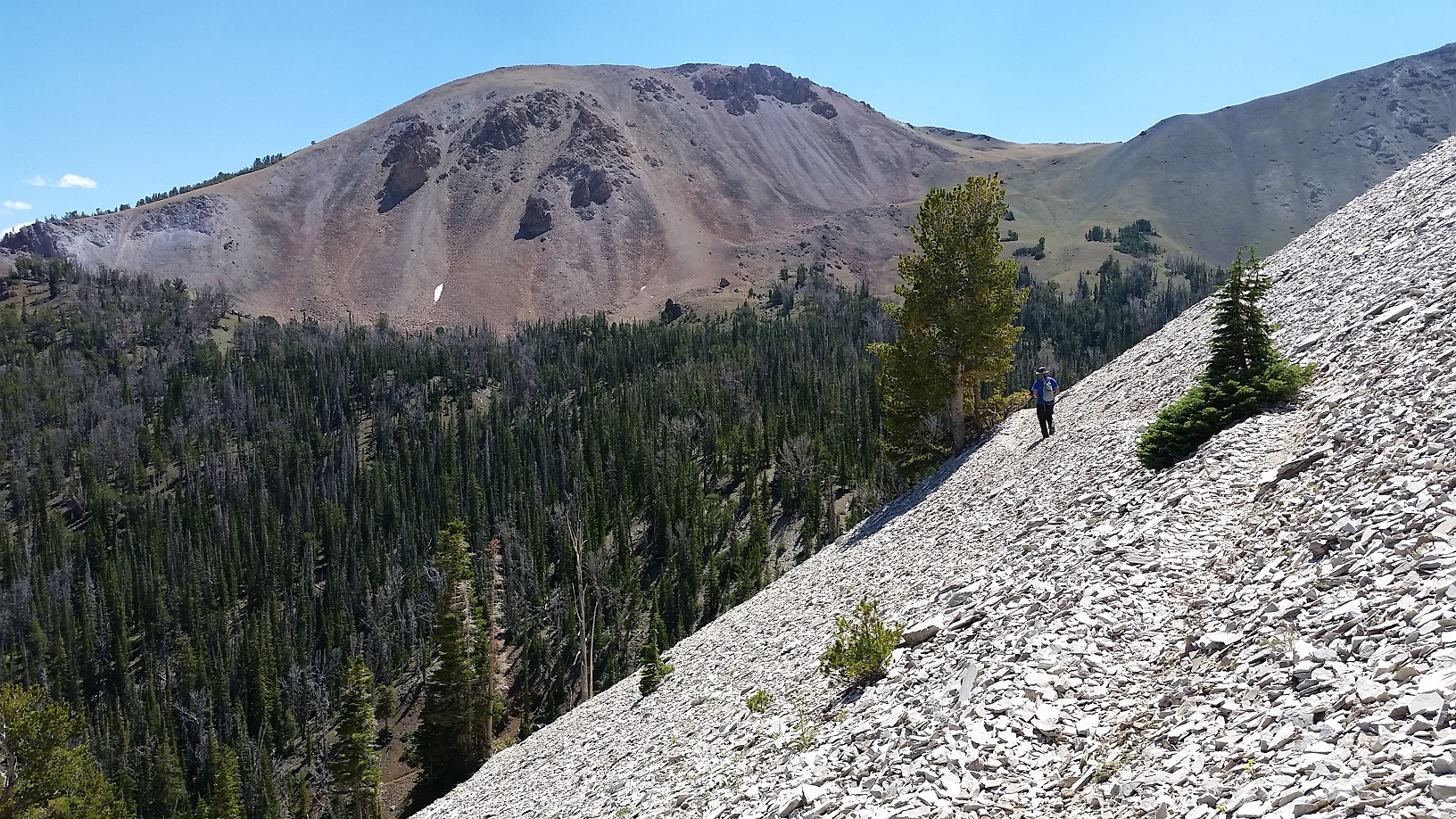
Eventually the trail hits switchbacks up the side of the ridge. However, before starting up the switchbacks, another one of the adults and I decided to take a side trip to Castle Lake. We were in the back of the group, so we didn’t get the chance to talk anyone else into coming with us.
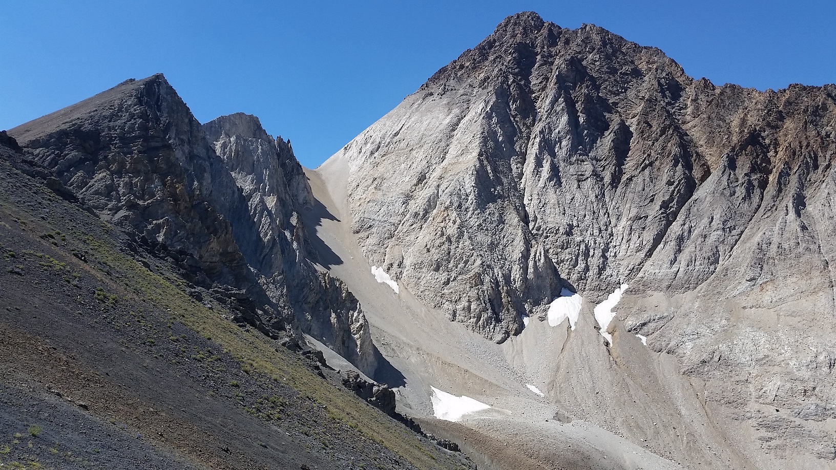
We had our eye on the spot where we would approach Castle Lake, but we weren’t sure if it would work once we got there. Looking at Castle Lake from the trail we were at, we were hoping we could approach it from our left. There are some cliffs with a shale face above it that we hoped we could traverse. We dropped our packs, grabbed our fishing gear, water, and some snacks, and headed for the lake. To our delight, we discovered a trail right in the spot we were aiming for that traversed the shale area. Even though there was a trail, it was a little freaky. If I looked down when we were above the cliffs I actually got some vertigo — I think due to the crazy angles and drop-offs.

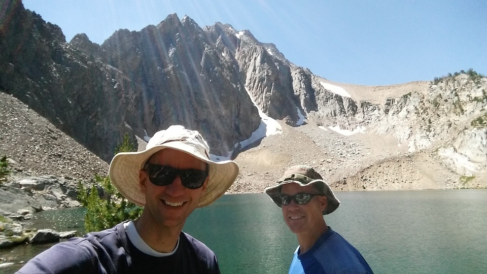
The trail took us right to Castle Lake, and we hardly changed elevation from where we dropped our packs. It was a pleasant surprise as we expected a challenging climb. Castle Lake is beautiful. Nestled between Castle Peak and Merriam Peak, two thirds of the lake is surrounded by mountains with the remainder opening up to the basin below.
After an enjoyable time at Castle Lake, we headed back out to the main trail. We worked our way up Castle Divide and then down the other side into Chamberlain Basin, where we finally met up with the rest of our group.
Actually, just as we arrived at the first big Chamberlain Lake, we were met by another ranger and a film crew. They were filming for Outdoor Idaho, a PBS series. They interviewed me and my hiking partner and got some footage of the ranger telling us about Leave No Trace principles.
As we wrapped up with the film crew, a few of the guys from my group arrived from camp in their running clothes. They had ran each day of our trip, and thus far I hadn’t gone with them since I was still trying to recover from the Morgan Valley Marathon and the XC12K. However, I was feeling up to it at this time and I wanted to see the upper lakes anyways, so I asked them to wait for five minutes while I headed for the brush to change into my running shorts and drop my pack.
The run was amazing (unfortunately I don’t have a GPS track of it). We saw all the upper Chamberlain lakes and headed all the way to the bottom of the ridge at the top of the basin. It brought back memories as I had once been to one of the upper lakes when I was a teenager (we came over the ridge from Washington Lake but didn’t go far down the basin). It was nice to get a little run in and felt much different on my legs than all the backpacking. I was quite sore as we ran back down towards camp, but it was worth it and felt wonderful.
It was also nice to warm up right before jumping in the lake.
I really enjoyed dinner that night — mashed potatoes and soup. I slept ok.
White Clouds Backpacking Day 4 – Chamberlain Basin Past Washington Lake and Back to 4th of July Trail Head
Our plan for Saturday was to wake up a little extra early and head out in small groups to give the slower hikers a bit of a head start.
The first group of 6 or so headed out at 7:30. I was in the next group at 7:45. The last group left at 8:00.
The hike starts with a gentle incline and passes one of the nastiest looking lakes I saw on our trip — a small lake with no outlet and no apparent inlet. After that lake we got a nice view of the ridge we would have to surmount. It was warming up so we changed into cooler clothes and headed up. At the bottom we saw the group ahead of us, and at the top we saw the group behind us.
As usual, there were some awesome views at the top of the ridge and we snapped some photos before descending down the other side. There was some nice downhill (much of which we jogged) and then a gradual uphill to Washington Lake. I really wanted to do a little excursion to the small lake southwest of Washington Lake, but I didn’t have anyone to go with me and I didn’t want to keep the others waiting.
Our whole group met up at 4th of July Lake and we snapped some group photos. Finally we headed down the last stretch of trail to get back to our cars.
What I Ate During the Backpacking Trip
I thought it would be useful to list what I ate during the trip, since it’s sometimes hard to get good ideas.
Breakfast
I kept breakfast pretty simple: two oatmeal packets and hot cocoa. This was easy as I just needed to boil 2-3 cups of water and I had a warm meal ready.
Lunch and Snacks
I had a peanut butter honey bagel sandwich for lunch every day. I also had the following to supplement lunch and eat as snacks each day: three granola bars, ~1/3 lb trail mix, dried peaches, and raisins or corn nuts.
Dinner
Mountain House meals are easy but expensive. I used a Mountain House one day.
Another day I used a $1 package of dinner noodles from Walmart. These are just as tasty as Mountain House, but the downside is they have to simmer for 7 minutes. Some of them also use milk, so I had some powdered milk to add as well.
The last day I did instant potatoes and some stew. The potatoes just require boiled water and a $1 package was very filling (2 cups). The stew had to simmer for 10 minutes, but it was very tasty.
Treats
I made pudding one night which was quite good. It just requires pudding, powdered milk, and cold water. Mix it all in a ziplock bag.
I also packed in my traditional tortilla chips and a jar of Salsa con Queso, which is not backpacking food at all but was really delicious!
Cost
Total cost of food for the three night backpacking trip was about $25. Not bad at all! The Mountain House was about 1/3 of that. I hiked out with a spare package of Top Ramen and two spare granola bars.
Wrap Up
The trip was a huge success. There were 20 people in our group and no one got injured or lost. There were no arguments or issues with the boys. Everyone had a good time and carried their own packs the whole way. Some of the boys struggled on the hikes a bit, but they all made it and still got to have some great experiences.
I had a wonderful time. There is something about high mountain peaks and mountain lakes that makes me love going back again and again. I’ve now seen almost every lake in the lower White Clouds, so I hope to hit some different areas next time around. That said, I wouldn’t hesitate to do this same trip again.
Very impressive. I have hiked more in the northern part of the white clouds. I would love to pick your brain sometime.