50 Mile Backpacking Trip in the Sawtooth Wilderness

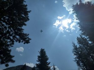
I’m an adviser for a group of 16-18 year-old young men in The Church of Jesus Christ of Latter-day Saints. This means I help the group organize activities and generally mentor and guide them where possible. Every year we do a “high adventure” trip where we take a few days to do something outdoors that is memorable and character-building. Last year we went on a fantastic 50 mile canoe trip. This year we did a 50 55 mile backpacking trip through the Sawtooth Wilderness in 5 days. It was about what you’d expect: grueling, spectacular, and memorable.

Part of the reason I wanted to do this trip this year, was that we had a group of boys that I thought could handle it. It would challenge them, but we didn’t have anyone that couldn’t get it done, as far as I could tell. Another reason is that I have fond memories of hiking in these same mountains from when I was a youth. There are things you learn about yourself, others, and God on a trip like this in the mountains.

One limitation of the Sawtooths, and many similar areas, is a group size limit. The group size limit in the Sawtooth Wilderness Area is 12. I know people who have attempted to break this limit. Not only will this lead to fines, but I’ve come to appreciate the size limits as a way to protect these incredible areas. One group I know of was a couple miles into their hike when a ranger found them. Because their size was more than 12, the ranger turned them around and followed them out. Fines are common and are meted out regularly. Our group ended up including 6 youth and 3 adults. If you have a large group, please find somewhere else to go.

We debated the best course to take a group through the Sawtooth Wilderness. We considered some routes that would allow us to make a stop and transfer people in and out. We decided against this as it could easily lead to boys giving up and these routes weren’t optimal for what we wanted to see: lakes, peaks, empty spaces.

We decided to leave a car at Iron Creek Trailhead, then start the backpacking trip from Petit Lake. This enabled a point-to-point course.
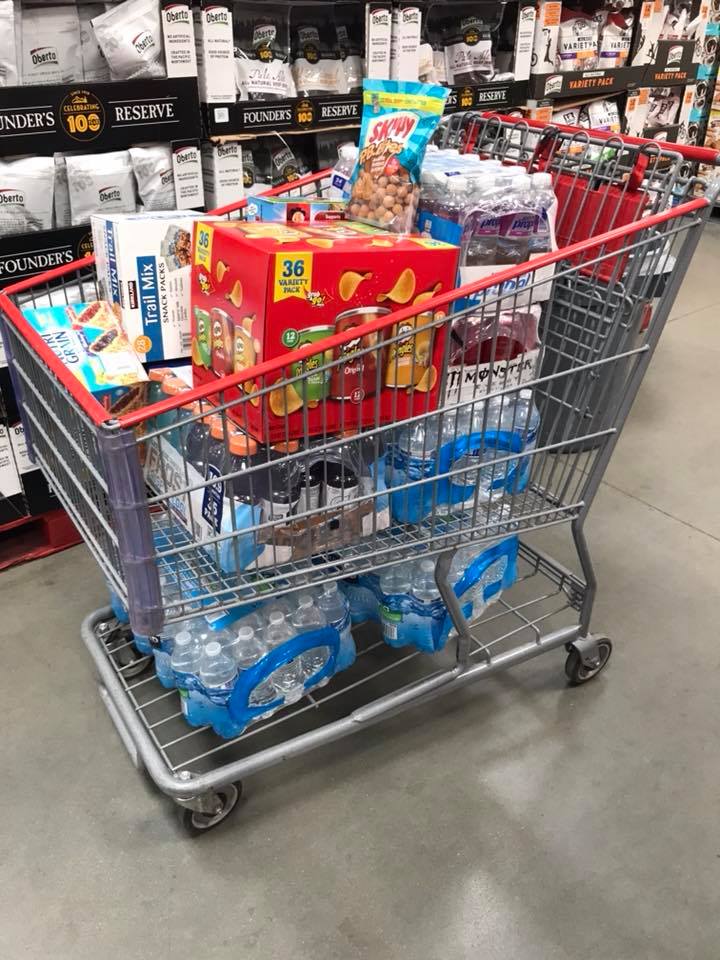
Food

Fires aren’t allowed in some of the drainages, so we packed in small stoves and food that could be cooked on a stove. This was our meal plan:

DayBreakfastLunchDinner
MondaySack lunchHome-assembled minute rice and Freeze-dried chicken
TuesdayOatmealCrackers, cheese, & hamSoup & mashed potatoes
WednesdayOatmealBagel peanut butter honey sandwichMountain House
ThursdayBring your own
FridayOatmealLeftover snacksRamen
DessertsChips Ahoy, Oreos, Pudding (made in a ziplock from a box and powdered milk)
SnacksHot cocoa, cider, granola bars, raisins, craisins, Crystal Light, beef jerky, dried fruit

Day 1: Petit Lake to Toxaway Lake, 13mi & 4000 feet (including Snowyside Peak summit)

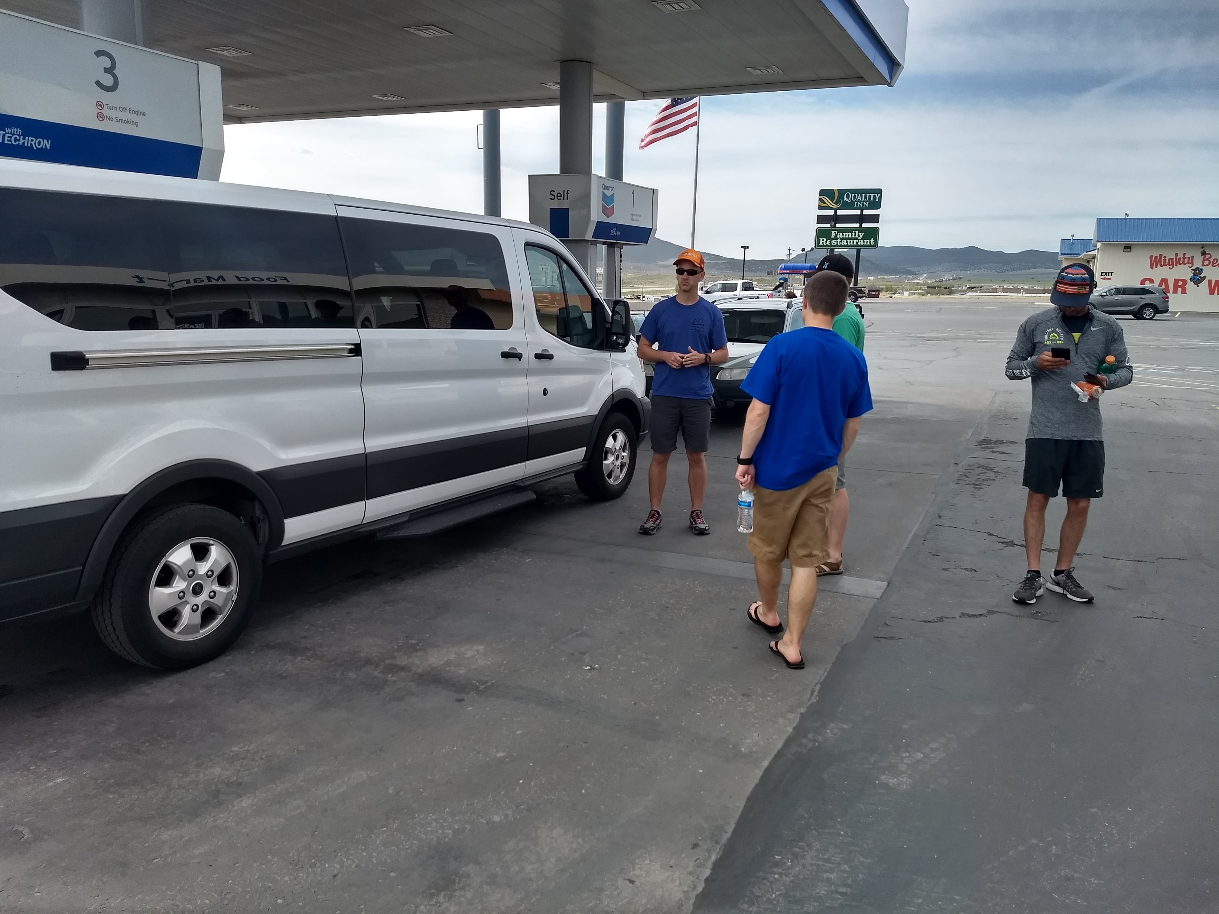
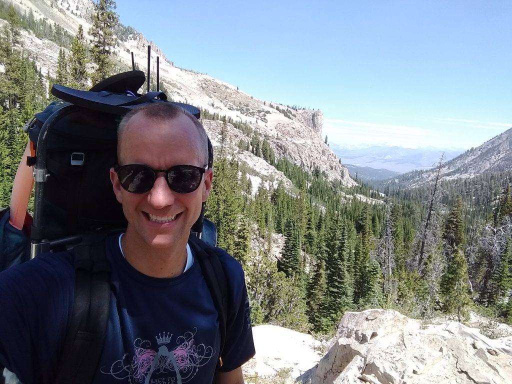
On Monday we loaded into the cars and set out at 6:30am from the Boise area. We started hiking from Petit at about 11am.

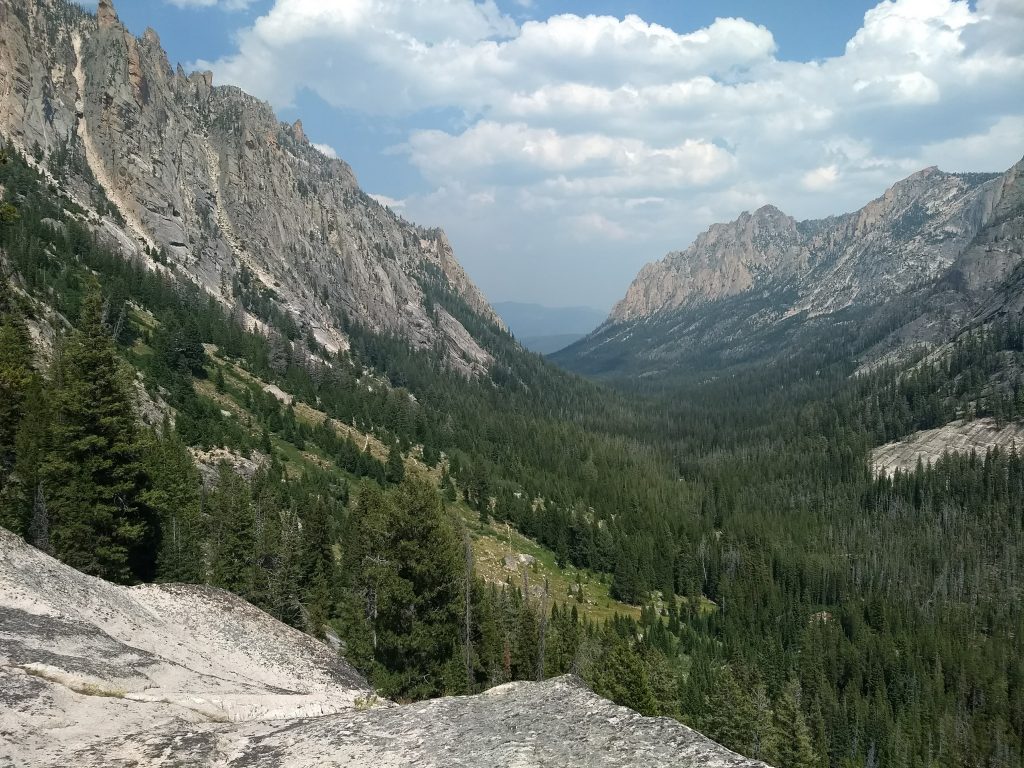
Petit Lake is very long, which is part of the reason we decided to go this direction. We didn’t want to end with the long straight-away next to the huge lake.

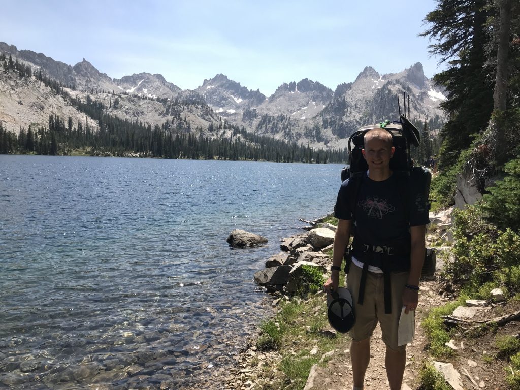
From the Petit Lake trail head, it’s about 6 miles to Alice Lake. Petit is at 7000 feet and Alice is at 8600, so there are plenty of switchbacks and a few creek crossings between the two lakes. During the hike there are some great views of the basin looking back towards Petit. We passed some other hikers during this part of the trip, including Buck, an acquaintance of mine. Many people do this segment as a day hike.

Hiking up the basin from Petit Lake

Alice is a beautiful lake, although we didn’t spend much time at it. It has some nice peaks and ridges to the south and west.

Alice Lake
Next to Alice Lake

We kept moving past Alice towards Twin Lakes. This required a little climb of 200 feet or so. Twin Lakes are much less popular, although they looked nice enough. We initially planned on camping at Twin Lakes, but everyone was feeling good. After a pow wow, we decided to push on to Toxaway Lake, our Plan B.

Blisters already – Above Twin Lakes

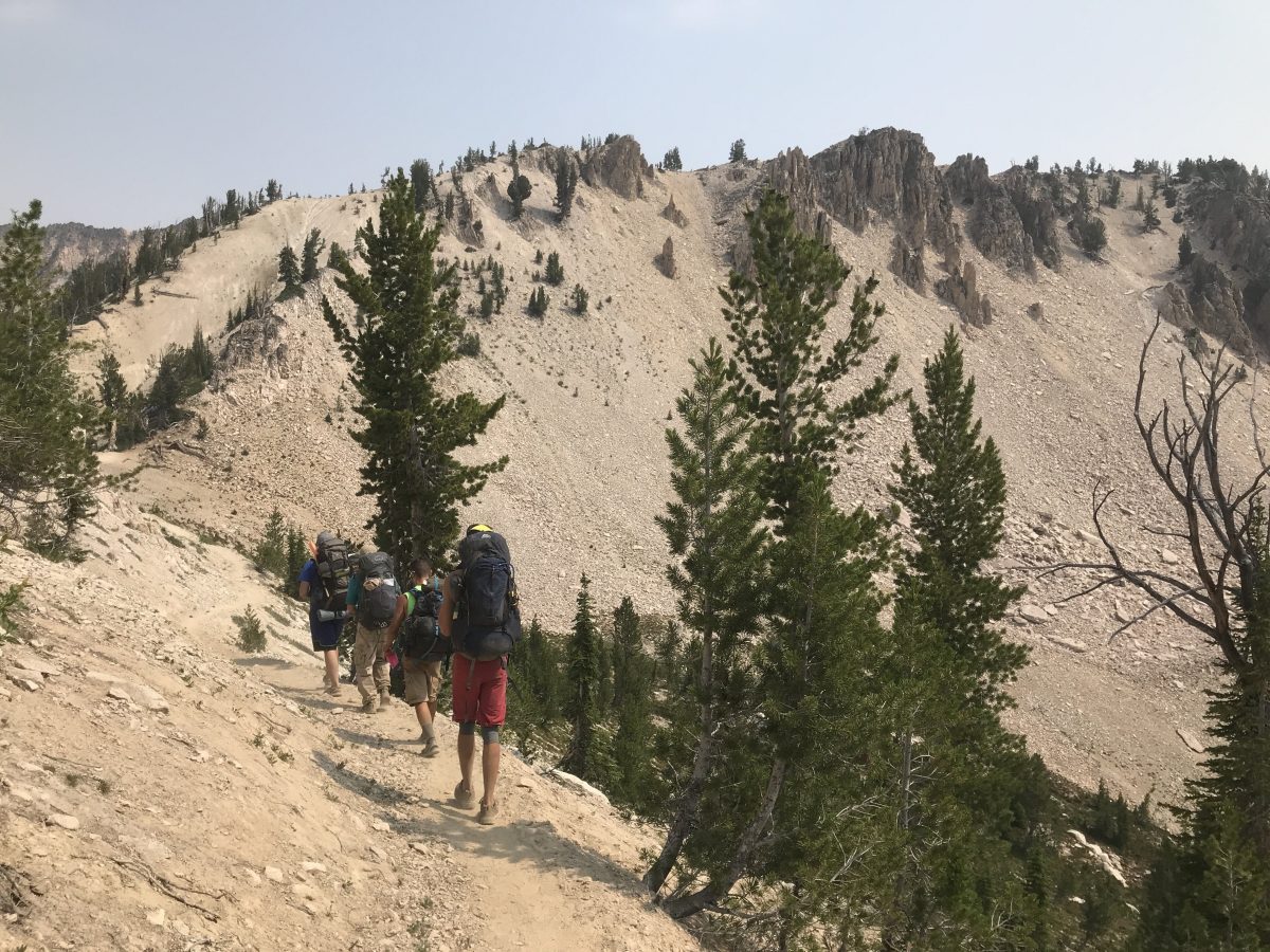
To get to Toxaway we needed to hike over a ridge at 9500 feet. This was a natural resting point to let everyone gather together again. It also presented a nice option to summit a mountain. Snowyside Peak towers over the ridge. It was as close to a peak as we’d get without going out of our way. After some discussion and debate, several of us decided to climb it. My rationale was that we were in good spirits and right next to the peak, so we should climb it now as we didn’t know what would happen during the rest of our trip that might prevent us from climbing other peaks.

Snowyside Peak
Snowyside Peak

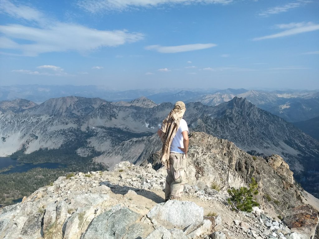
Two of the boys had no desire to climb, so they forged ahead to secure a camping spot at Toxaway Lake. The rest of us made our way up, some faster than others. It took 1.5-2 hours to get up and back. A couple of the boys were much more deliberate about their steps and less experienced, so they took quite a while to get down. The views from the peak were spectacular (of course).

Snowyside Peak
Snowyside Peak

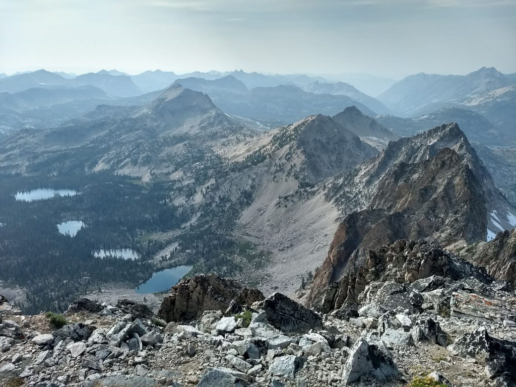
When we were finally all back down, we walked the final ~3 miles into Toxaway. We were exhausted by then. I took a dip in the cold lake to wash off and went to bed pretty early.

Excluding the peak, it was a 2500 foot elevation gain to the ridge and 1100 foot decline from the ridge to Toxaway Lake. We traversed 55 switchbacks (I counted). Snowyside Peak was about 1100 feet up and down from the ridge.

Day 2: Toxaway Lake to Hidden Lake

I woke up early to fish at Toxaway and the sun came up right in the dip between the mountains

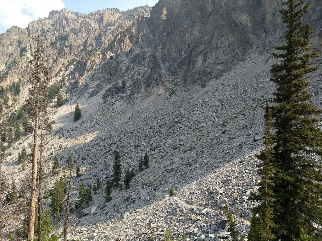
During the night I woke up at one point and heard some huge boulders falling down the ridge on the opposite side of the lake. In the morning we woke up, ate breakfast, and then started heading up the ridge to the north. This was an arduous 2 mile, 900 foot climb to start the day with plenty of switchbacks.

The ridge above Toxaway

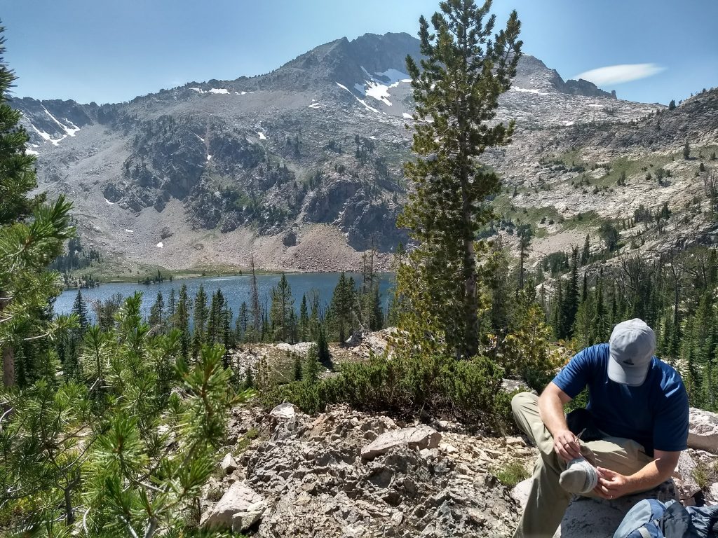
We took a break at the top, which offered some nice views, as well as a little patch of snow. We then made our way 800 feet down to Edna Lake. Another one of the adults and I actually dropped our packs and hit Rendezvous Lake on the way. We tried fishing it, but there were lots of frogs and no fish. I’m pretty sure it was too shallow.

We ate lunch and took a dip in Edna Lake, which is quite large and deep. Then we hiked past Vernon Lake without stopping much to take it in. After Vernon there is another little lake up a 300 foot climb. It has one nice camping spot which someone had taken. In fact, we passed a surprising number of people on this day when I thought we’d be pretty much alone.

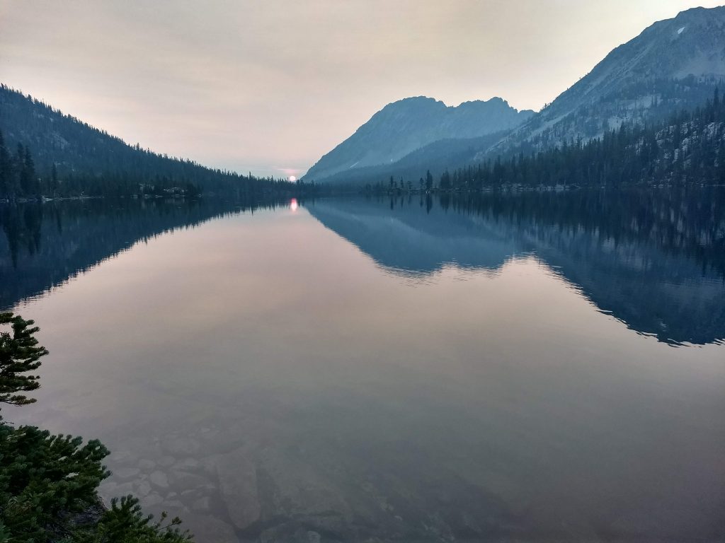
We dropped another 600 feet to get to Ardeth Lake. Ardeth has a nice granite backdrop and is quite large. We were considering staying there for the night and taking it easy, but after a pow wow and some discussion, we determined to push on to Hidden Lake. This was no easy task, as it required yet another a 600 foot drop followed by a 1000 foot climb. We were all in pretty good spirits though, and we managed to stick together for much of those final 5 miles.

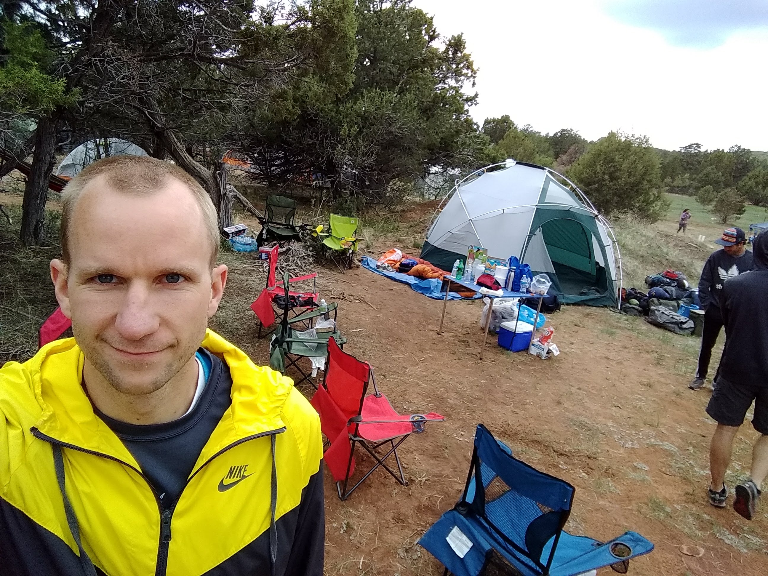
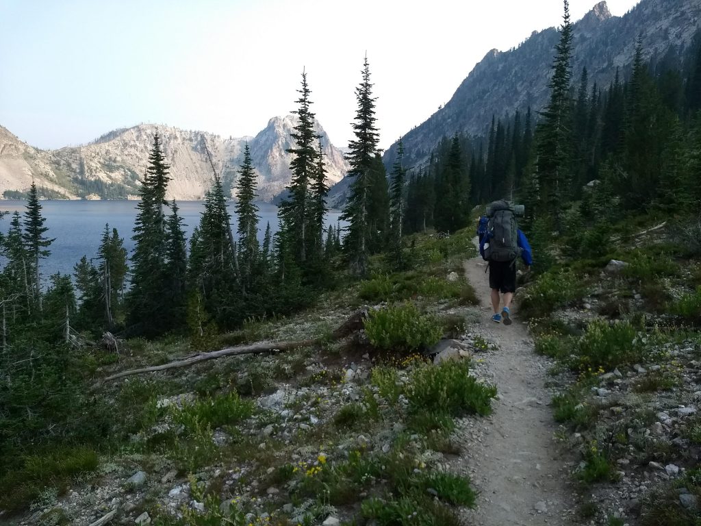
Hidden lake was a little gem at 8600 feet, nestled between two ridges. We made camp after a second day of 12+ miles, and once again some of us took a dip to clean up. We used a fire blanket to make a little fire and had a great spiritual discussion there in the mountains.

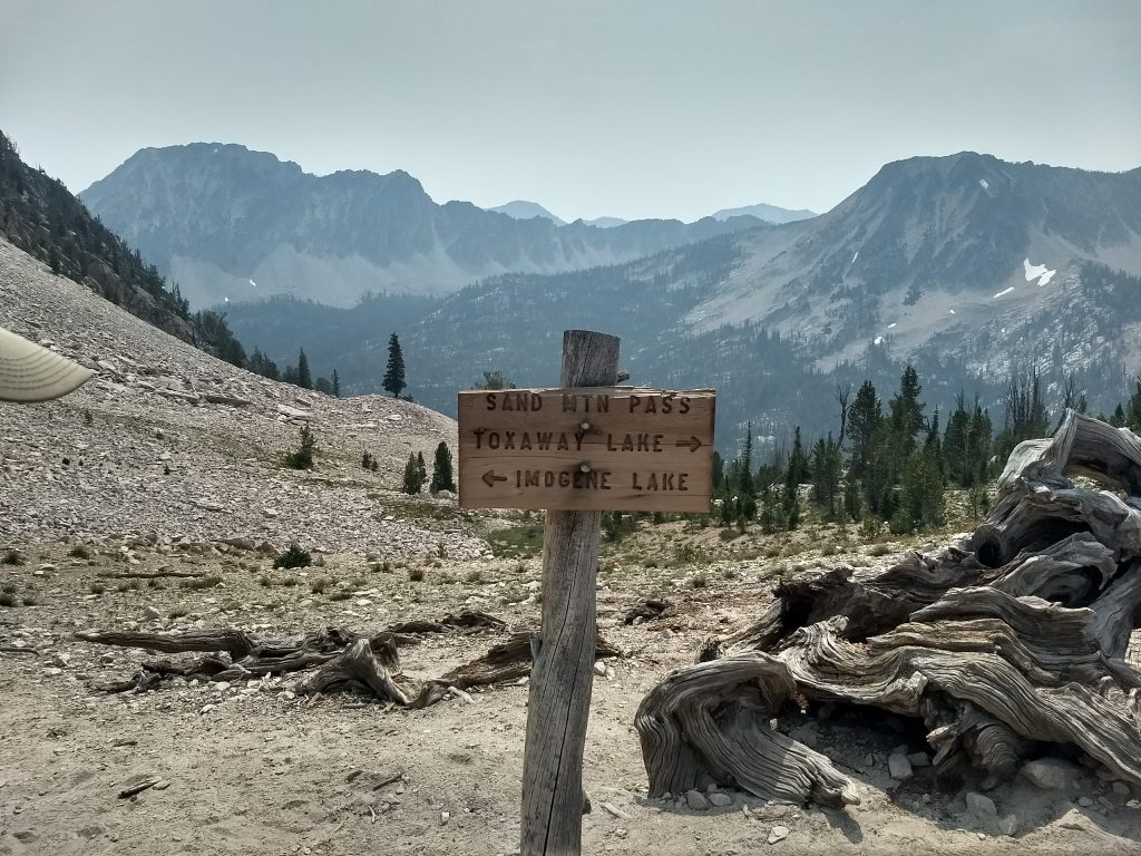
Day 3: Hidden Lake to Baron Lake

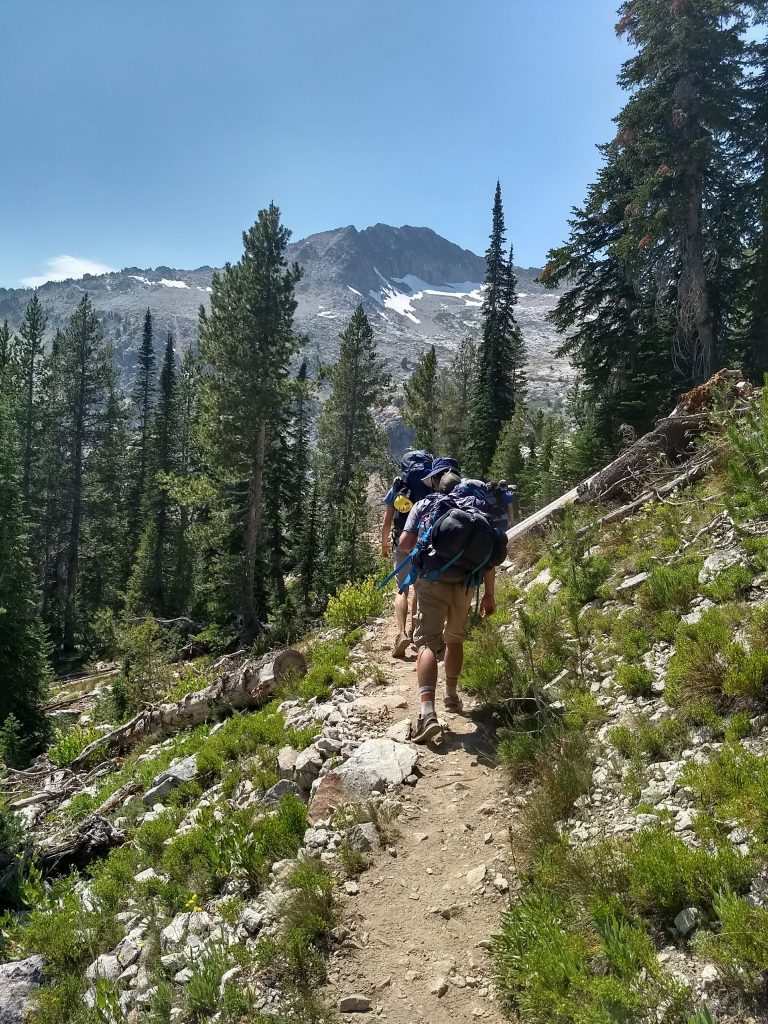
On the third day we awoke and started our climb to the west of The Temple and Mt. Cramer. Some of us were considering summiting Mt. Cramer, but due to our added mileage we decided it wasn’t worth the risk of wearing out or worse. It would have likely taken a couple hours and would have separated the group early on.

About to hike down into the Cramer Lakes area

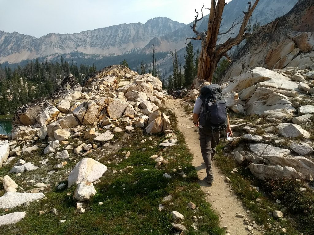
Instead, we started the 6 miles downward in the direction of Redfish Lake. We passed Upper Cramer Lake, Middle Cramer Lake, and Lower Cramer Lake, as well as one other lake that wasn’t as visible from the trail. At one point, one of the boys got very worn out and slowed down considerably. We started getting worried and wondered if we should escort him out through Redfish. We forced him to eat, and after some time and some prayers he perked back up and we caught up with the whole group at the large creek crossing.

Some A-10’s happened to do a flyby through the basin near Redfish Lake – they were low and fast

From this point on I started having some memories of a 50 mile hike in the Sawtooths from my youth 20+ years ago. Part of our hike was from Baron to Redfish, so some points on the trail were etched in my fading memory.

When we left the creek, one of the boys took off about 100 yards ahead of me (I was still putting my pack on after a break). I immediately arrived at a fork and knew I was supposed to turn left. I couldn’t see the boy in either direction, so I sped up to ensure he was ahead of me. I kept speeding up but I didn’t see him. Luckily there were some switchbacks, so from a high switchback I called down to the others to go back for him. We sent one of the cross country runners, and about 10-15 minutes later they rejoined us. We were really glad we caught the lost boy that quickly! It cost him at least a half mile of hiking.

From the low point to the high point was a solid 1800 feet in 4 miles — a little less elevation than we had already hiked down. We passed Alpine Lake and some puddles. It was quite a climb, but we were rewarded with some great views, including “Heaven’s Gate” as we looked toward Redfish.

Heaven’s Gate leading down to Redfish Lake

From the summit it was 800 feet and 2 miles down switchbacks to get to Upper Baron Lake and then Lower Baron Lake. There was already a scout troop in the ideal spot at Lower Baron Lake, but we found a good spot downstream with nice water access. We played some games that evening and had a good time, although we were all beat after a 14 mile day. It was pretty fun for me to be at Baron Lake after a 21 year hiatus.

Day 4: Baron Lake to Sawtooth Lake

Getting from Baron Lake to Sawtooth Lake was pretty grueling and not particularly interesting.

We followed Baron Creek down 7 miles and 2600 feet to where the south fork and the north fork meet up.

Heading down the mountain from Baron Lakes. Can you see the hikers?

Where the creeks join up they form a roaring stream with some logs to cross on. I’ve heard that people have died here due to the high logs and rapid stream. We used the stream for water, but we didn’t need to cross since the trail forks back up toward our Sawtooth Lake destination.

This was another relatively uninteresting hike comprising 7 miles and a 2900 foot gain. There was a bit of brush and downed logs we had to work through, which slows things down. The trail leaves the bottom of the ravine and works its way up the side of a mountain, with occasional run-off streams crossing down. Eventually the trail takes a northward turn and closes the final distance to the large Sawtooth Lake.

There’s a really nice meadow on the south side of the lake that had enough room for us and another group. I slept under the stars that night and admired stars that can only be seen in the mountains on a clear night.

Day 5: Sawtooth Lake to Iron Creek Trailhead

We had now effectively cut a day out of our planned 6-day trip. Our last day was the shortest, a simple 6 mile and 2800 foot hike from the lake down to Iron Creek Trailhead. We passed Alpine lake on the way, but we didn’t bother stopping there as we had seen lots of lakes and we were all eager to get our packs off our backs.
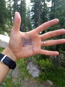
Hiking out next to Sawtooth Lake

Switchbacks

Just for fun, I counted switchbacks each day as best I could. I used a pen, my hand, and a bunch of tally marks. This is what I counted (includes uphill and downhill switchbacks):

Monday55
Tuesday87
Wednesday109
Thursday61
Friday37
Counting switchbacks

50 Mile Backpacking Trip

I realized that 50 mile backpacking trips aren’t particularly “fun”, especially if they’re fast. I’m in really good shape (albeit running shape and not necessarily backpacking shape), but even so I went to bed exhausted every night. Some of the miles were quite difficult and I just had to trudge on.

However, 50 mile backpacking trips like this are spectacular and memorable. We saw countless mountain peaks and lakes. We pushed ourselves and suffered together. We had great conversations and bonded together. It was unforgettable. Someday I hope to do a trip like this with my family (all 6 of our kids). I know it won’t be easy, but it will be something they’ll never forget.

Hood to Coast Relay 2018

Before this year, my father-in-law had run in the Hood to Coast Relay 19 times. His birthday is in late August, which is right around the time Hood to Coast takes place. So this year he put together a family team for his 70th birthday and 20th Hood to Coast. I got to run Leg 5 and I had a great time!

Hood to Coast is a 199 mile relay that begins at the base of Mt Hood and ends in Seaside, OR. It starts with some steep downhill on a highway in the forest, continues through some smaller towns amidst farmland, then into Portland, along the Columbia River, through windy forest roads, and finally onto the finish line at the beach.

Hood to Coast is truly the “mother of all relays”. It boasts 1200 teams, and triple that many team applications. It has some elite teams sponsored by Nike and others that finish at just over 5:00/mile pace. Hood to Coast is the relay that inspired the creators of the Ragnar relays.

Our kids had already started school before the race, so we waited until Thursday after school to head from Idaho to the Portland area to meet up with family. The drive went pretty well and we pulled into town around 11pm, so we basically went right to bed.

The next morning we woke up and I hopped in with Van 1 to head to Mt. Hood. It was quite chilly and breezy at the base of Mt. Hood, but it was a fun atmosphere. This was my 4th big road relay, but it was my first time in Van 1. It was great to be there at the start as we started our journey across a large chunk of Oregon. My father-in-law, Jerry, ran Leg 1.

Photo op at the starting area at the base of Mt Hood

Jerry handed off to Cyndi for Leg 2.

Jerry passing to Cyndi

The first few legs of Hood to Coast are pretty steep downhill. However, I was running Leg 5 which had a decent amount of uphill to it. I was targeting a ~6:30 pace for the whole race, so I figured I might take it easy on my first leg. I ended up feeling pretty good and hitting a 6:23 pace. All three of our volunteers were on my leg, so that was pretty fun. Two of them were handing out water and the third was at Exchange 5. Overall it was a nice first leg.

I handed off to Monte, who was 2-3 minutes late to the exchange thanks to a long line of traffic. I promptly drank my first chocolate milk, which I now believe is the secret to keeping my stomach calm during a relay.

We met up with Van 2 at Exchange 6. They were excited to be starting their first legs. We had some spectators who met us there as well. Also, we substituted a few runners in and out. Since it was Jerry’s 70th birthday, he wanted to give a some of his 34 (?) grandkids an opportunity to run, and they couldn’t all handle three legs. Also, Cyndi had just delivered a baby ~7 weeks earlier, so she only ran one leg. This isn’t exactly up to regulation, but we weren’t exactly a competitive team.

All the team and spectators at Exchange 6

Van 1 stopped for a while at a nearby Wendy’s and we met up with our volunteers there. My daughter, Paisley, was now in the van in Cyndi’s place, and we each had a baked potato. That was probably the nicest meal I’ve ever had during a road relay. After relaxing for a while, we endured rush hour traffic through Portland to get to Exchange 12.

Paisley would be running Leg 13, but since it’s on the river front (with a river front type of crowd mulling around) and it would be getting dark, I ran with her for her 4+ miles. It was a nice and easy pace, so it felt pretty good. She was super nervous to take the hand off in front of the big Exchange 12 crowd under the overpass.

Paisley getting ready to take the hand off

Paisley nervously awaiting the hand off before Leg 13

She had a nice finish and was really excited to be part of the relay team.

I gobbled a Kind bar and a breakfast bar to refuel before my next run.

Jerry ran Leg 14, then Tyrel ran Leg 15, then Christy ran leg 16. The Hood to Coast traffic was starting to back up considerably at some of the exchanges. We had to wait a long time before Christy could get out of the van to meet Tyrel.

It was back to me for Leg 17. While I was waiting in line at the Honey Bucket, I had a nice conversation with a Marathon Maniac. He said he was getting too old to run, and he had lost count of how many marathons he’d done.

I was a little nervous for my third run in the last 12 or hours. It would be my longest, and I wasn’t sure how fast I’d be able to go. Fortunately it was a nice temperature with little wind and I ended up feeling just fine. I went faster than expected — hitting 6:10/mile (excluding the annoying 37 second stop I had to make at a crosswalk right before the end).

At this point I really wanted to take a shower, and there was one at this exchange, but we had to move to Exchange 18. It annoyed me that all the showers were basically unavailable to the 5th and 6th runner in Van 1.

I don’t remember Exchange 18 very well, except that Van 2 complained that we had kept them awake by texting at each of our exchanges. I asked them if they were familiar with “airplane mode” and I also reminded them that at Exchange 6 they had complained that we didn’t give them enough information. It was pretty funny to me, although I do feel bad they didn’t get to sleep as much as expected.

We made the drive to exchange 24. When we got there we were all very tired. It was foggy and dark and this would be our one chance to sleep. We had planned on having a big tent set up, but there was a miscommunication and it didn’t work out. I ended up just placing a tarp on the ground and rolling out my pad and sleeping bag on top of it. None of the other people in my car came with me, so I just set my alarm to make sure I could find them before it was time to go. There was some risk of getting lost in this huge, dark exchange.

I was able to get a couple hours of decent and much needed sleep when it came time to wake up. I went to the car and found the rest of our runners packed inside. In a previous relay race I learned that sleeping with everyone in the car is a bad idea, so I’m glad I wasn’t squished in there as well.

Eventually our other van arrived and we found them despite the lack of cell phone reception. I didn’t even see their runner come in because I was getting ready to get back in the car. Christy started running just before 6am, right as dawn approached.

Jerry and Tyrel both ran about 6 miles. Traffic was getting bad, and Jerry had to wait a few minutes for Tyrel to use the Honey Bucket. Tyrel had a strong run and passed loads of runners that were slowing down on their final leg. Paisley went really fast on her run, and traffic was such that I jogged the last half mile with her at a 7:30 pace.

I then reset my watch and headed out for Leg 29, my most challenging leg: a 6 mile run with 566 ft vertical. I hit it really hard. I was trying to pass as many people as possible to keep up with all the people Tyrel passed, but that didn’t happen. I passed a couple dozen people, but overall everyone was pushing hard up the hill. At the top of the hill there was a small of people cheering, including my van. That made this leg extra fun. I pushed hard down the hill as well and I came in at a 6:11 pace, which I was very happy with.

Monte took the baton and our van headed to the last big exchange before the finish. There were tons of people, and we had been running faster than expected, so we spread out to find our other van and give them a heads up. I eventually found them and they were surprised to see us. They had been battling traffic and had only been at the exchange for 30 minutes or so, so they weren’t thrilled to see us. They got going and Van 1 was very happy to be done.

Some of us took a much needed shower at Seaside and then spent some time at the beach waiting for our team. We all finished together and we celebrated with a delicious seafood lunch.

The team at the finish line

I’ve learned a few things during previous relays that helped make this one my most successful in terms of comfort level:

  • Drink a big chocolate milk immediately after each leg you run
  • Have a good plan for warm, substantial food
  • Don’t try to sleep in the van at major exchanges. Bring a sleeping bag and use it.
  • Backpacking gear can be very useful

Relays aren’t exactly my favorite type of race, but they can definitely be fun and challenging. I’m sure I’ll do more in the future, and I hope Hood 2 Coast is included in that.

Nisene Marks Marathon in Aptos, CA

We decided to do a family reunion in Aptos, California this year since my brother lives there and we love the beach. I suggested a weekend that conveniently coincided with the Nisene Marks Marathon.

The Nisene Marks Marathon takes place in the Forest of Nisene Marks State Park. This is a beautifully lush redwood forest located just outside of Santa Cruz. The marathon has some significant elevation changes — totaling about 3100 ft up and down. It’s a small event, with only 37 finishers this year. Both the elevation and the size make this marathon much different than most of the races I’ve done in the past. I typically do road races that are either pretty flat or downhill.

Friday was the last day of school for my kids, and my 5th grader had her final “graduation” assembly and ceremony. We left straight from that for the ~10 hour drive from Idaho to California. We picked up some great pre-race nutrition along the way, In-N-Out. We arrived at about 10:30pm Pacific Time, which felt like 11:30pm coming from Mountain Time. We immediately went to bed and I was dreading waking up the next morning for the race.

Fortunately the race was scheduled to start at 8am, which is a bit later than most marathons. They also had packet pickup in the morning, which was convenient. I grabbed my bib and studied the map a bit while I waited. There were a few people I talked to and/or listened to, including one guy who had run ~250 marathons. He’d done all 50 states and was working on doing every marathon in California. Dang.

We started running the marathon about a minute late and the small field of ~40 people quickly spread out. I was running with 3 other guys for the first couple miles. One of them was a runner from New York who was doing his first marathon. He was a college runner and said he’d been training for 80 miles per week, which is more than I’ve ever done. However, I noticed he wasn’t carrying any water. I didn’t think this would be a big deal, but I was carrying my own water bottle since the aid stations were pretty spread out. It turned out to be more of an issue than expected.

About 2.5 miles in there were some cups at an aid station, so I grabbed one. Based on the map, I hadn’t expected water for another mile, but no big deal. A couple of the other 3 runners I was with didn’t grab any.

Two of the runners got a bit ahead of me and the other was several yards behind. I let the two go and tried to run my own pace. My pace was showing low 7:00’s, but with a steady climb that seemed fine to me. It felt about right.

Shortly after mile 4 the big climb started. The two runners in front of me immediately slowed down so I passed them and moved into 1st place.

The climb was pretty tremendous (for me at least). I’m not used to trail marathons. The race had started around 70ft above sea level. The big climb started around 350ft and would reach about 1800ft before turning around. I tried to just keep working at the hill without going to hard. My pace ranged from ~8:30/mi to 10:00/mi depending on the grade.

My left foot started to get irritated at one point so I stopped and loosened my shoe. Still no one caught me, although I could see another runner on some of the big turns.

The scenery in Nisene Marks was great, although it didn’t change a whole lot on this part of the course. We were running through a dense forest with big redwoods. It was very green and almost completely shaded.

Speaking of shade, based on the map I was expecting for an aid station around mile 6. Didn’t happen. Also nothing at mile 7. I was out of water in the bottle I was carrying and I was beginning to worry a bit. Finally at mile 8 I came around a corner to surprise an aid crew. They didn’t have any cups ready, but after opening a big jug we were able to fill up my bottle. There was a turn-around ahead, so I knew I’d get more water soon.

The turn-around was at mile 9.6 according to my watch, which was about a mile earlier than the map said. It turned out that my watch wasn’t very accurate in the forest, so I’m not sure where the actual turn around was.

On my way back I got to see how close the guys behind me were. They weren’t back very far. It was also fun to see other people coming up since I was their first sign that the climb was almost over. I was surprised that my downhill miles were only in the mid 6:00’s to low 7:00’s, but it was on dirt and I was trying to save some energy for the second big climb.

There was more water at the bottom of the second climb, which was around mile 16 by my watch. Once I started going up again I knew it was going to be taxing. My legs were pretty tired and I had not consumed enough water. It was fairly warm even though the trees blocked the sun.

At this turn we moved from fire road to single track in dense foliage. It was a well-used trail and there were lots of marks to keep us on the right path, but it was dense, hilly, and very steep in some parts. We had bottomed out around 250ft and we would top out at over 1100ft.

Some of the climbs got too steep for me, and I had to walk a couple of them. My pace had deteriorated quite a bit, so I figured someone would catch me sooner or later. I started to pass some half marathoners as well as some day-hikers.

Fortunately there was an aid station around mile 20 at the top of the hill. I gave a volunteer my water bottle and another volunteer said, “Only fill it half way so we don’t run out!” He filled it all the way anyways and I moved on.

About the time I started my descent, the next runner caught me. I sped up and stuck with him for a half mile or so, but it was clear to me that I wouldn’t keep up for long. I asked him how far back the next person was and he said we probably had plenty of room. I wished him luck and he moved on.

The last few miles were pretty grueling. I was just trying to finish the race so I could get a drink. My watch was off so I wasn’t sure exactly when it would end. I looked back a few times to see if I could spot any other marathoners, but I didn’t see any.

Finally I came around the last turn and finished. I considered running another 1.5 miles to make sure it was a full marathon, but after running about 150 yards, I realized that was stupid and I was finished.

I ended with an official time of 3:33:00 and confirmed with another runner that my watch was indeed off (his showed ~26.2).

I talked with the race director after and let him know that the water was an issue, especially since the map showed there would be aid stations every few miles. There were only 5 total, and the last one ran out of water a while after I went through it.

Besides the water issues, the Nisene Marks Marathon was enjoyable. For someone that doesn’t run in forests very often, it was a different experience. It’s a small field of runners and mostly on dirt road and trail. The elevation is challenging. I had a good time and I even got a pullover for getting 2nd overall.

After the race I grabbed a hot dog and some chips, walked to my car, and went to the beach to spend a couple hours playing in the waves with my family.

Ragnar Trail Zion UT 2018

Having done the Ragnar Wasatch Back road race a couple times, I had some interest in trying out a Ragnar Trail. Not enough interest to actually put together a team, but enough to want to try it out “some day”.

A few weeks ago a great opportunity presented itself. A local team was looking for a last runner two weeks before the Ragnar Trail Zion UT race. Out of desperation the team captain, Nate, contacted me via Strava and asked if I’d be interested in joining the team. After some discussion I decided to give it a try and I committed to coming. I had never been to Zion and thought it would be fun.

I didn’t really know Nate. I had unknowingly stolen a segment from him last year during the Shamrock Shuffle (which I consider my best race ever), and he promptly stole it back. We then started “following” each other and that was about the extent of our relationship. It turns out we had run against each other in high school, but I didn’t remember that. I actually only kind of knew one person on the team, but I knew the names of two or three others, having seen them on Strava and race results.

One thing I did know about the team is that everyone was pretty fast and they expected to win the race. This would be a bit different than the teams I’m normally on, which are generally a hodgepodge of runners varying in speed and age. There are advantages and disadvantages to either type of team. The main point with a relay, or any race for that matter, should be to have some fun. That said, it’s fun to throw in some competition and challenge yourself.

Cade loaded us up with essentials before the trip

We met up on Thursday before the race, threw our gear into a big van, and hit the road. It was nice to put some names to faces, as I had only met one of these guys before. We drove down to Springville, UT (near Provo) and stayed at a hotel. On Friday morning we woke up and drove to Zion Ponderosa Ranch, where the race would take place. We took lots of bathroom breaks on the way due to a van full of well-hydrated runners.

A gas station

In Beaver

Barak, Nate, and Ryan G. at a rest stop

One nice thing about being on a fast team is that we had a late start time of 3pm — pulled in from 5pm due to heat and other teams. Many runners had already been on the course for hours before we arrived. We were still able to secure an awesome camping location right at the finish line. Some people like to camp farther away to avoid the noise. I get this, but our spot was really fun.

During a Ragnar Trail, each runner takes turns running the same three loops in different order:

  • Green loop: 3.1 miles with 213ft elevation gain. This loop was fairly easy, although the last mile was fairly technical.
  • Yellow loop: 4.3 miles with 722 ft elevation gain. A tough climb followed by a windy downhill on single track.
  • Red loop: 7.6 miles with 1048 ft elevation gain. A mix of tough climbing, technical downhill, and longer distance.

Our relay was set up like this:

Runner Ryan M. Tyson Cade Nate Barak Blake Ryan G. Kevin
1st run (Start) Green Yellow Red Green Yellow Red Green Yellow
2nd run Red Green Yellow Red Green Yellow Red Green
3rd run Yellow Red Green Yellow Red Green Yellow (Finish) Red

Ryan M. started us off

Followed by Tyson (being cheered on by Nate and Ryan G)

Followed by Cade

Followed by Nate, Barak, me, Ryan G., and finally Kevin.

Each of the runners faced a different amount of light, darkness, heat, and wind. The order of the runs also made a difference.

The exchange area

Our first few runners were all pretty speedy, as expected. It was hot and windy, but everyone was still excited to be running. Tyson was dealing with some stomach issues, but he still put in a good time.

I started out with my Red run at 6pm. Cade had run it earlier and gave me a brief overview. It was still pretty hot and there was a ~20mph wind which had peaked around 4-5pm. I pushed hard on the uphill and quickly realized that my hill training during the past couple months was insufficient (no thanks to a knee injury that took out most of my April). It was crazy how many people I passed. There were a lot of walkers, especially on the uphill, and many people were taking it pretty easy on the downhill. My goal was to at least be below an 8 minute pace and with the downhill I was able to get some time back. I pushed hard on the downhill and my knee started to get a little unsteady. I also noticed I was already burning out my quads on my first of three runs. With about 1.5mi left the course went onto a nice dirt road and I picked up some time. Then there was a little more uphill and a fun ending: we ran through several campsites with people cheering and giving high-fives. I finished pretty strong and was happy with a time of ~59 minutes.

Immediately after my run I drank a chocolate milk and headed to eat my free dinner. I wanted to refuel as soon as possible so that I could recover and digest the food. One tough thing about being on a “fast” team is that you only have about 4-5 hours from the end of one run to the beginning of your next run. I tried to rest a bit, but sleep wasn’t going to happen. I have a lot of irrational anxiety in relays as I worry about being ready for my next run on time.

I started the yellow loop at about 11:20. The temperature was nice, but it was very dark. My uphill portion went a little slow. I could tell I was dragging and paying the price for a hard red run. I figured I could make up some time on the downhill; however, despite having a cheap headlamp as well as a flashlight in my hand, I couldn’t see the trail clearly on the downhill. I had to slow down my pace to avoid tripping and stumbling on the rutty single track trail. I was much slower than the downhill portion of the red, and not due to fatigue. This was very frustrating and I finished a bit disappointed and unsatisfied.

I again drank some chocolate milk and also made myself some oatmeal.

And I ate some bacon. Nate had brought ~12 lbs of bacon which he started cooking up about the time I left on my yellow run. Since we were right next to the course, he and Kevin began advertising the bacon to people finishing their loops. Some were extremely grateful and it made their night. The announcer started noticing people coming across the finish line eating bacon and mentioned as much. Eventually they took some to her. Other people turned down the bacon, of course. A couple said (rather snootily) when they were offered a piece, “I’m vegetarian.”

Eventually I laid down in the tent in my sleeping bag. It was dark and getting cold. There were issues with the finish line timing, so the announcer was constantly calling out team numbers to alert runners who was coming in. This amounted to torture for someone trying to sleep. Imagine someone in your bedroom randomly calling out numbers between 1 and 425 after you lay down. That’s what it was like, but it was still worth being close to the finish to be close to the action. I was also battling my irrational relay anxiety of worrying about missing my next leg. I figured I could lay down and rest my legs and heart even if I wasn’t actually sleeping much. I spent about 2-2.5 hours in my sleeping bag “resting”.

Finally it was time for my green loop at 5:30am. It was cold and dark, my energy was gone, and my legs were tight. Fortunately it was only a 5k loop with relatively flat terrain. I stood by the fire until I heard Barak’s number called so I could keep warm.

It took about 1.5 miles into the run before I really felt warmed up. I appreciated the flatness, the wider dirt road, and a very bright headlamp that Nate loaned me. I was able to open up a bit and I tried to quicken my pace as much as possible. It got a little technical in the last mile which slowed things down, but that was fine with me at this point.

I was really happy to be done. After another chocolate milk, which I assumed no one wanted but apparently someone was saving (sorry Tyson!) I was able to take a hot shower. It was glorious and just what I needed.

We waited for Kevin to finish up. He was our last and fastest runner and came through with a great time and completely filthy from a fall on the red loop.

Kevin was a bit dirty after running the red loop

We ended with a time of 16:36:15, which is something like an 8:18/mile pace. That also includes exchanges, which ranged from 10 seconds to a minute or so each. Before actually running the course I would have thought that would be a slow time, but the hills were a significant factor and really slowed runners down. I think our team would have done a 6:30 or better pace on a flat road. The median time across all ~425 teams was about 27.5 hours, or a little under a 14:00/mile pace.

After some photos we packed up and headed home. We were considering doing the Angel’s Landing hike in Zion’s National Park, but we quickly agreed to just drive through. I was very impressed by the drive through the park and I plan on going back to spend some quality time there someday.

Me, Nate, Ryan G., Barak?, Ryan M., and Cade in Zion National Park

Bighorn sheep (?) in Zion National Park

A selfie in Zion National Park

We stopped for gas a few times on the way home as well as Five Guys for some greasy burgers and fries. I finally arrived to my house around 9:15pm, exhausted and sore.

It was a great trip. It was fun to be on a team with a bunch of guys that I could compete against, even though I’m slower than about half of them (or more depending on the distance). The guys were fun to be around and talk running among other things. I liked the camping aspect, but it honestly felt a lot like a Road Ragnar. The advantage was being able to see a lot of other runners and being able to see all of our runners finish their loops (unless I was sleeping or something).

I’ll be considering Ragnar Trail Zion UT again next year if the opportunity arises.

Wilson Creek Frozen [20 Miler]

I consider myself much more of a road runner than a trail runner. For some reason I don’t take trail runs quite as seriously. The runner in me likes a standardized distance on a mostly standardized course. This doesn’t mean I’m not willing to do a nice downhill marathon, but the competitive part of me prefers a race that’s more straightforward than a typical trail run.

That said, I understand why people like trail runs: often better scenery, more natural, challenging terrain, unique courses, etc. (Some people also argue that they are easier on the joints, although I’m not convinced.) I’ve done a few trail runs, including the Foothills 50K Frenzy and XC12K a few times, but less than 10% of my races have been on trails.

Last year I signed up for a crazy race called the Wilson Creek Frozen 50K. It was to take place right in the middle of my Boston Marathon training, so I’d be prepared for 50K. Unfortunately the Treasure Valley’s 2017 Snowpocalypse happened. Despite repeated attempts to keep the trails groomed, the 2017 Wilson Creek race had to be cancelled.

I wasn’t quite as excited to run it this year, but I figured I’d use my 60% discount/refund. I didn’t feel like recovering from a 50K and I wanted to focus on speed a bit more this spring, so I signed up for the 20 miler rather than the 50K.

This year the winter has been much more mild. I drove the 45 minutes to the trailhead to find no snow, soft dirt, and 40 degree temperatures. The weather was essentially perfect for a mid-January run.

I had done a micro-taper for the race, taking it a little easier than normal during the week, but I wasn’t trying to break records or anything. I viewed this race as a tough training run with some competition to make me push extra hard.

After getting my bib and standing by the fire for a bit, we lined up for the 7:30am start time. The 50Kers and 20 Milers all started together — the 50K course used the 20 mile loop as the first 20 miles of their race. To start the race a guy shot a shotgun, which was a nice touch. Many people had headlamps, but I figured there was enough light that I’d be ok without a flashlight (I was barely right and was grateful that there were some other lights around me). I also stupidly didn’t bring a water bottle even though I knew there were only two aid stations — one at 3 miles and one at 12 miles. It’s only 20 miles, right?

Wrong. It was 20 miles with 4900 feet elevation gain and loss. In the summer I generally work more hills into my training, but I hadn’t ran a decent hill since the week after Zeitgeist in early November. I quickly realized I was a little under-prepared for that aspect of the course.

The first couple miles were fairly tame with some single track. I started off pretty easy and worked my way up to second place. I got a drink at the aid station at 2.5 miles. Then the hills started. The next mile was about a 13% grade. Knowing that I had 16 miles ahead of me still, I conceded that walking up this grade was ok.

In fact, I walked quite a bit between mile 2.5 and 7.4 (the top). The average grade is about 10%, but that includes some blistering downhill portions. I alternated between walking/scrambling up steep hills and trying to maintain control on some 100-200 foot declines. We were on a rough dirt road. I found that I was sweating way more than expected due to the tough hills and unseasonably warm weather. This concerned me a bit as I knew there was a long way to the next aid station.

The scenery was pretty nice. It was high desert type scenery — some sage, cheat grass, and lava rock cliffs.

Finally I reached the summit and also had an opportunity to see that I was 3-4 minutes behind the leader. The summit has a radio tower and is a short out-and-back. I grabbed a plastic snake from a bag at the tower and dropped it off after the “back” portion to a guy on a 4-wheeler to prove I made it to the top. Luckily he had a water bottle he said I could take. He actually had a jug of water, but no cups, so he just told me to take the bottle he had. That was perfect and I was very grateful for it.

The next 5.5 miles of the course was almost entirely downhill. It had rained a couple days before so the ground was soft without being too muddy. The leader was long gone so I was hoping for second at this point, maybe first if I got lucky.

After a long trip down I found the aid station and was happy to grab some snacks and refill my water bottle. I was about to get back on the dirt road when one of the volunteers pointed me to the weeds. Seriously, we were supposedly on a trail but I could hardly see a trail. It was weeds. And it was straight up again — about a 700 foot gain over the next 1.5 miles. As I made my way up the “trail” I was astounded to be scrambling through weeds that were sometimes as high as my shoulders (and I’m 6’4″). The people that marked the trail did a fantastic job and I typically just looked for the next pink tape and went straight for it as there wasn’t much of a trail to follow.

I finally made it to the ridge and was happy to find another dirt road near the top to follow down. It was a very rocky road, but since it was also pretty steep I was moving down it pretty fast. My mind was wandering a bit and I was thinking about Waterloo (I was in the middle of reading the book, Waterloo), when suddenly my right foot caught a rock. I let out a yell as I did a superman pose right into the dirt. I laid there among the rocks and dirt for a second before hopping up. I was very thankful I didn’t have any serious injuries, but I certainly had some scrapes from my knee to my waist to my chest to my shoulder and out to my hand. Ugh. That was the worst fall I’ve ever taken while running as far as I can remember.

I documented some of my scrapes after the race

There was only one thing to do, so I plodded on. At about 17 miles I turned off the road onto single track again and headed up a steep 250 foot climb. While going up I caught a glimpse of a runner behind me, which gave me some impetus to keep working. I was getting worn out by now and looking forward to the end.

The plateau on top of the hill was a scenic area and I enjoyed running through it. Then there was a steep downhill on single track before a final stretch to the end. As usual, it was very refreshing to finish up and get some food and water in me.

While I ended up being the first finisher in the 20 Miler, it didn’t feel that way since the runner ahead of me and behind me were both doing the 50K. I was very happy I wasn’t doing the 50K since I was feeling pretty beat up.

Cyndi snapped a photo of me when I limped into the house.

The “medal” was a little hokey but very Idaho. Same with the award for first place.

The medal and plaque from the Wilson Creek 20 Miler